March 11th & 12th
Kilometer 595,1
Here in the quiet town of Bolonia, we start the stage to the southernmost tip of mainland Europe and summer is back in full force! At least, it feels like summer when we set off at around 9 o'clock with about 16 degrees in the full sun. We walk along the now almost deserted main street, where some locals and fishermen are having breakfast on the palm-lined promenade. In a few weeks it will be crowded with tourists here, now there are only some campers parked on the shore. After a while, the road becomes unpaved and runs as a wide path into the dunes. We could walk along the beach, but this looks like a beautiful area, so we keep following the markings of the Camino de Santiago del Estrecho and the GR145, which run together here towards Tarifa. It's a path of loose sand, and runs well uphill several times, but the scenery is indeed stunning. Open stretches with bushes, flowers and grass where cows and horses graze are interspersed with wooded areas and the occasional nice view of the ocean. After a few kilometers, we walk past a small village, Paloma de Baja, which we also exit after a few steps. On the other side, we follow an asphalt road uphill, past some abandoned buildings. On the satellite map it is blurred, so it might be some military buildings.
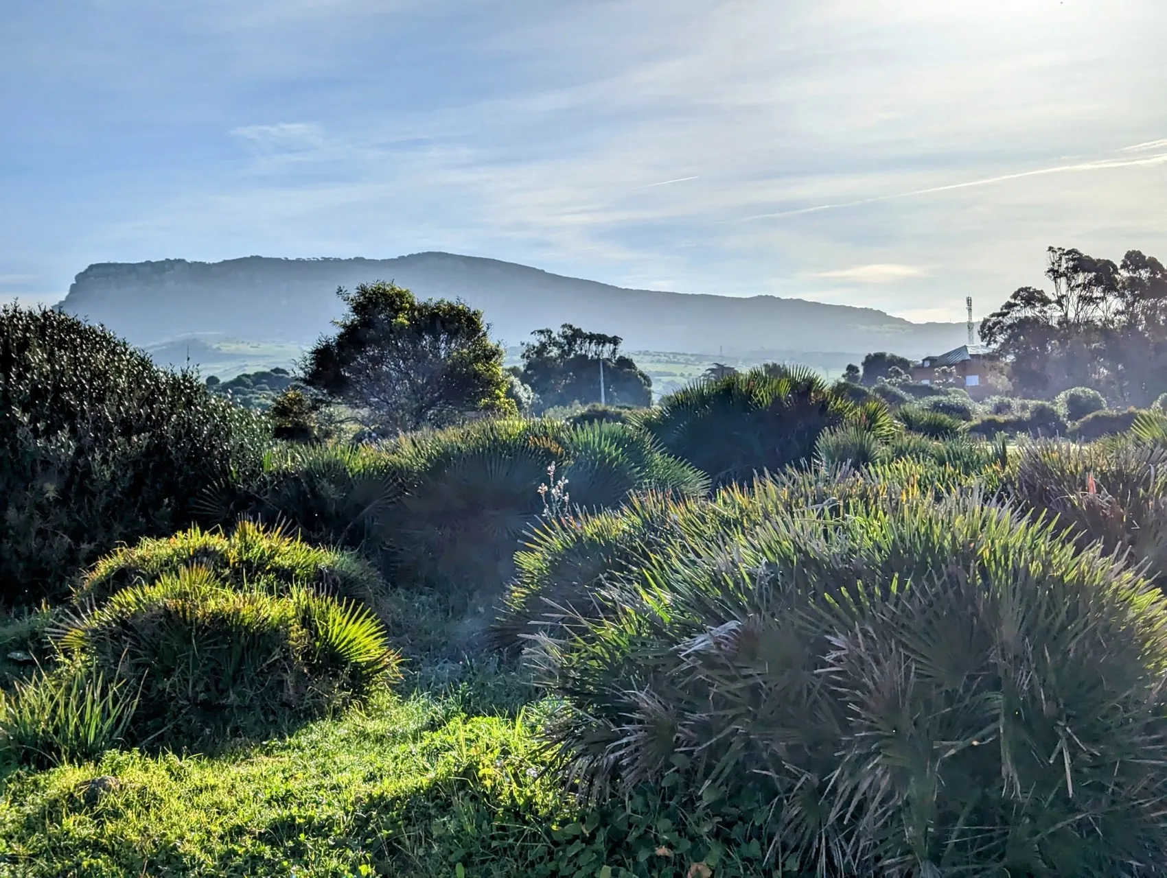
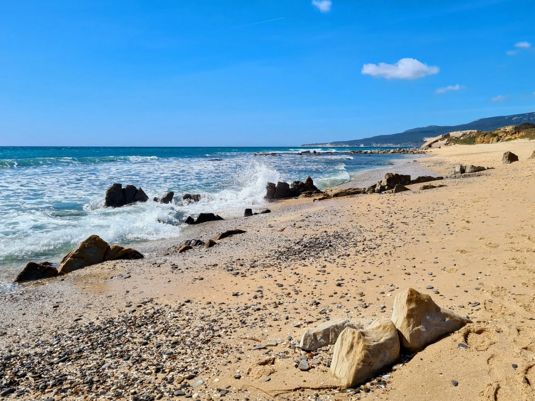
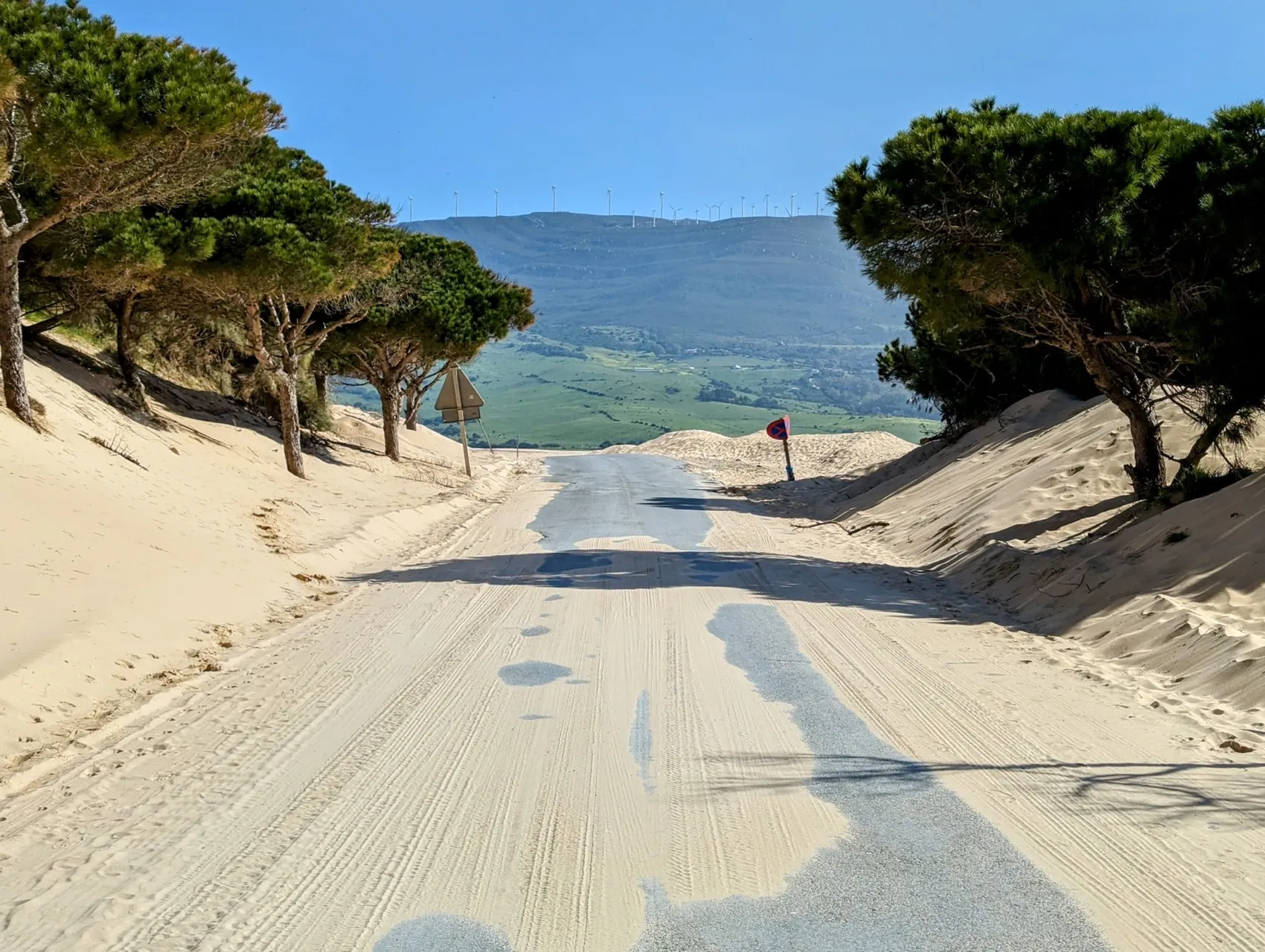
Once we reach the top, it looks like we're walking through the Sahara. High dunes and sand are blown across the road. At first still with trees at the sides of the road, but soon more open with stunning views over the hills and the ocean. We are quite a bit above the water and decide to descend to take a break by the water. We move quite a bit of sand during the descent, with our mountain boots on and backpack on. Down below, we enjoy what probably will be our last break by the ocean. Sitting in the sun with the waves in front of us and gorgeous views of Morocco. It's Saturday around noon, so the beach is crowded.
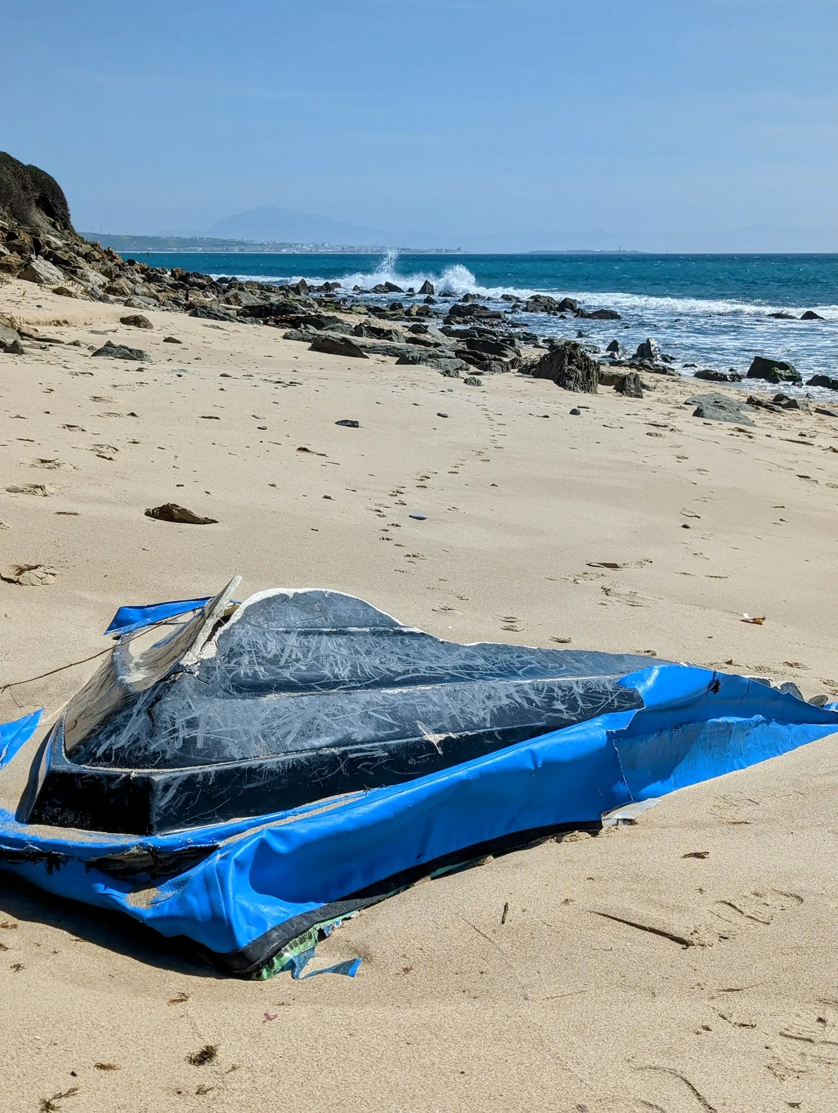
From here, we keep following the beach. The water is still low enough to walk along the rocks. We find a few more splendid type of shells. The water does get higher and higher and we have to climb over the rocks several times to get a bit further. And after each bend, the view of the southernmost point with the high Moroccan mountains behind it becomes more and more impressive. But several times, the flip side of this point, where ravaged Africa and Europe are so close together, also becomes clear. In a couple places we see the remains of rubber boats lying in the sand and between the rocks. Probably left behind by people who risked their lives to make the crossing, in search of a better future. The short distance and vastness of the beaches make this a common place to cross. Very strange, with the beach bars and villas along the same stretches of coast...
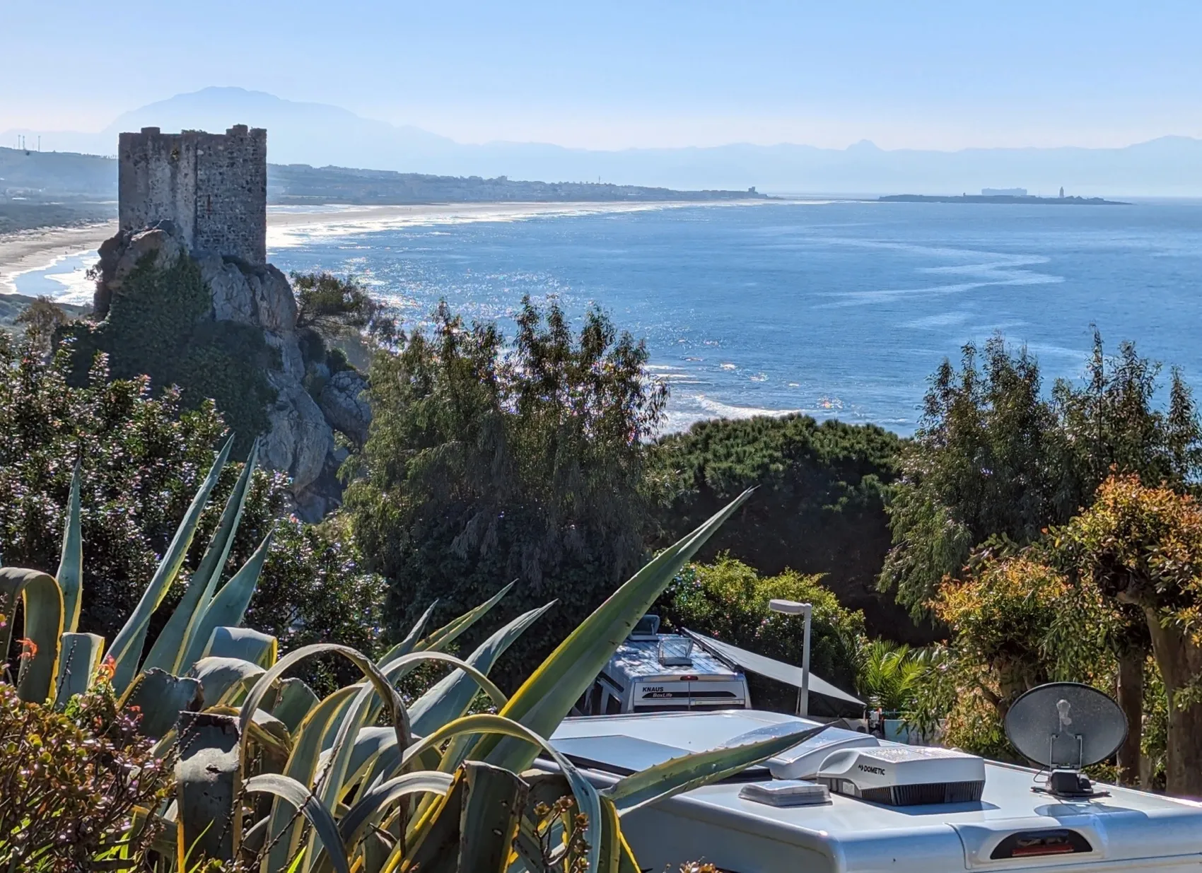
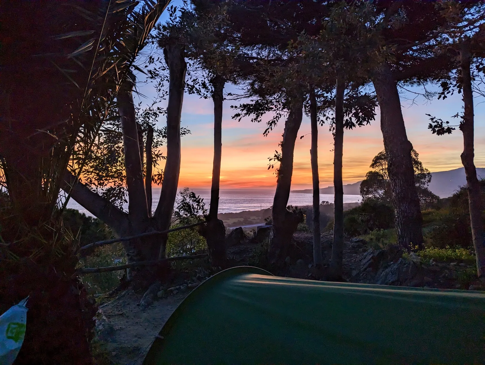
We arrive at La Peña where a nice campsite is situated and decide to save the last 8 kilometers of this stage for tomorrow. We spend the night on a gorgeous spot at the campsite, with a beautiful sunset and nighttime views of the lights of coastal buildings on the continent opposite us.
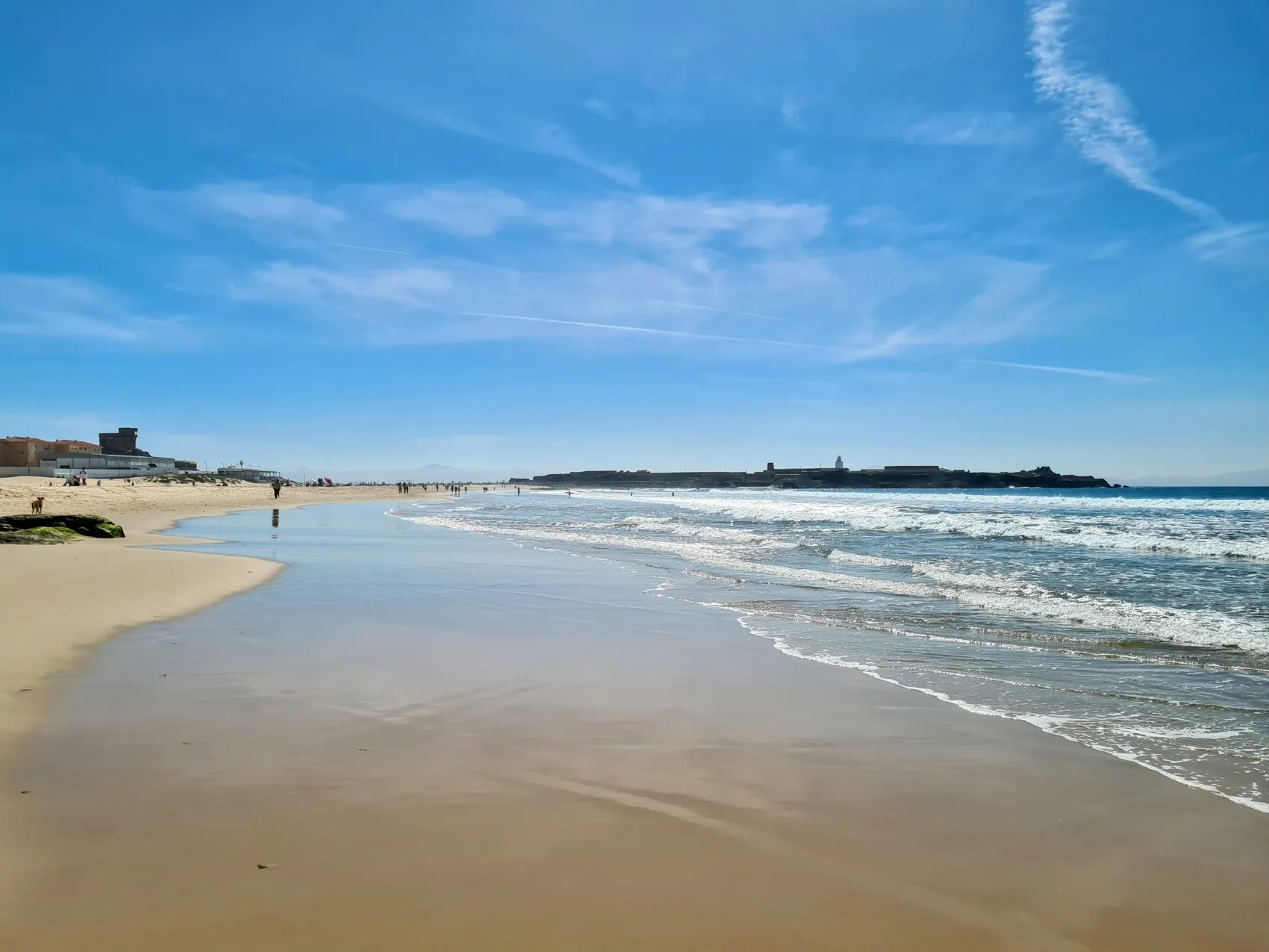
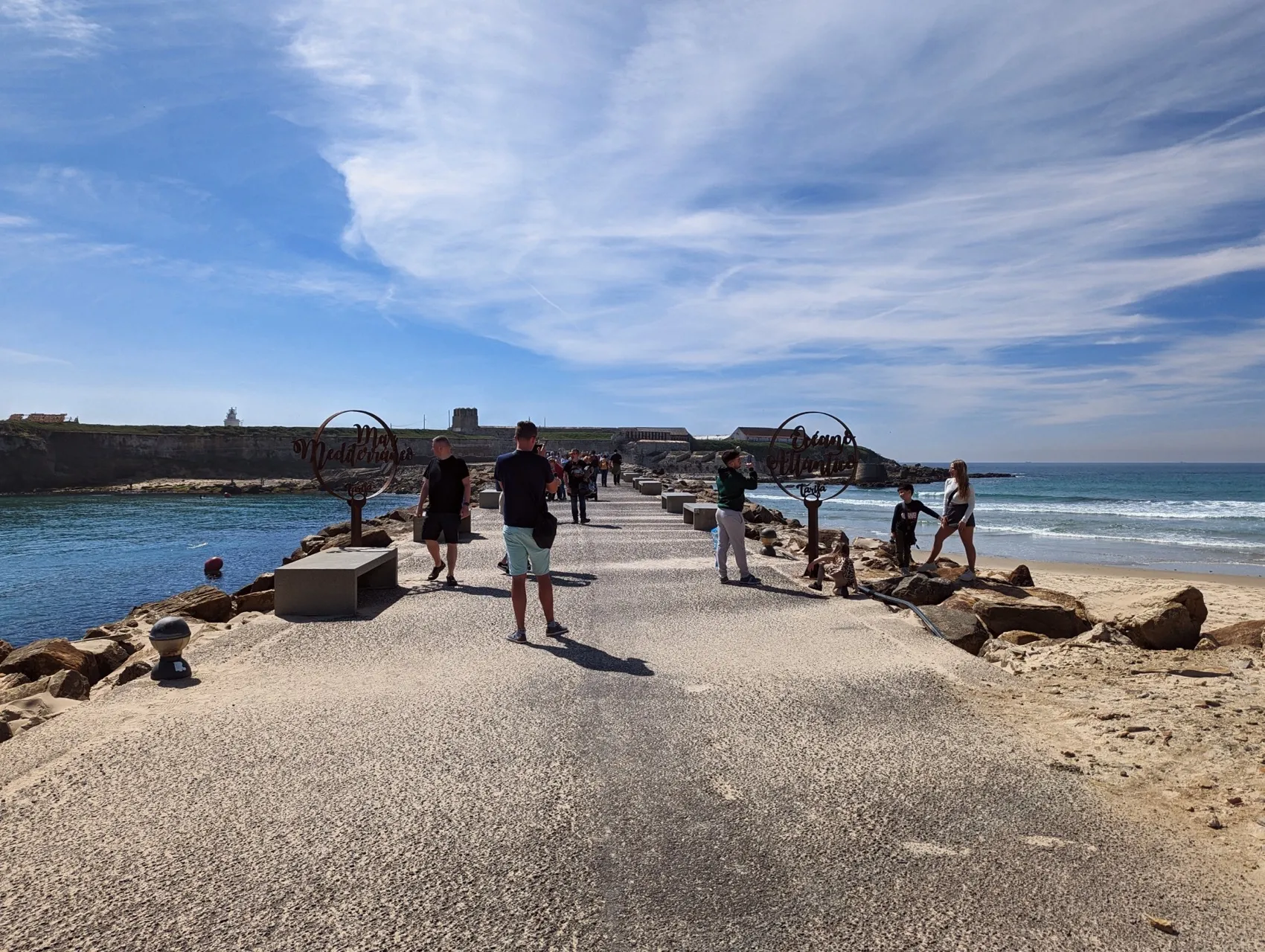
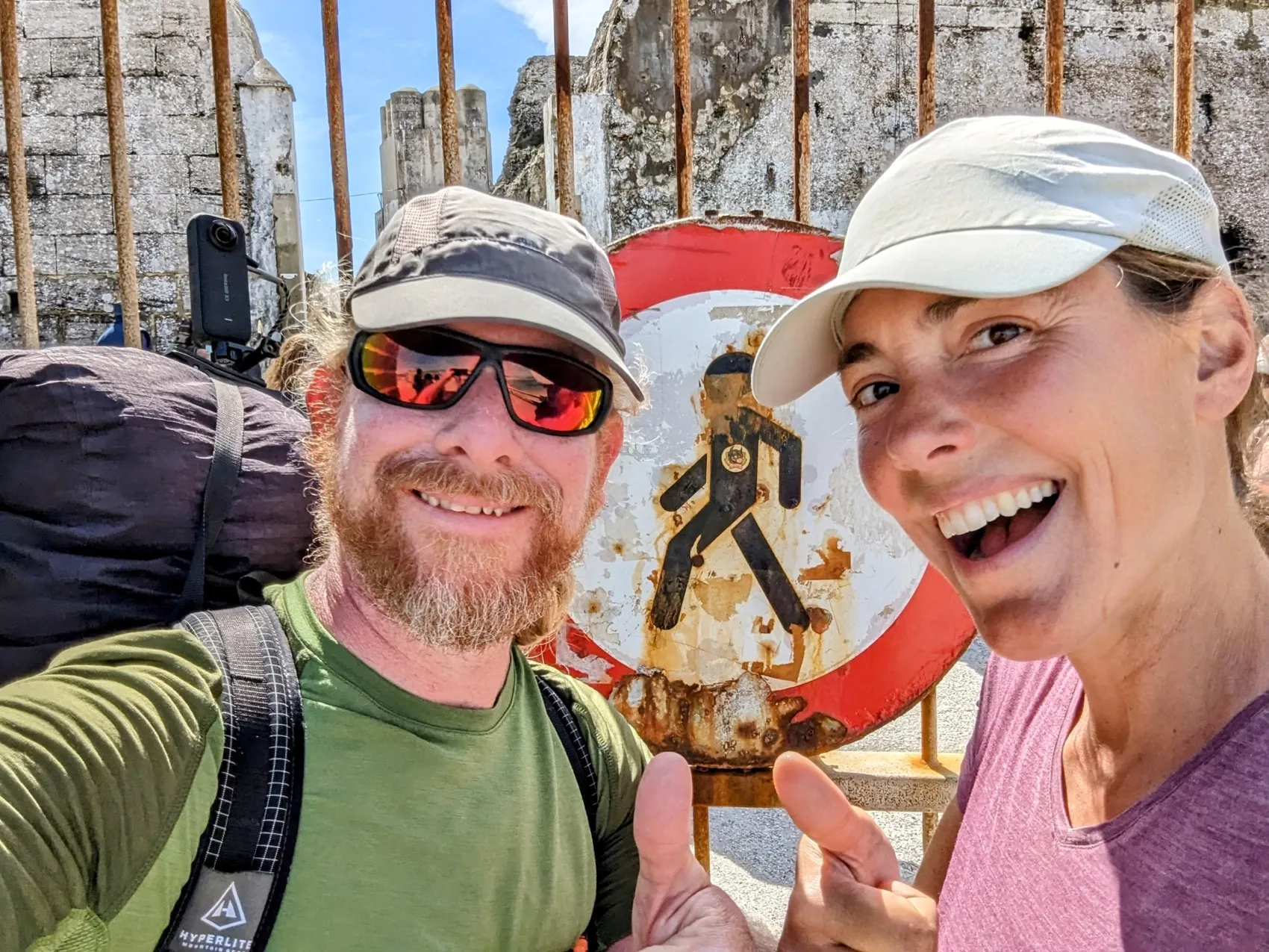
This morning we set off for the final kilometers along the coast. We descend to the beach and follow it to the end. It's a Sunday morning with lovely weather so it is busy again. Lots of people with dogs, children playing and especially many surfers are on the beach and in the water. The waves are a lot lower today than yesterday, but even now it's easy to see why this stretch of coast is known as surfers' paradise. A small river flows into the sea here. This one is just too deep to wade through with our shoes on and the bridge is just a bit too far away. That means: shoes off and continue barefoot! It's lovely to walk through the water. We keep our shoes off and barefoot, through the fresh ocean water, we walk the last few kilometers of this stage. The last piece of land is fast approaching. And with it, the end of this first part of our new journey to Nice. At the end of the beach, we climb to a road that leads to Isla de Tarifa. This is the utter southernmost point you can get to, on foot. And just now, while standing here, we realise that with the end of the ocean, the Mediterranean Sea begins on the other side of this road! The water looks immediately calm, sleek and azure. This is how we recognise it from last year in Nice. Good memories and a good prospect!
Unfortunstely we can't enter Isla de Tarifa, it's closed off and can only be visited with a guide. But we have achieved our goal for now. And here, at the end of the beach, at the end of the ocean, at the end of the green hills and after almost 600 kilometers of hiking, our new journey northwards starts: with the sea behind us we'll hika all the way through the inlands of Spain towards the Pyrenees.
We are curious to see how it will be, but we will probably miss the ocean...