After a peaceful night, we wake up early, sheltered by the hills but with a magnificent view. We've set the alarm extra early because we are quite close to the trail, so by quarter to six, we are up, packing up all our gear, breaking down the tent, and then having breakfast. Around half-past six, the first hiker passes by. It's a German lady we met at the campground in Lescun, she stayed overnight at the busy refuge and left early. She had quite a bit of trouble with the guard dogs in the previous valley. She had to wait meter by meter until the dogs calmed down so she could continue walking. She made it here without any mishaps, but we're glad we covered that stretch at the end of the day yesterday when the dogs were a lot calmer. Apparently, the dogs have a bad morning mood…
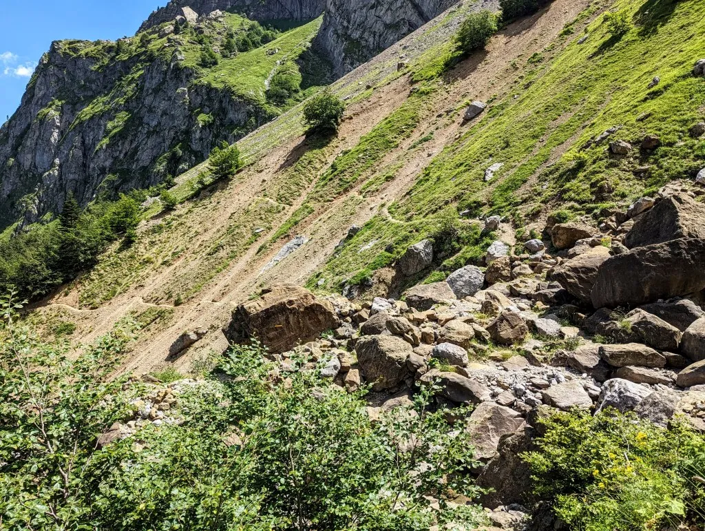
We enjoy our breakfast a bit longer and then head in the same direction. A short climb up, and then we start to descend. It's a descent of almost 2.000 meters long to 1.350 meters, along narrow paths along the flank of the mountain with a new valley, and thus a new view, ahead of us. Each valley is the same: forests in the lower parts, higher up bushes and grassland, then grassland and stones, and at the top only rock. But each valley is also so different, each with its own feel. That's what makes mountain hiking so special and exciting; over every peak lies a new landscape to discover. Further down the descent, we pass by a small farm. Two collies lie in front of the house and are a bit 'watchful,' but they soon settle relaxed.
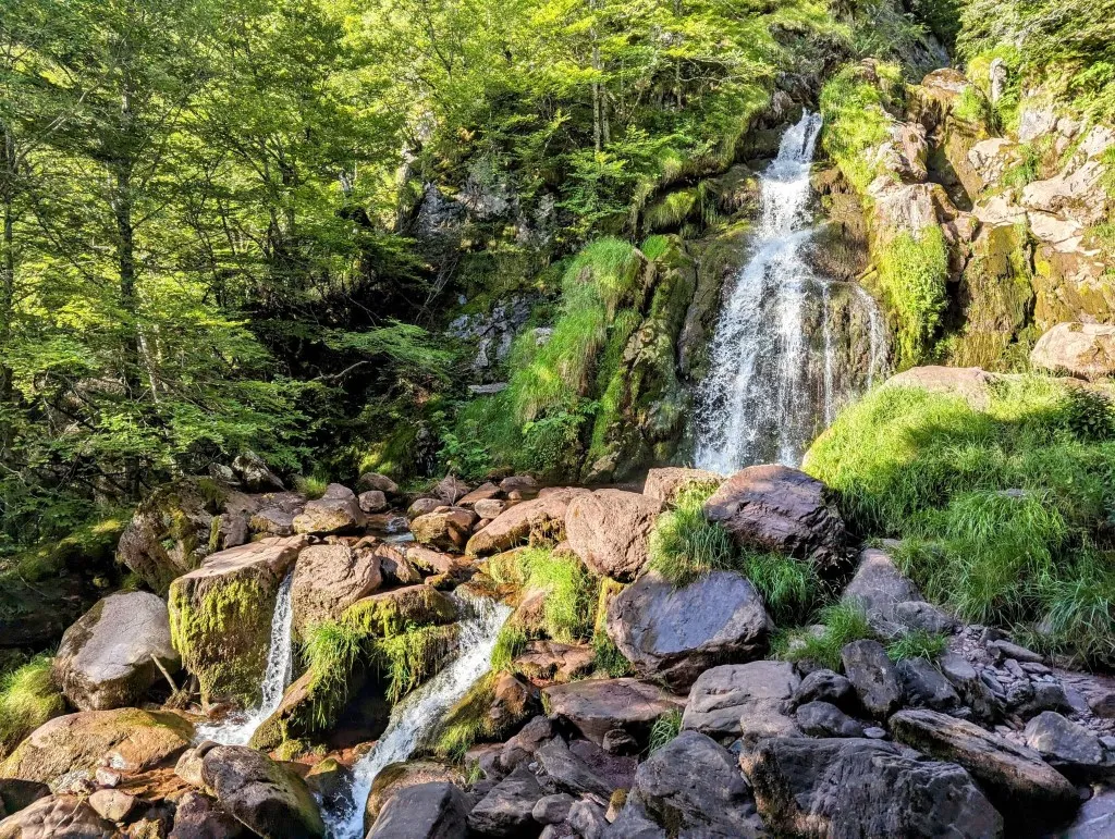
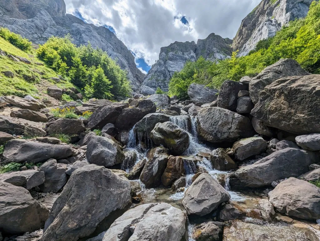
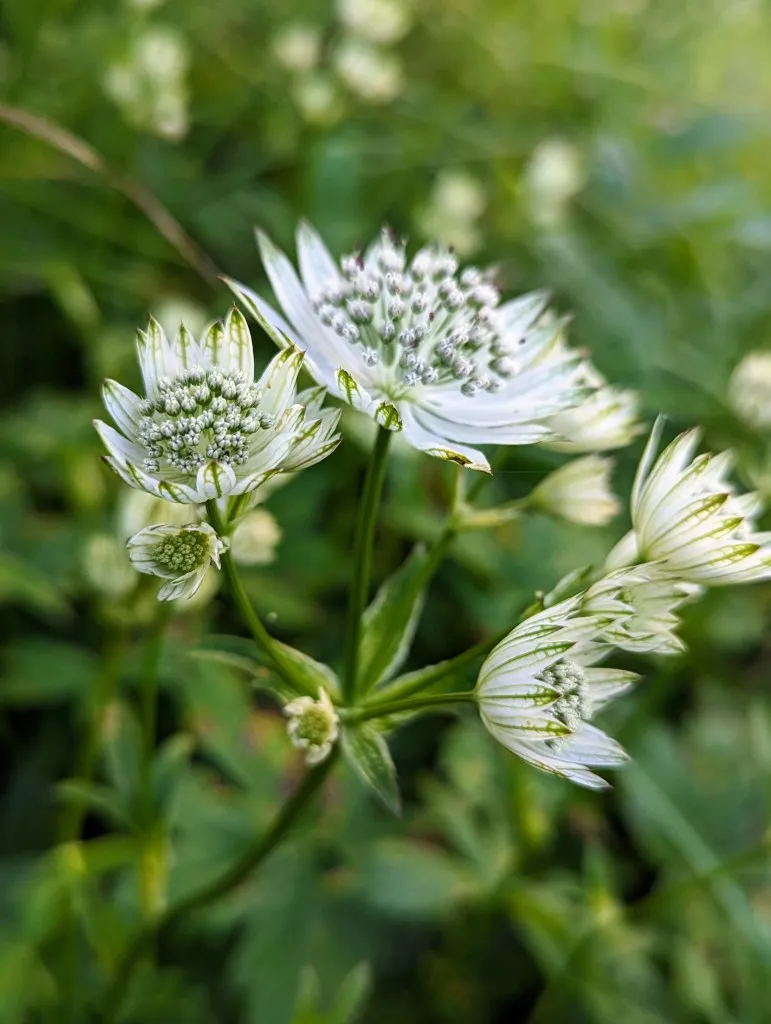
We see the farmer a bit further on, milking sheep in a small pen on the land, and the farmer's wife comes around the corner of the house carrying two large, heavy, old-fashioned milk cans. Ah, the idyllic mountain farming life! The grassland transitions into forests as we descend further. At the path’s lowest point, a spring is marked on the map. After wild camping, we could use some water, so we detour to the spring, but can’t find it. Unfortunately, no drinking water, but there is a beautiful waterfall. And… bushes full of blueberries! A few handfuls of blueberries also quench our thirst.
Back on the path, we walk alongside a Dutch couple for a while. They too are trekking the Pyrenees from west to east, but aren’t sure of their exact route. They rely on GPS navigation, which shows where they are, and if they dislike the path, they switch routes, provided they have signal. It sounds convenient, but it reminds us of an accident not far from Lescun a few days ago. During our rest days there, we saw a trauma helicopter flying towards the mountains we had come from. Later online, we learned that a man on the GR10 had died. He got lost and likely fell in the dark, which cost him his life. Being well-prepared is crucial for safety, and knowing where you are and how to orient yourself is a significant part of that. Sometimes, especially now in the high season, the mountains seem like a playground. Many rush to the highest peak or the top of a waterfall for the perfect photo. Prepare and be cautious because the mountains are real. Their allure can be dangerous, and for some, that danger is the allure itself.
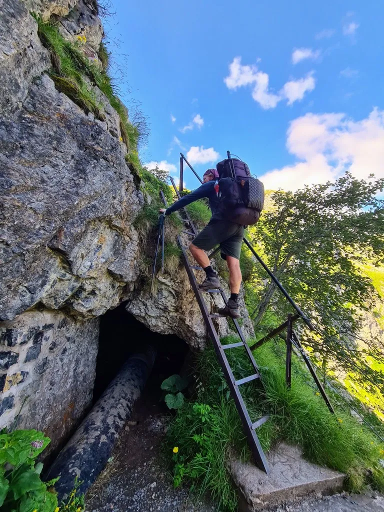
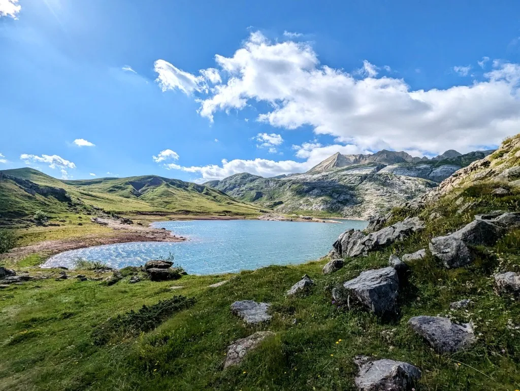
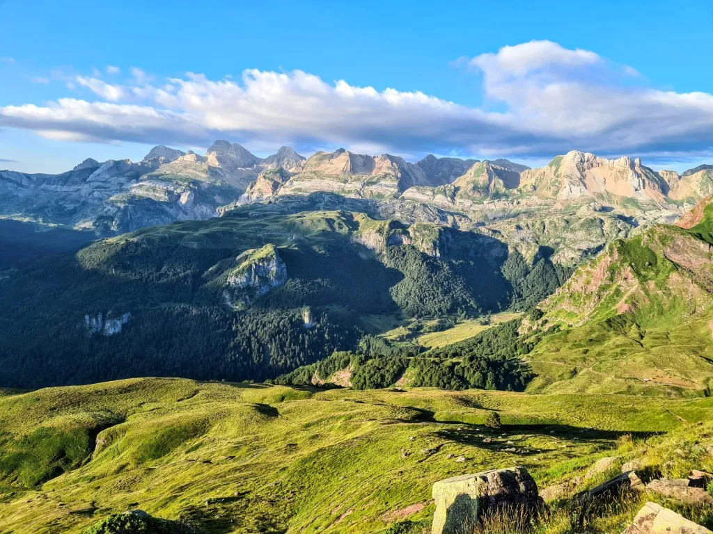
Meanwhile, we've ascended significantly over zigzag paths through the forests. According to the map, we’ve covered most of the elevation, but it gets really steep at the end near some rock walls. Fortunately, there are stone steps at points, and even a steel ladder at the steepest part. It’s quite a challenge with a heavy backpack and holding two hiking poles, but we make it to the top. And there lies a stunning lake. Between high gray mountain peaks sits the large, crystal-clear Ibon de Estanés, back in Spain at an elevation of 1.754 meters. It's an easier access point from the other side, becoming a popular spot to escape the heat of the valley. It's also an ideal spot for us to take a break. Once we sit down, we do it right. With our last bit of water, we make coffee, and prepare a luxurious sandwich with cheese, vegetables, and an egg. Having already covered many elevation gains and half our day's distance, we enjoy this beautiful spot a bit longer. As we continue along the lake's shore, large gray cows with fluffy white ears graze near the other end. We walk through the herd and climb a bit more. Fortunately, we pass a spring and can refill our drinking water. We cross the highest point, then begin our descent. This side is busier, we're clearly not alone. The path gently slopes through grasslands, though there are some steep sections. We turn right to bypass the deepest parts of the valley; we need to reach the next valley.
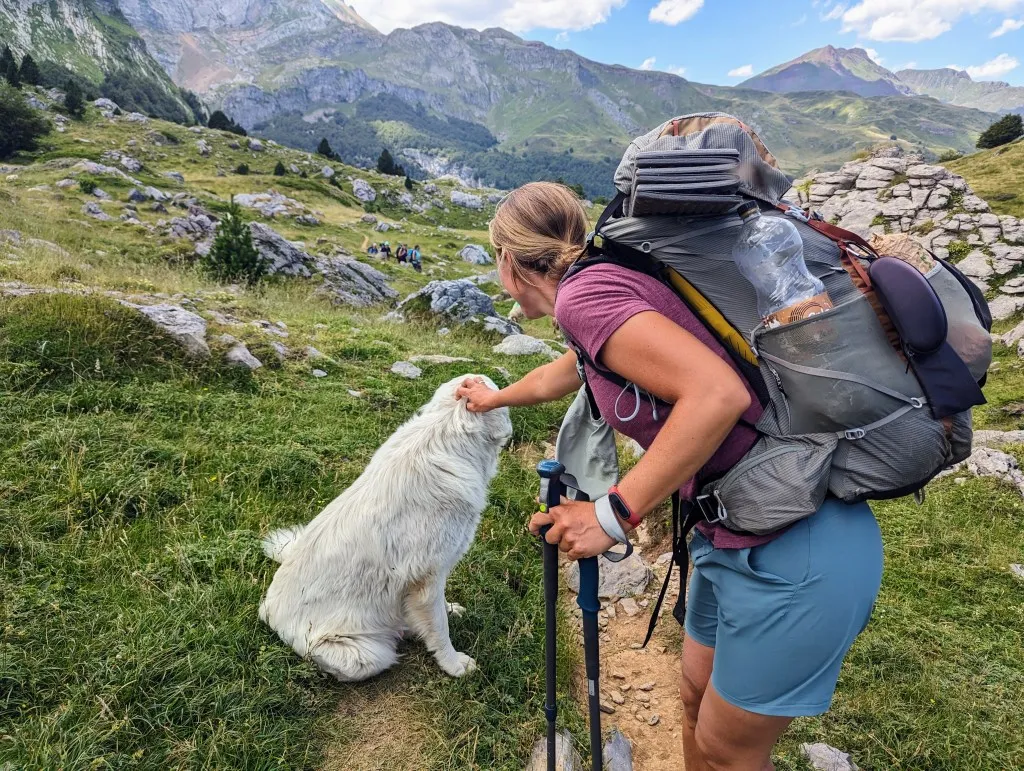
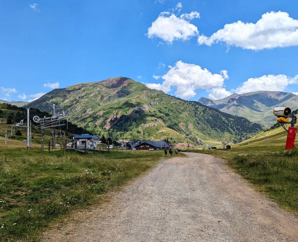
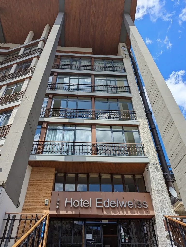
We re-enter the forests and cross a broad river strewn with large rocks. The path disappears, but two paths are visible across the river. It takes some acrobatics to cross, and once on the chosen path, it's impossible to switch due to steep cliffs. We choose the upper path, which luckily turns out to be correct, and continue towards Candanchu. The rest of the route is easier and flatter. Just before the village, we pass a large flock of sheep guarded by a large white sheepdog. He sees us walking through the herd (there was no way around), approaches us, and… lies down for a pat. Haha, this is the most relaxed guard dog we’ve encountered! Candanchu turns out to be a Spanish ski village that's somewhat active in the summer. The slopes are bare, with ski lifts crisscrossing everywhere. We're back in civilization. There’s no campground, but there is a delightful hotel. And a small shop for some groceries. It’s wonderful to shower and rest our legs after the past few days of substantial elevation gains. And beautiful mountains, vistas, and experiences. What a wonderful world!