We were so relieved to arrive at the hotel. And we were even more thankful the next morning that we had pushed on and not stayed in the mountains. It was pouring rain, and it continued like that all day. Above 2,800 meters, it was freezing and snowing; according to the weather webcam of the refuge in the mountains, there was a wind chill of -4 degrees Celsius. Not just a bad day, but a day where you normally wouldn’t venture outside, and especially in the mountains, it becomes dangerous. But we weren’t worth much after such a long and intense day, so we really needed the rest, and where better than in this beautiful mountain hotel!
This morning, we’re fully ready again and looking forward to today’s stage. It’s a stunning valley we’re in, and we’ll hike it all the way to the end, or rather, we’ll hike all the way to the beginning, and then a little further. But first we enjoy our breakfast at the hotel as early as possible to fuel up for the mountains. A little after nine we’re outside in the sun, under a bright blue sky, and we continue through the Benasque valley. This valley is surrounded by the highest mountain lakes, the largest glaciers, and the highest peaks of the Pyrenees.
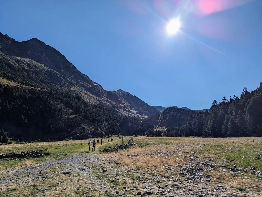
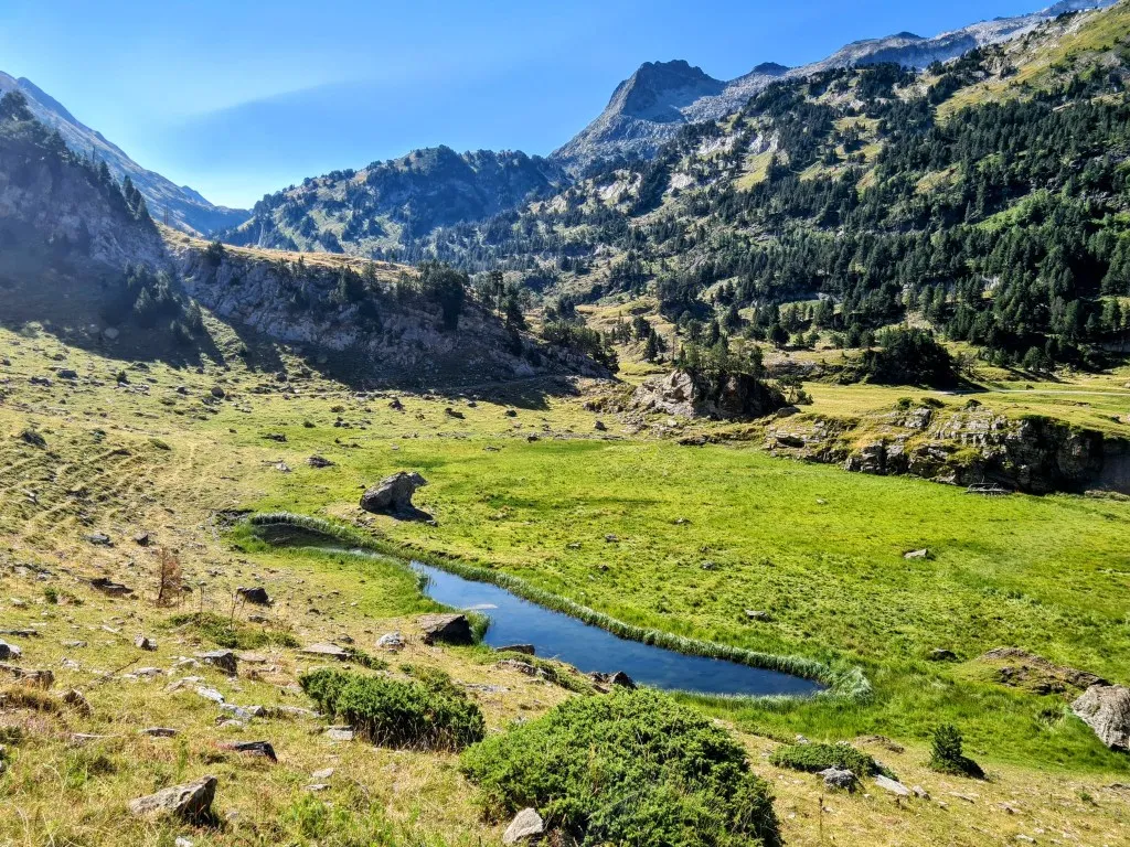
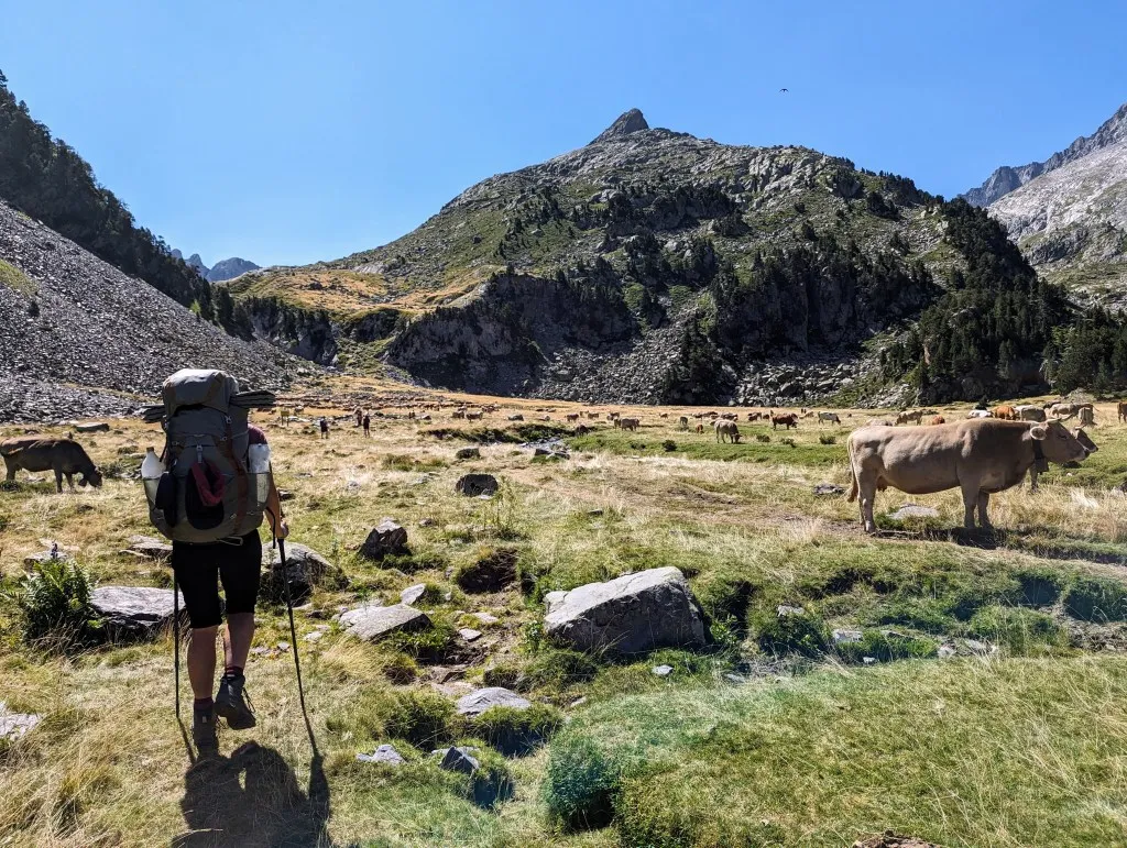
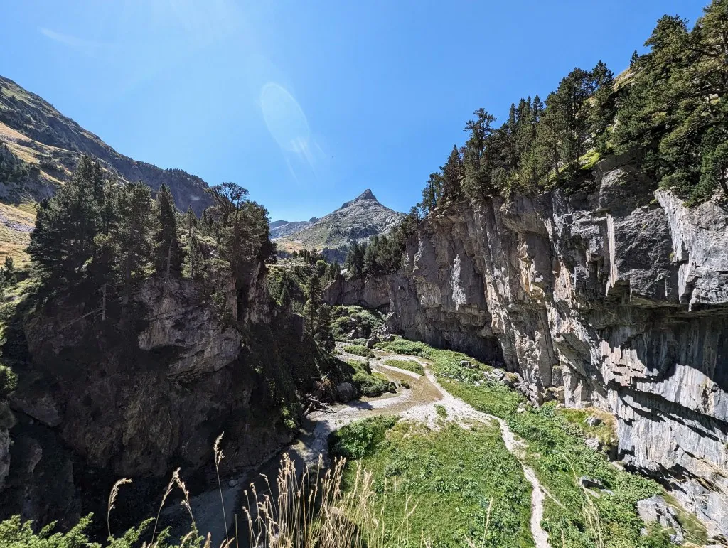
With most of the peaks reaching 3,000 meters and the highest peak being Pico Aneto with its impressive 3,404 meters, the second-highest mountain in Spain (by no means the highest, that would be Teide on the island of Tenerife at 3,718 meters, and in the south, in the Sierra Nevada, lies Mulhacén at an elevation of 3,482 meters). It’s an awe-inspiring place to hike! Fortunately, the weather is good, and we have beautiful views. We start off in a wide river valley, surprisingly flat amidst the mountains. But occasionally, we climb up to a higher plateau for the next flat stretch. In the valleys, there’s a lot of grass with flowers, but also more pine trees and blueberry bushes. It’s a stunning valley, and we’re not the only ones who think so. It’s crowded; there are many hikers out this morning, especially near the refuge we pass by. Many are heading to Aigualluts, a large sinkhole where a river of meltwater from the Aneto glaciers disappears into a crack in the earth, only to reappear 3.6 kilometers away on the French side of the mountains and flow into the Garonne, which then reaches the ocean near Bordeaux.
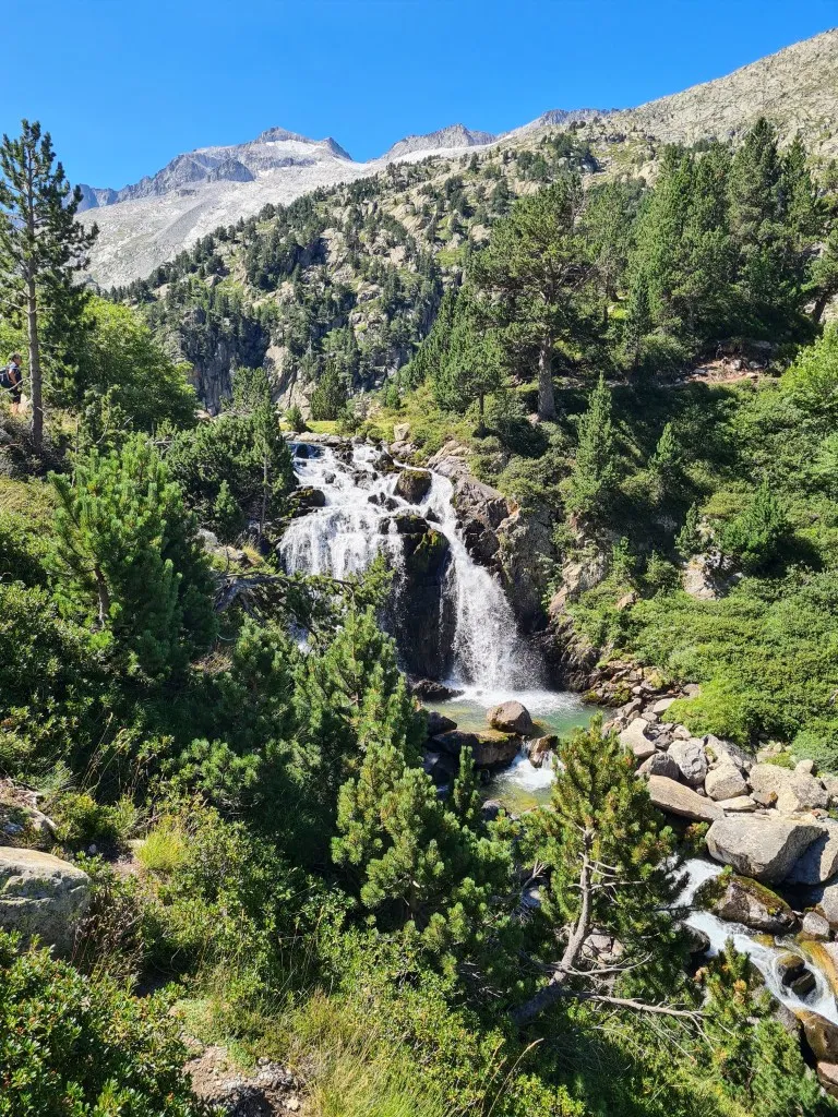
The fairly large river flows through a large waterfall into the 70-meter wide and 40-meter deep crevice and then disappears. Pine trees stand on the cliffs, and due to the moisture from the river, there are many ferns and mosses. It looks dreamy. We continue walking along the upper edge and move on. Again, a bit higher and flat, it’s easy walking. After about 8.5 kilometers, just before it starts to get really steep, we take a break to tackle the climb with fresh legs. The last 5 kilometers to the highest point are much steeper. We collect drinking water from a stream that also disappears into the mountain a bit further ahead and make coffee. This stretch is already much quieter. We enjoy a last muffin from the hotel overlooking Aneto. As we continue, we climb again and pass a large herd of cows. Thankfully, we have properly purified and boiled the water.
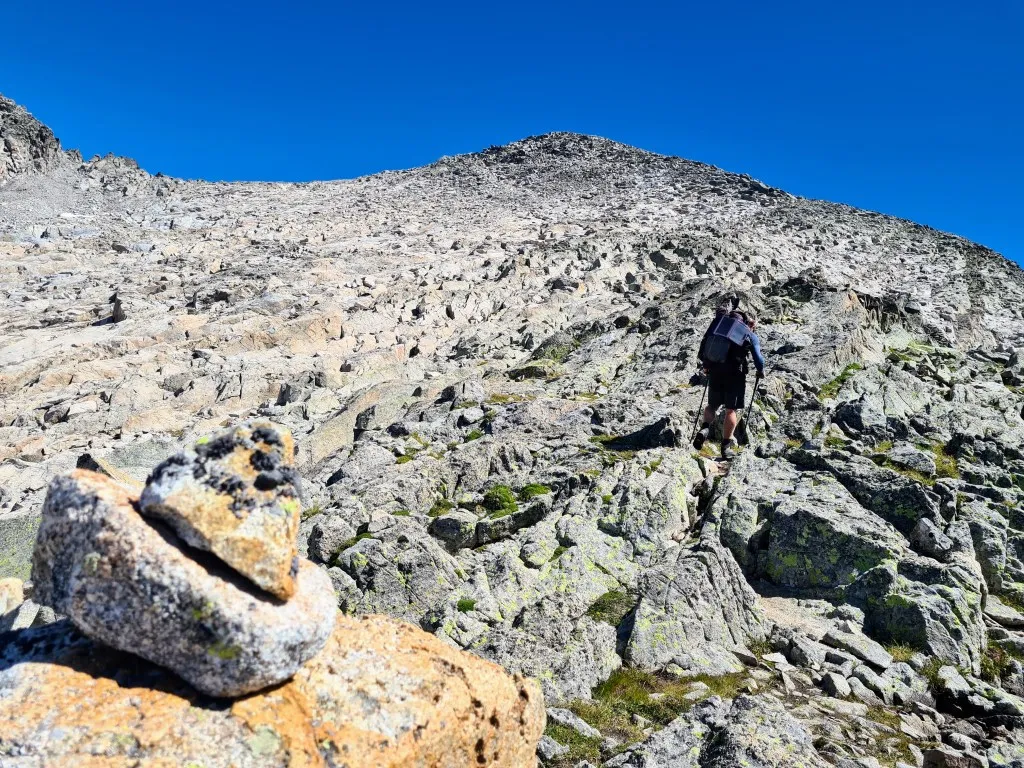
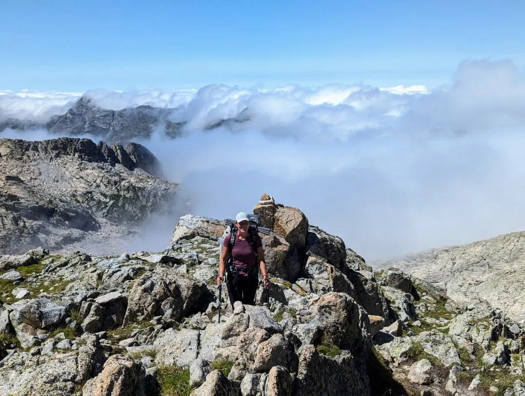
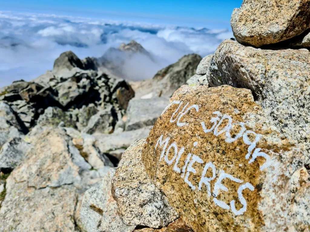
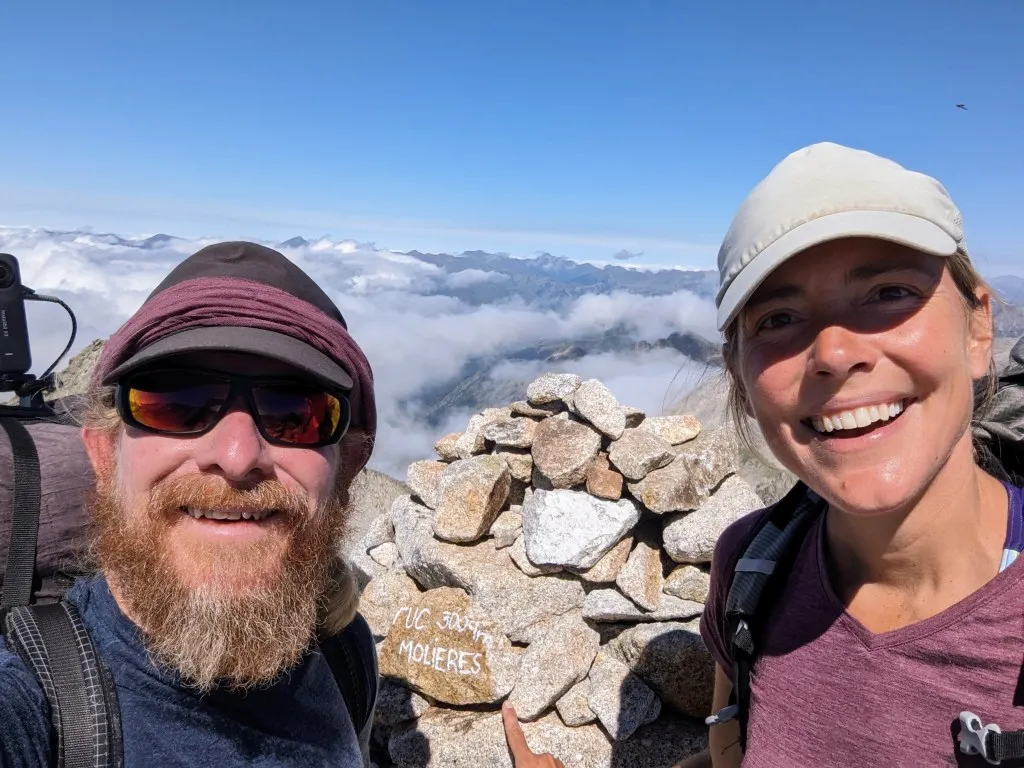
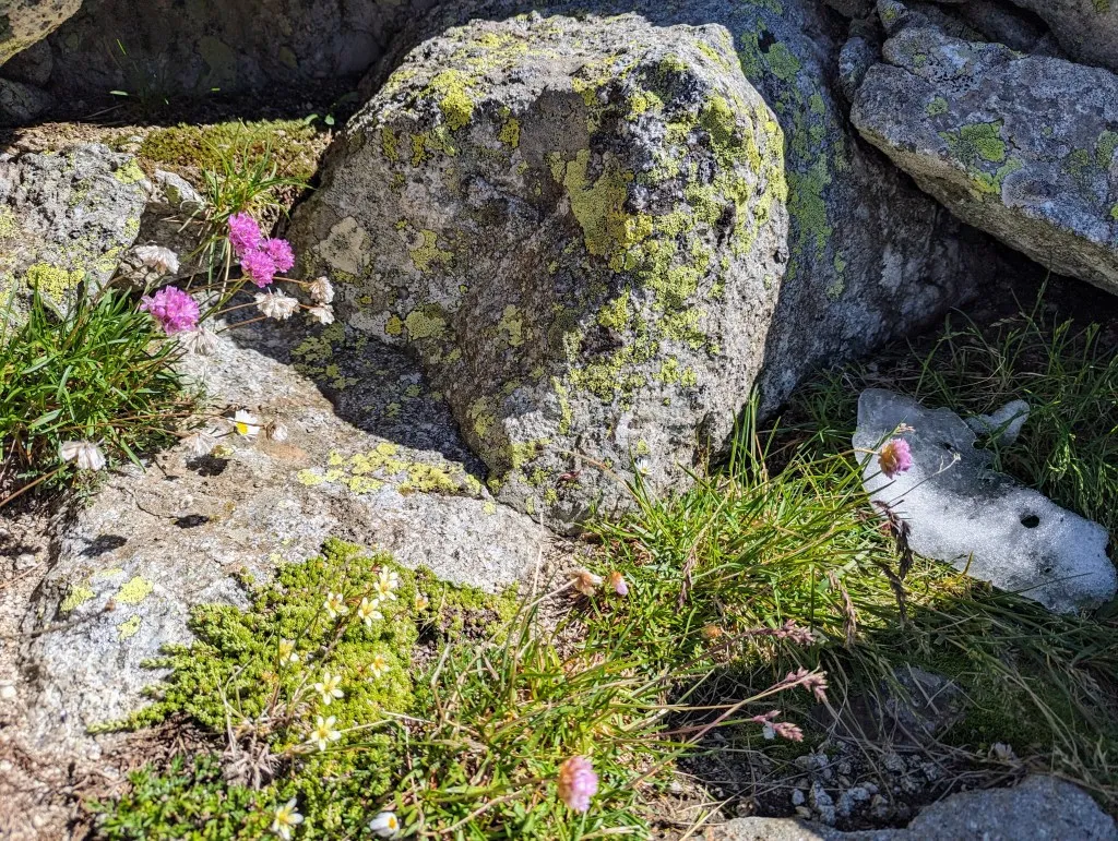
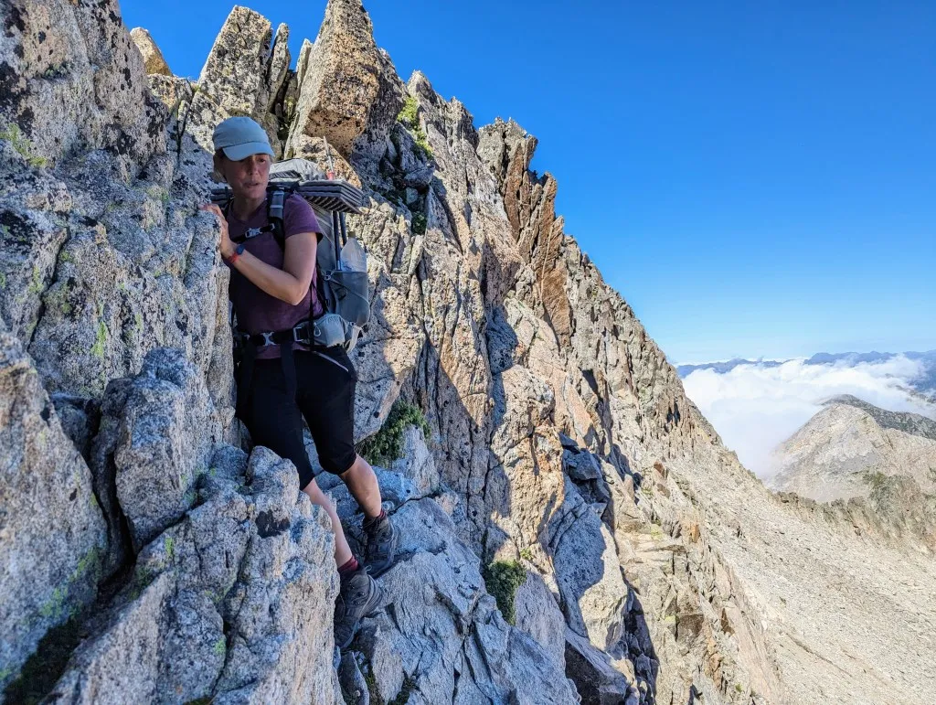
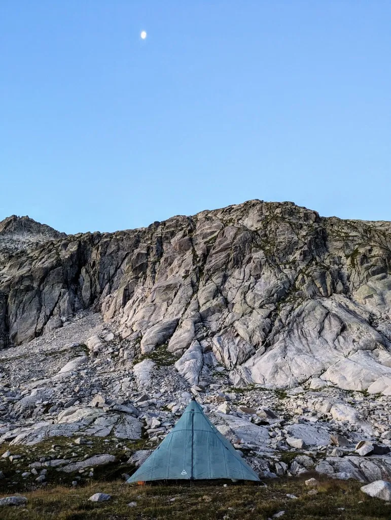
It proves once again that you should be careful the mountains. We are already a bit above the trees, and the grass starts to thin out. We pass a few last small lakes, leave the greenery behind, and step onto the rocks. Fortunately, there aren’t really many loose stones; it seems like one massive slab. This massif is granite, a tough rock formed by solidified magma under high pressure. It erodes much slower than the sandstone and slate on earlier stretches. Aneto is situated to our right with patches of snow near the summit, and Tuc de Molières is on our left. Normally we would go over a col, but here, we first go over a peak, then towards the col before descending further. Occasionally, the view is limited by an approaching cloud. Sitting on a large gray slab, the world suddenly seems very small. It’s steep, but easy to walk, one of the easiest climbs we’ve had. Until the last stretch. The peak seems like a 100-meter-high pile of boulders, large stones where there’s almost no path to be seen. But we can see the top, marked by a large pile of stones indicating the highest point. By now, we’re quite adept at finding a suitable route over rocks, and as long as they are large, stable rocks, it’s not a problem. We scramble and climb to the highest point and reach the top at 3,010 meters. Yahoooo, the first time above 3,000! Wow, what a spot again. We sit down for a moment to recover and enjoy. We won’t easily surpass this; from here, the Pyrenees slowly get lower. We start the descent, over the same large stones as the last stretch to the top. Soon, we see fresh remnants of snow from the day before yesterday, luckily we were safely in our hotel then. Descending to the col goes quickly. But then we reach the notorious descent of Coret de Molières. This is the section of the HRP that goes straight down. They call it a ‘technical descent’… Fortunately, we’re alone and are able to choose the best route undisturbed and with utmost concentration. We pause, assess the routes, but at some point, you have to take the first step. Mark goes first, a big step to a ledge and then… cramp. Ouch, that’s not convenient. Malou follows, and she also gets a cramp in her leg. Why now!? We never have that. It’s probably the tension getting to us a bit. We stretch for a moment and continue. ‘Put your foot here, then you can hold onto that, your other foot there and descend to there…’ This goes on for about half an hour as we slowly descend along the rock face. Eventually, we have more than a stone handhold and a few centimeters of rock under our feet. Here, we come out onto a section of rubble and loose rocks; this side is clearly more eroded than the other. This section also goes slowly but well. The part with only loose stones isn’t very long, and soon we encounter occasional rock slabs and larger boulders. The valley is quite narrow, and at the base of the cliffs we see four lakes in a row. At least, from above they seem to be in a row, but there’s still quite a bit of height difference. We descend towards the second lake. From above, it seems like there might be a possible spot for our tent at the end, but it’s always uncertain. A bit further is a metal hut anchored on the rocks, Refuge de Molières, with beds and emergency provisions. We hope to bivouac in our own tent; the refuge will already be quite crowded, but if necessary, it could be an option. As usual with us, the descent takes a lot of time. From the peak to the lake is only 2 kilometers, but it took us 2 hours. Around 7:00 p.m., we arrive at the lake, with dark blue water surrounded by the incredibly high gray granite giants. Snow still lies at eye level; we’re at 2,400 meters here. The spot for our tent we saw from above turns out to be large and flat enough, and there’s water from a stream from the lake around the corner; we couldn’t have wished for better. That’s it, the infamous stage over the highest point of the route. After the previous stage, we were a bit apprehensive. It was exciting, but it went surprisingly well and smoothly. Now, here we are tonight with the mountains behind us and the long valley ahead, under a crystal-clear sky revealing more and more stars, enjoying a soup and freeze-dried chili, with raspberry crumble for dessert, we can only conclude that it was an incredibly beautiful stage. Literally and figuratively, a HIGHlight!