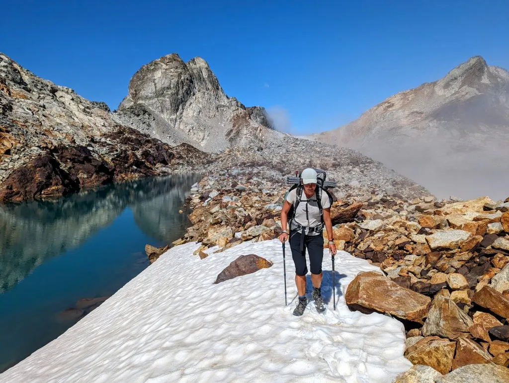
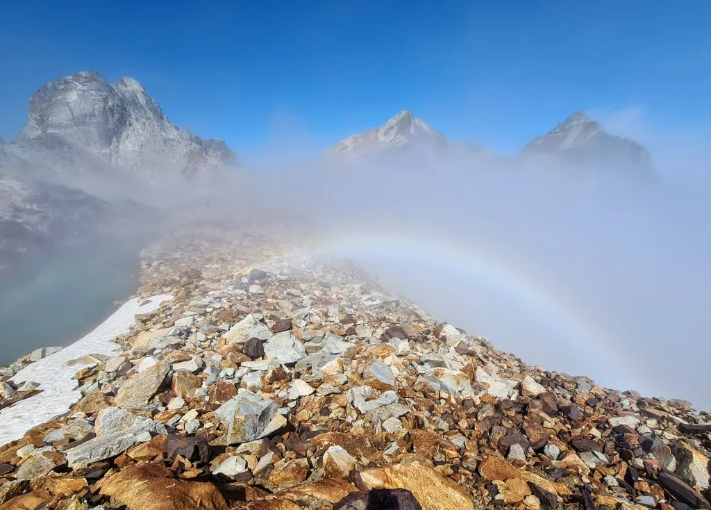
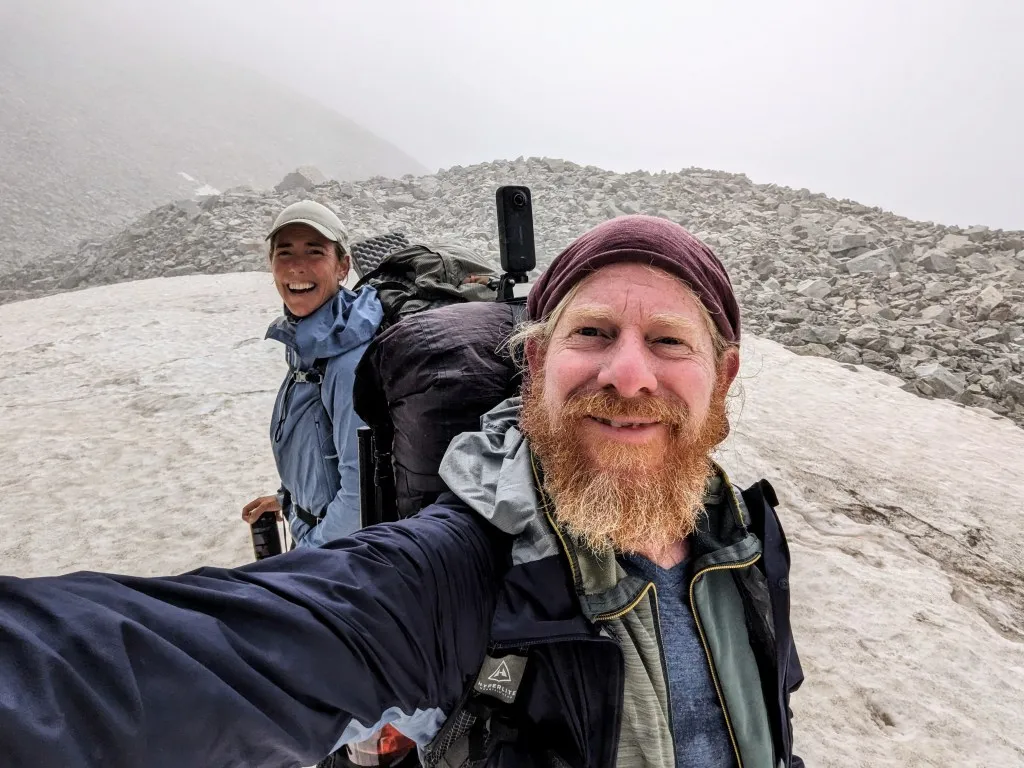
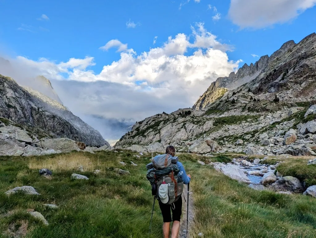
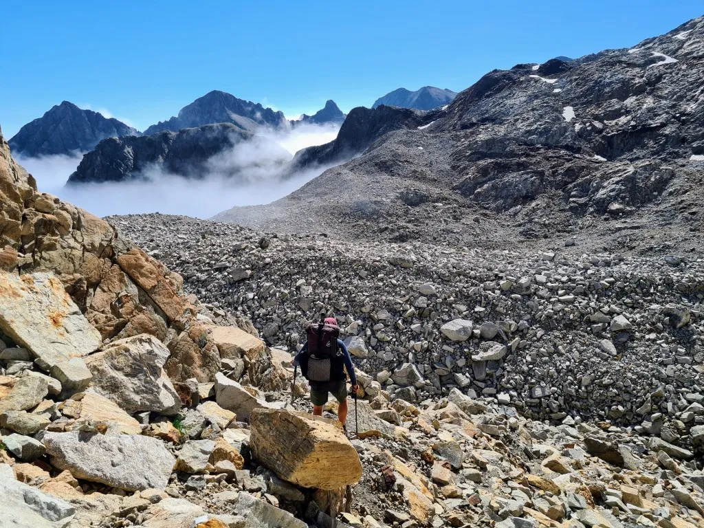
It’s cold and windy as we emerge from our tent just after six o'clock. It’s chilly enough to quickly crawl back inside for coffee and breakfast. Luckily, the wind is at our backs, allowing us to leave the doors of our tipi tent open. What a view to wake up to! We’re above the clouds, with a substantial blanket hanging towards France. Occasionally, a patch of cloud drifts by, enveloping us momentarily in mist. A passing hiker admires our tent, and we chat briefly about tents and routes before he continues on his way. We’d better get moving too, because despite the cold and this stunning spot being tempting to linger in, we have a significant stage ahead of us with plenty of elevation gain. We pack up our gear and set off. The first part isn’t too steep yet, but soon we’re scrambling over large boulders. And before long, it becomes steep and solely over large boulders. We step and leap from rock to rock with sizable gaps in between. There isn’t really a trail, but there are cairns to mark the route. We find ourselves in the mist more often as clouds drift by. With the bright sun in front of us, there’s a sort of colorless rainbow visible in the mist behind en slightly below us. So, technically, it’s a mistbow, a rather unique phenomenon. Occasionally, we hear bleating from the mist and a stray sheep emerges, but otherwise, we’re alone on the slope.
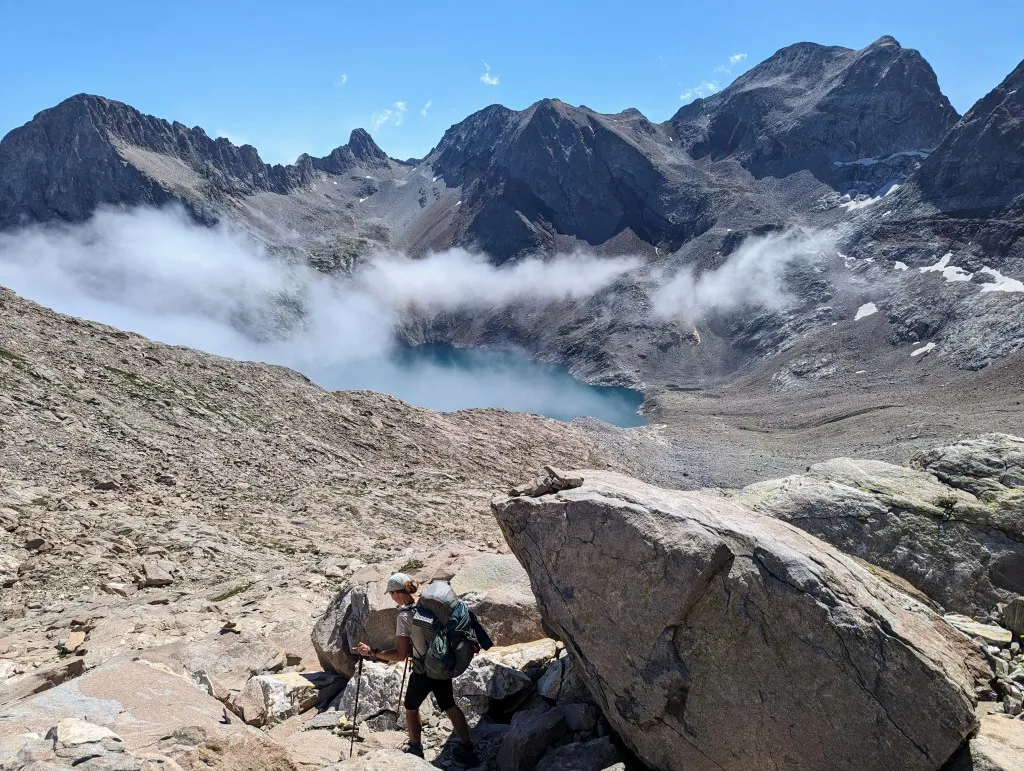
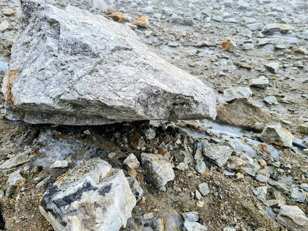
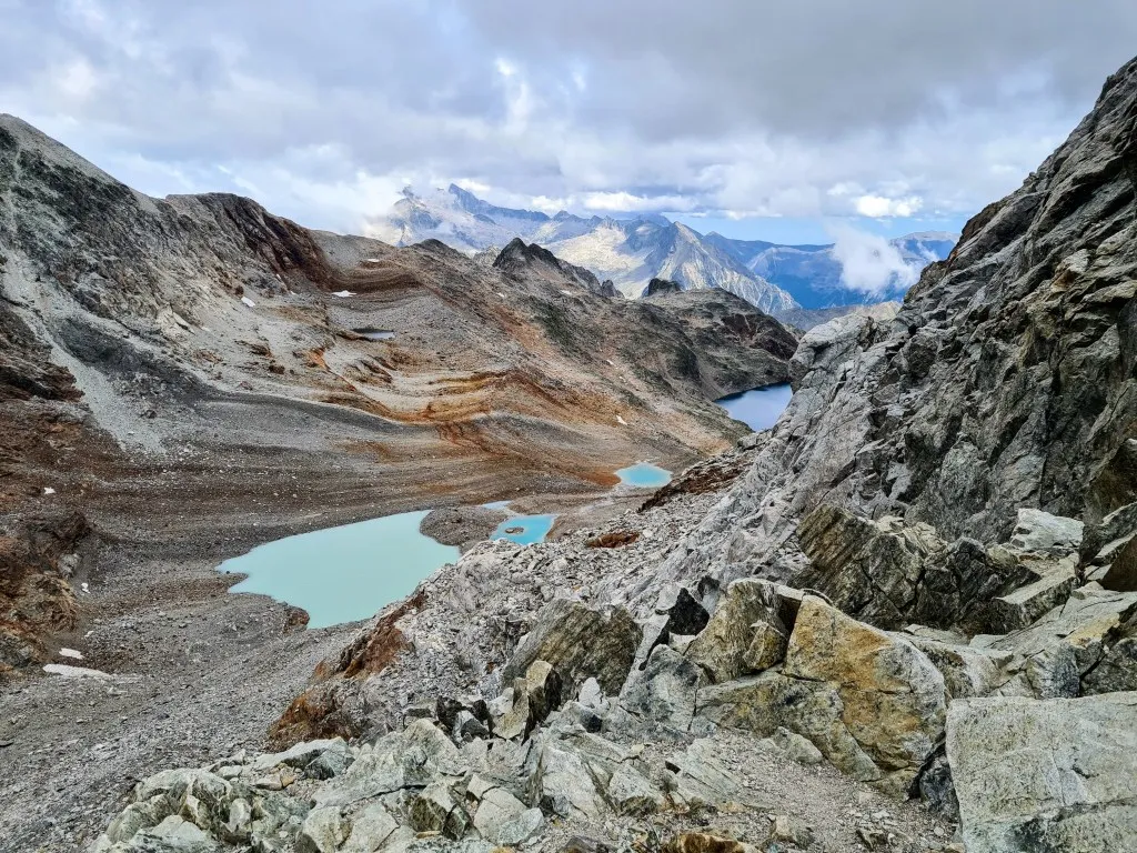
The gray landscape is occasionally interrupted by a single flower and now and then a small lake, one blue, the other almost pink. After 2.2 kilometers, we reach the first peak, having ascended over 450 meters. According to the map, there’s a stretch of 1,200 meters ahead that’s described as rolling, but fairly flat, before we begin the next descent. Standing atop the col, Col des Gourgs Blanc at 2,877 meters, we wonder where this flat section is. Ahead of us, the slope descends even steeper than the ascent, over plains of loose stones. With each step, we sink an extra step down. It requires careful footing to avoid sliding meters downward, but there is indeed a trail. Once at the bottom, it’s once again a stone plain, with no more cairns in sight. We attempt to navigate our route using the map and navigation system, which goes reasonably well. In the valley lies a small ice field. As we approach, we see a large hole underneath it, revealing a sizable glacier hidden beneath the stones. That ice must have been there for a long time, longer than the stones. We make our way upward over stones, rocks, and ice fields to Col de Pluviomètre at 2,860 meters. It’s breathtaking! The ice and snow by the blue lakes, the dramatically gray rocky landscape, and another beautiful mistbow! We enjoy the scenery but are also surprised that this descent of ‘only’ 80 meters and ascent of 60 meters took so much time and energy. It’s nearing noon, and we’ve barely covered 3.5 kilometers, barely 20% of the hike.
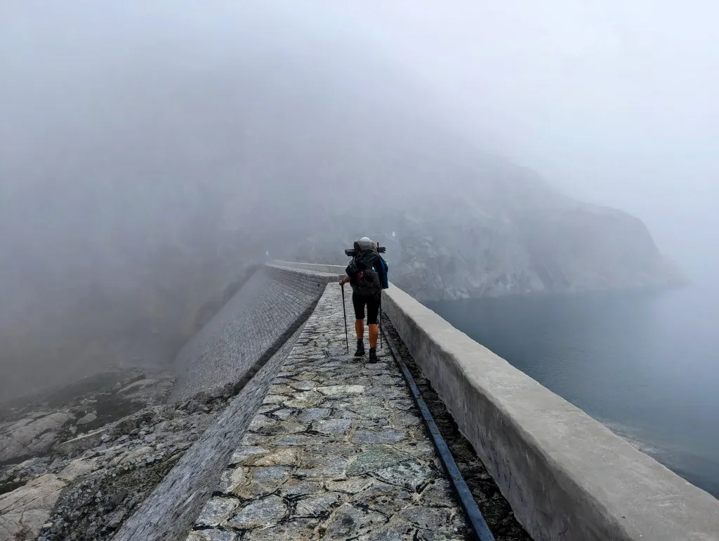
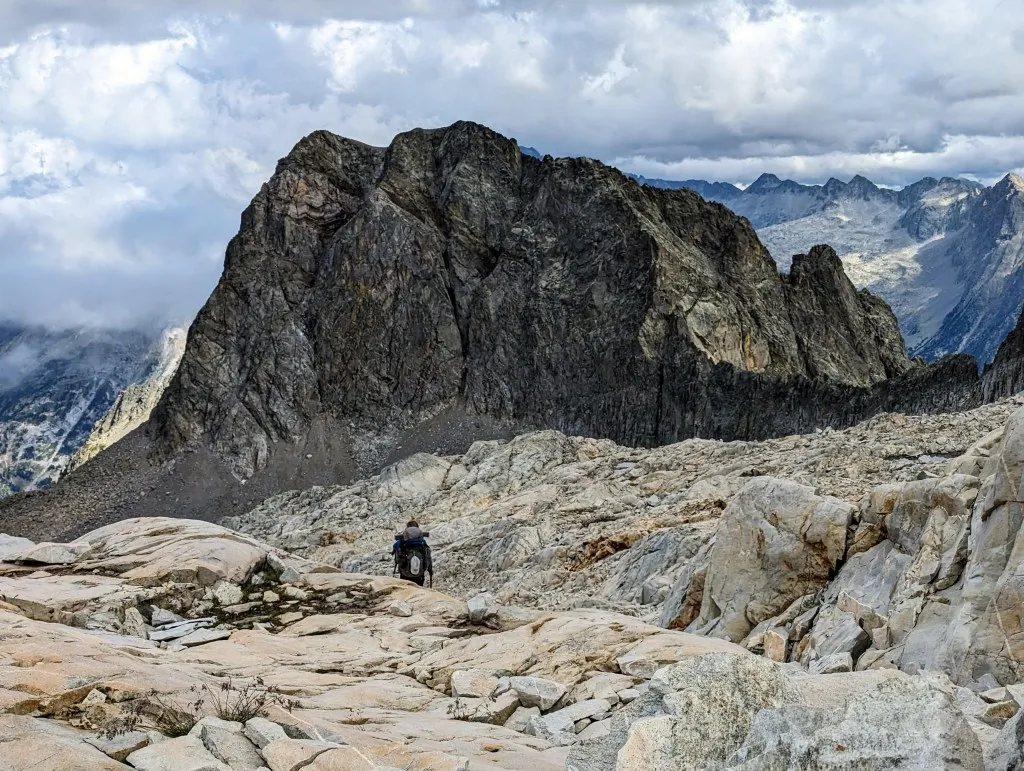
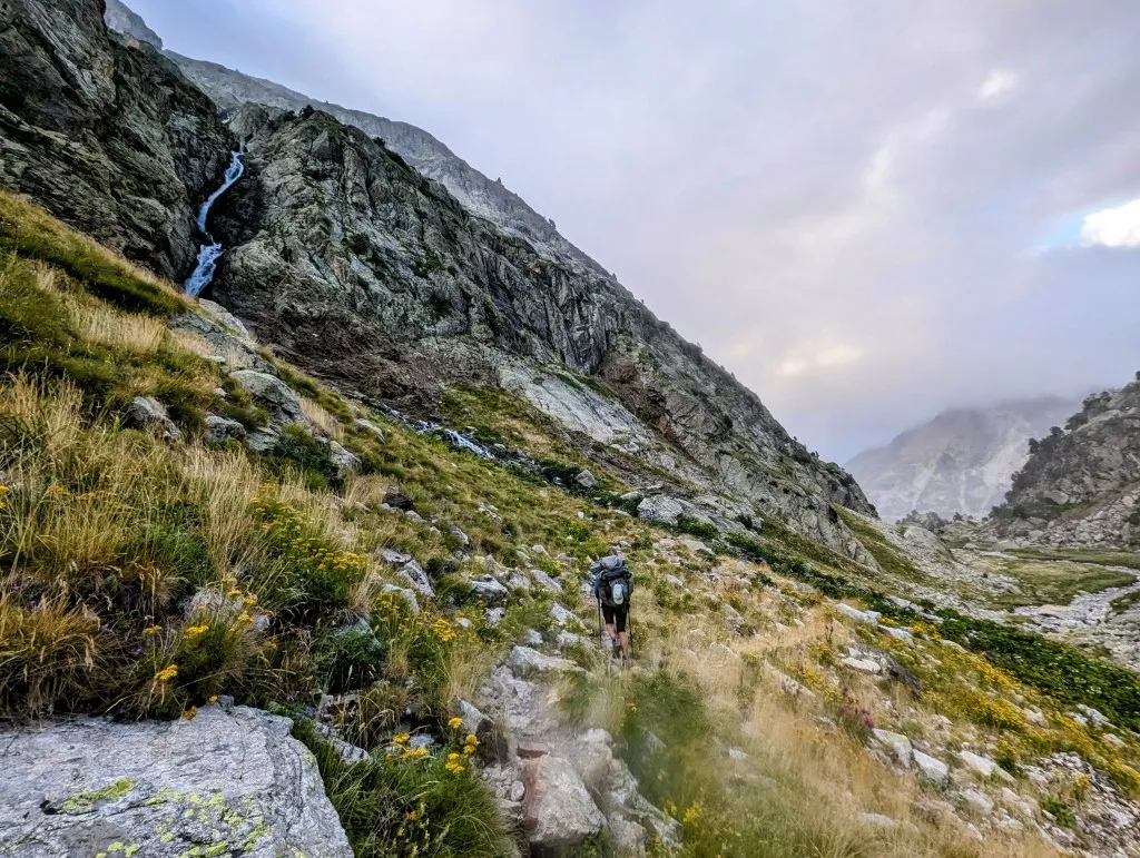
The terrain you walk on makes such a difference; ascending and descending is one thing, but the many stones make progress slow. A deeper valley lies before us, it’s a significant descent to Lac du Portillon. Descending 300 meters over 2.7 kilometers, the average gradient isn’t particularly steep, but it begins with a nearly vertical section. After this stretch, fortunately the terrain becomes less challenging; from a field of stones, the trail transitions into a ‘normal’ path across grassland. Occasionally, we catch glimpses of the lake, but more and more we find ourselves in the clouds, and it becomes misty. Without the sun, it’s noticeably cooler. As we continue to descend, it starts to drizzle and the wind picks up, making it quite wet and cold. At the dam we have to cross is a large refuge situated. We debate whether to go inside for something warm to eat and drink, but it’s quite crowded, and the thought of sitting in our wet clothes isn’t very appealing.
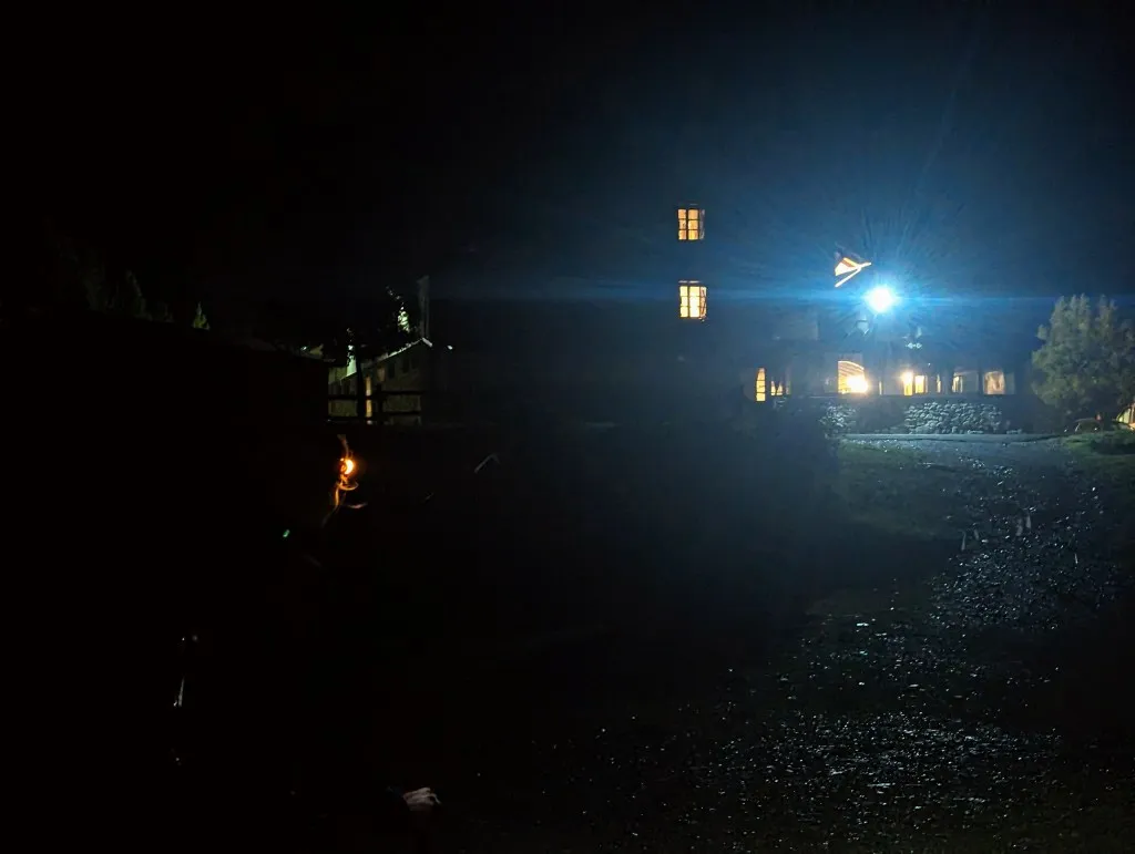
We get some drinking water and after some deliberation, we decide to push on despite feeling tired and chilled, and start the climb, hoping to emerge above the clouds again and take a break there. It’s already half past one, we’ve been walking for 5 hours by now and are quite in need of a break. We cross the dam and begin the ascent; the slope goes up quite steeply. Even though the climbing feels good despite the fatigue, we still hope to encounter some sunshine soon. But it takes a while; eventually, the sky lightens up a bit, and we come across a small flat spot where we can pause. We’re glad to sit down for a moment after 6 hours of non-stop climbing, but it’s chilly, it starts raining again, and the temperature drops quickly. Nevertheless, we need to eat and drink a bit because we still have some way to go. We’re heading towards Portilló de Lliterola at 2,981 meters. While we’re taking a break, the hiker from this morning passes by, a hiker from South Africa. He heard at the refuge below that the weather is changing further up and that there’s a chance of snow on the higher parts. There’s only a small window of time left to cross the pass. He’s glad we’re following him so that if something happens to him, we can find him. Hmm, that sounds serious. As far as we know, there’s no one behind us anymore. After a short break, we hurry to continue and climb quickly. The trails give way to fields of stones again where there’s no path to be seen. We focus on patches of snow: go right of that one and left of that one… We climb until we reach a large snowfield at the bottom of the final ascent. The plain is steep, so we walk to the side before we start climbing the field of stones again. There’s water flowing between the stones, and suddenly, we see large pieces of ice everywhere. The stones are on top of a large glacier that we have to cross, upwards, to reach the final pass. It’s great to walk over a glacier; you almost wouldn’t recognize it under the stones. But we’re glad it’s not snowing yet, and due to the melting ice beneath and around us, there are occasionally quite large stones rolling towards us. The falling stones sound like thunder in the peace of the mist and the mountains. We climb quickly, just one last stretch, a very steep section over loose large stones, but it’s not really fast. We wait until the other person is a few meters ahead before the next one climbs a bit. We reach the top. At the highest point of the day, the highest point of this journey, and the highest point of all stages since we left home: 2,981 meters above sea level! Wow! The weather on the other side of the pass is cloudy but somewhat clearer; the risk of snow seems to have passed. We briefly enjoy the view and then start the descent at 4:00 p.m.. It takes a while to find the way down; it’s not easy to hike down the pass. We have a choice: steep over a lot of loose gravel and stones, or even steeper, step by step, hand by hand, almost vertically down, and then continue over the gravel. We opt for the latter and help each other safely down. The difficult part starts with the endless descent over the loose rubble. Every time you slip, you become more careful until it becomes impossible to walk, and the desire to hike fades away. It gets later and later. It’s a quarter past seven when we arrive at some firmer ground. We look back. That can’t be, did we really come down there? We don’t see a trail, and yet here we are now, quite at the end of our rope. What a beautiful landscape, what an incredible beauty those mountains... But we have to go on before it becomes too dangerous to continue. On the way down, we lose track. Just down then, that’s where we have to go. Until we stand at the top of a tens of meters high cliff and can’t go any further. A bit back then and try a bit further to the right. Fortunately, we see the little ‘stone men’ again to show us the way to the first high valley, the beginning of the Barranco de Remuñe river. We still have to follow this river all the way to the end, until it flows into the Rio Ésera. From 2,400 meters to 1,730 meters. It’s tempting to pitch our tent here. It’s a beautiful spot, flat and with water, but if the weather changes as predicted at this altitude, then tomorrow we’d have to continue the descent further down the valley in the rain over slippery stones. Even though it’s late, way too late, we decide to keep going. The path doesn’t get any easier; we’re walking over many stones again, through one ravine after another. Meanwhile, the route is descending steeply. Over sections without a path and along rocks with only a few centimeters of space to place your feet on a ledge. In the meantime, on a combination of adrenaline and autopilot, we arrive on grassland and later in the forest. It starts to rain and get dark, and in these mountains it quickly becomes completely dark. Fortunately, we have a headlamp and a flashlight, so the path through the forest and the marshes is clearly visible, and eventually, we get to a road that runs through the valley. Unfortunately, not the road to our hotel, Hospital Llanos de Benasque. To reach our place to rest we either have to walk around for 50 minutes or descend a bit higher and walk across meadows in the dark. The latter still works, and eventually, at 10:30 p.m., we arrive at the beautiful hotel in the middle of the mountains. Exhausted, cold and wet, but safe. That’s the main thing. A good shower and a good bed, that’s all we need, and we have that here, so we’re relieved. What a journey! 14 hours for just under 19 kilometers with only one short break. That’s slow, but faster than a snail, which only goes 5 meters per hour…