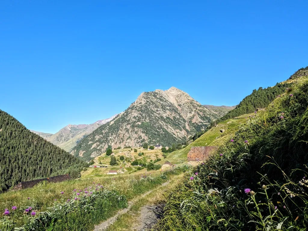
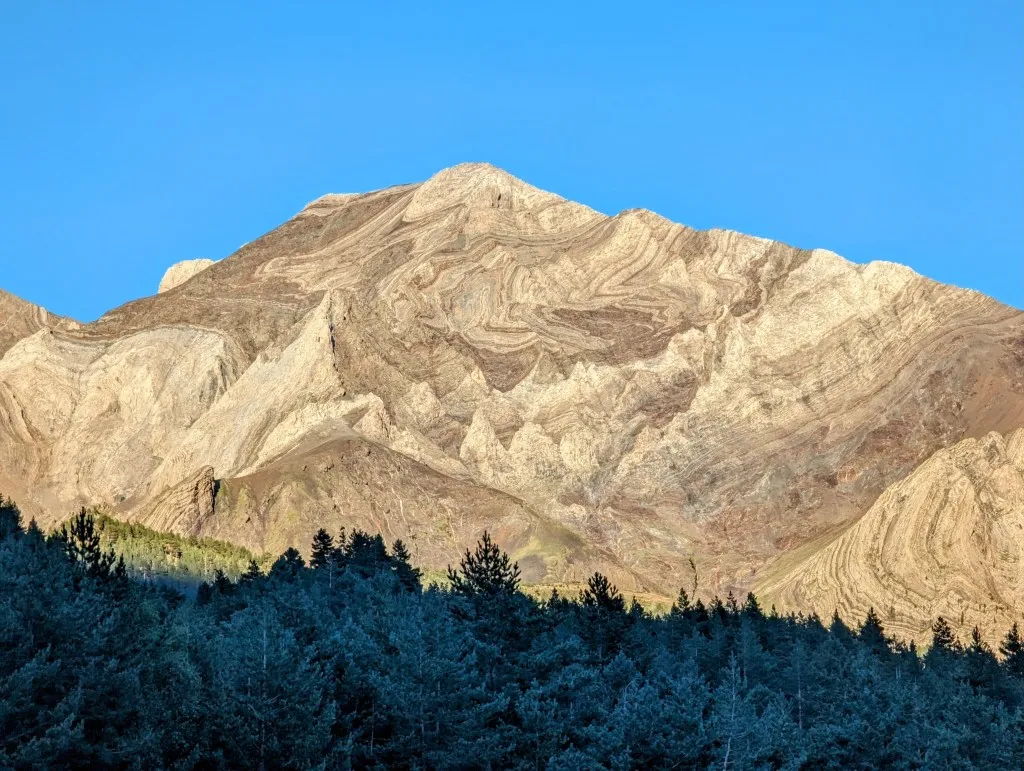
A few days we enjoyed the peace and the greenery of the mountains. The camping filled up in the afternoon and was nearly empty again in the morning. We managed to do some shopping in a small supermarket in the village of Plan, a good 11 kilometers away. That led to a beautiful walk through forests and along meadows, passing blueberry bushes and raspberries, gradually returning to civilization. After a Spanish lunch, we made our way back, ascending again to our oasis in the greenery. Today, we continue our journey through the Pyrenees. In the morning, we follow the GR11 and later transition to the HRP towards Col d’Aygues Tortes (not to be confused with the Aigüestortes i Estany de Sant Maurici National Park, further east in the Pyrenees) at 2,683 meters. This pass was previously known as Col de Clarabide and is also referred to as Puerto de Añes Cruces, Puerto de Clarabide, Puerto de Bachimala, and Puerto Superior de Aigües Tortes. Having just one name for this pass would be too mundane… We ascend along the river valley of the small but swiftly flowing Barranco de Añes Cruces. Starting below 1,600 meters, the landscape is still green and forested, with magnificent views of one of the most beautiful mountains in the Pyrenees: the Posets massif, although the morning sun is currently not ideal for highlighting the magnificent winding layers of red and gray.
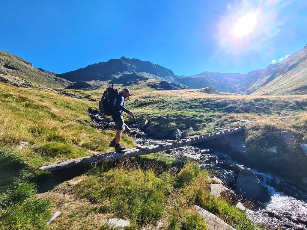
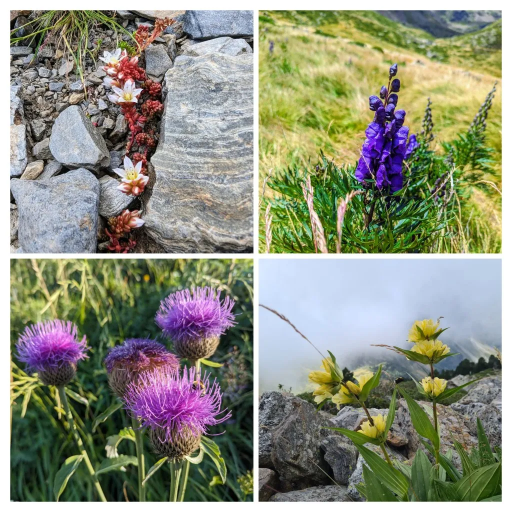
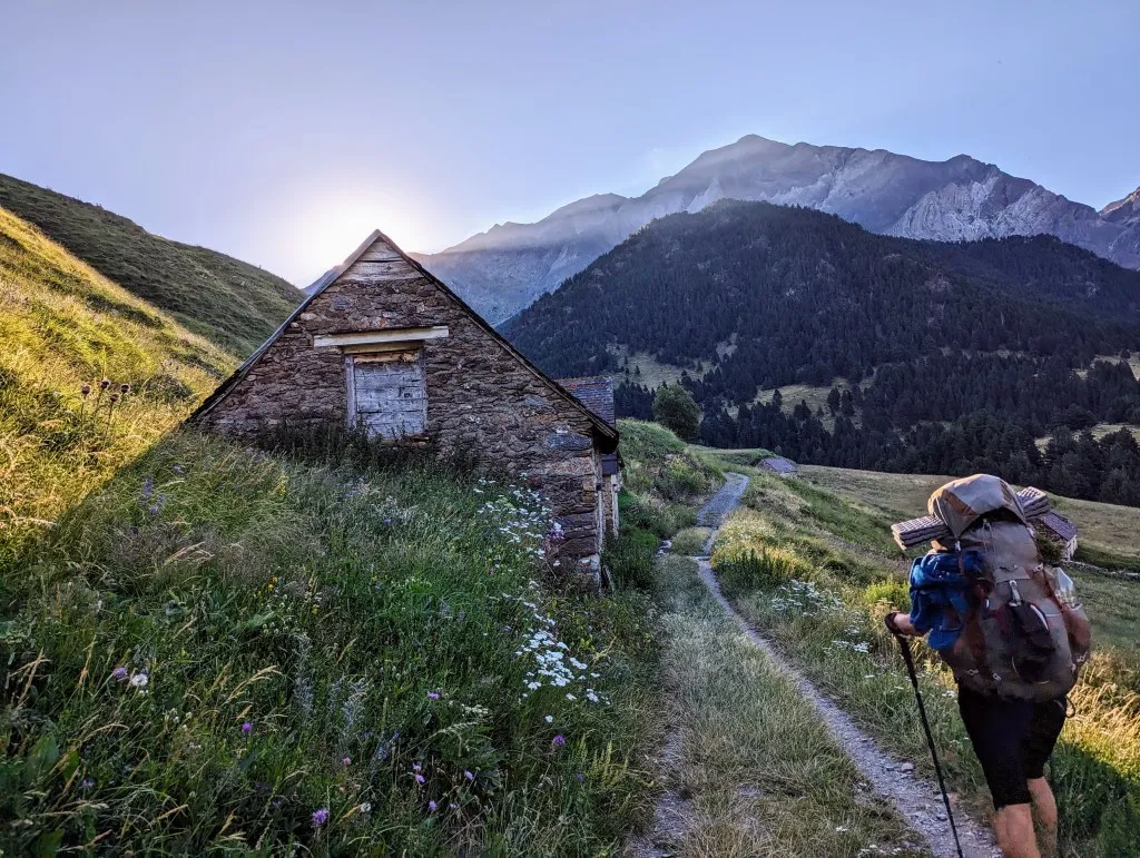
In the evening, the mountain is at its most beautiful. While the rest of the mountains have already lost their color in the shadow of the mountains behind us, this giant still shines in the setting sun. Now, the mountain is large and gray. We quickly climb over small paths between the hairpin bends of an unpaved road, heading towards a last parking lot and a refuge higher up. Soon, we emerge above the forest into the rolling grasslands between the steep slopes of the high mountains. The sun occasionally peaks along the peaks, the morning rays give color again to the grassland. This makes the many purple flowers stand out even more. The somber thistle, contrary to its name, stands fresh and proud above the grass. The blue monkshood also stands out with its deep color. Bees and bumblebees feast on it in the first sunbeams, while we enjoy the sight but keep our distance. The plant is very poisonous, even upon touch. We follow the path past a number of sheds, the last buildings in the valley, and continue on narrow but well-trodden paths. In the first 5 kilometers, we ascend 500 meters. After warming up, we get into a good rhythm, and our legs feel strong. We cross the river over two logs with planks transformed into a bridge. Here is the split between the GR11 and the HRP. The GR11 follows the side river Chistau into the side valley to stay south of the highest peaks. We continue on the HRP further into the valley.
And we'll immediately know what we're saying goodbye to; a path turns to the right, while we turn left, heading up a steep green slope where hardly a trail is visible. But it's a grassy slope, so we'll find our way, and a bit further, we do see a small path. We follow it along the river until we reach a flat area, the source of the river, surrounded by high cliffs. By now, we're just slightly above 2,300 meters. In 2 kilometers, we'll be back at the same altitude, but in the meantime, we have to climb 760 meters higher to reach the col at 2,683 meters. For that, we'll need some more energy, so we decide to take a break here in the wind-protected high valley, to start the climb refreshed. Fortunately, during the break, two hikers pass by heading in the same direction, so we can see how the route goes. It looks steep, as expected.
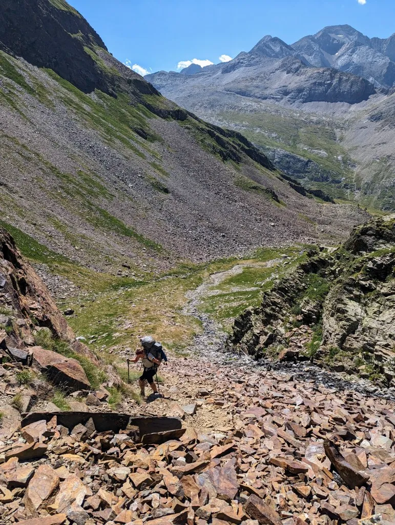
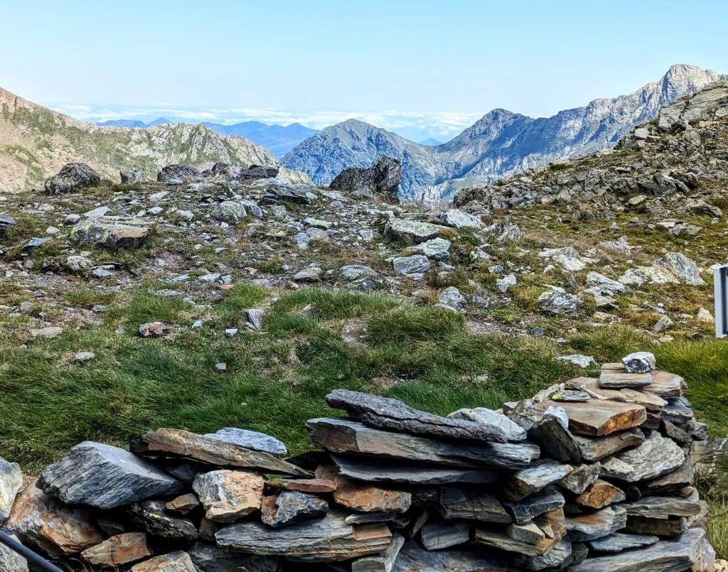
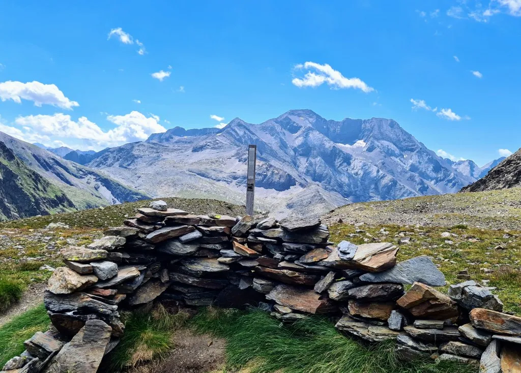
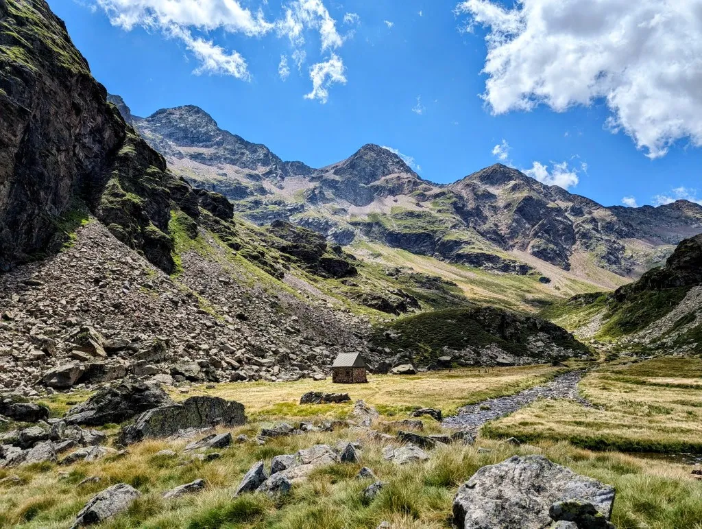
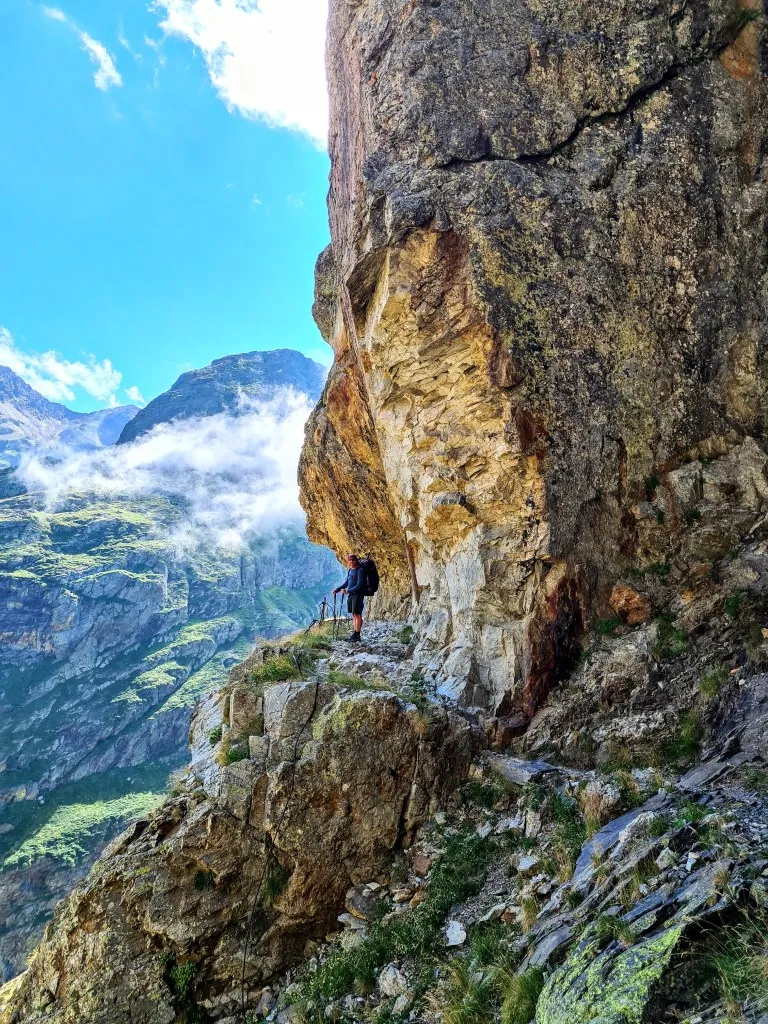
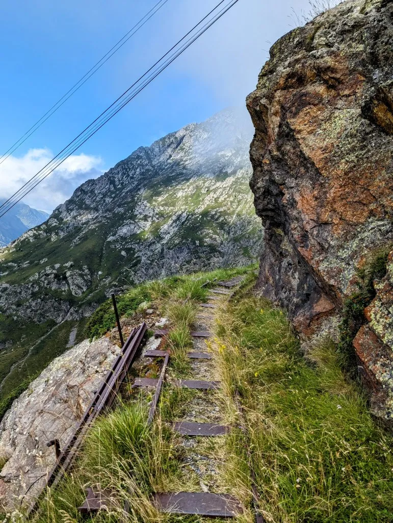
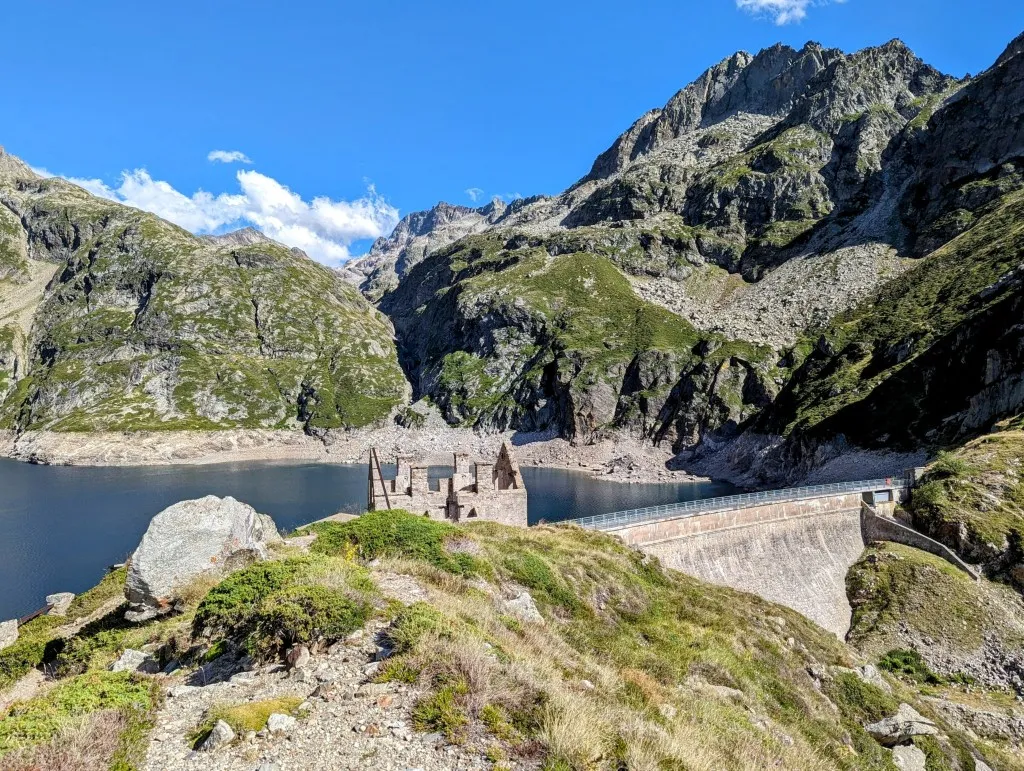
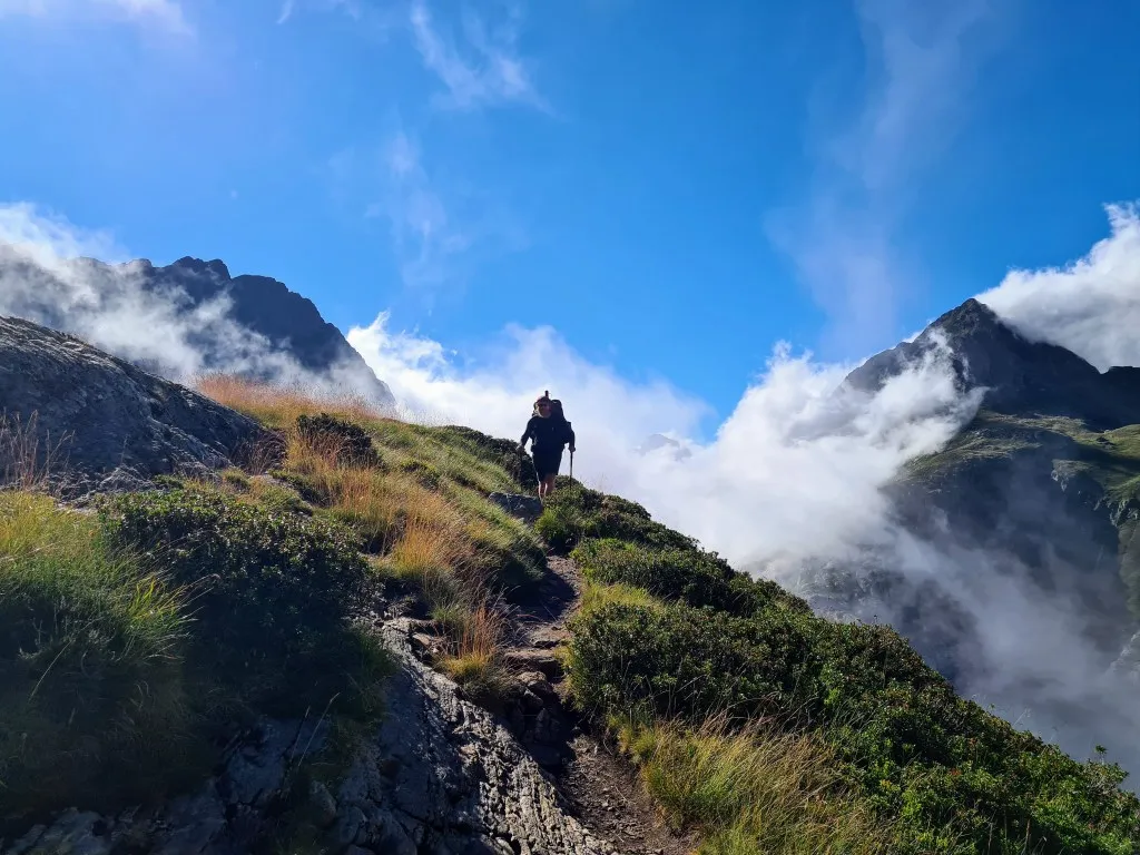
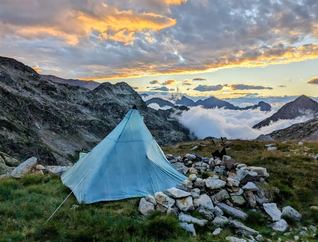
We walk the first meters flat and begin the climb over rocks and loose stones, sometimes almost straight up. We keep a good distance from each other to avoid falling stones. Step by step, we make it to the top. As always in the mountains, there's always another slope above what looked like the summit. That one is at least as steep, but there are fewer loose stones, which makes walking much easier. Now we're really on top! At the Spanish-French border. This is an old trade and smuggling route. It's almost unimaginable that people used to come over the mountain with donkeys to transport goods from France to Spain and back again. There's a monument at the pass with the story and a photo from that time. Impressive. From here, so many peaks are visible, north and southward. France is once again hidden in the clouds, as we often see it. We're above snowfields among the bare rocks, but occasionally some grasses and flowers peek through. Sedum atratum, known in the Netherlands for its 'green roofs' with beautiful deep red stems and delicate white flowers, thrives here. It's windy here, so we descend quickly but calmly. The descent is less intense than the climb. Equally steep, but with a lot fewer loose rocks. We're glad we're walking the route in this direction. We're soon back at 2,300 meters altitude, from where the path becomes flatter again, and the bare rocks turn into grassland. Further on, there are flocks of sheep; their bells sound wonderfully familiar by now. We follow a narrow path through the valley, descending to a large flat expanse of grass. Here stands a splendid-looking unmanned mountain hut with beds and a dining table. This would be an ideal place to stay, but it's still too early in the stage, so we continue walking and take a break on the other side of the plain, just before a route split. The HRP descends from here to Refuge La Soula, 350 meters lower, to then ascend back to this height and beyond. There's a path above, heading towards a reservoir and sloping around the mountainside, beautifully encircling the mountain. From here, the path is clearly visible. On the map, it's just a line or a dotted line; you never know what to expect, but from here, the path looks better than you'd expect from the altitude gain. A straight line runs gently uphill against the mountain. We climb to the lake and find the path. It's a beautifully constructed wide path, carved out of the mountains and rocks. Occasionally, we see metal pins and further on something that looks like overgrown rails. Here, a train used to run in the past. Not a tourist train, but a mine train. It's great that it's a path now because the valley lies deep below us, and this saves us a lot of altitude gain. We pass abandoned entrances in the mountain and a dilapidated cable car probably used to transport iron ore downhill. There's nothing left to find, but judging by the deep red stones, there's a lot of iron in the ground. These kinds of abandoned structures always spark the imagination. We'd love to investigate further, but we keep up the pace to make further progress. At the end of this path, we still have a considerable climb ahead. It's already 5 p.m., and we've walked 16 kilometers. We walk through a last abandoned building and begin the climb from 2,050 meters altitude to a reservoir at 2,200 meters, rest for a bit, and then climb further to the next lake at 2,400 meters. A stunning place to spend the night. We look for a spot to pitch the tent, but someone is already there a bit further, which doesn't give us a good feeling. We decide to continue to one lake further, Lac de Milieu, at almost 2,550 meters altitude. Wow! A breathtaking view of the French Pyrenees, in the clouds of course, but the peaks protrude above them. A little lake behind us and the lake below us. A stream for water, and a flat spot for our tent (which always seems to need just a bit more space than estimated when setting it up due to its pyramid shape). It's 8:30 p.m. when we set up the tent and much later when we enjoy our freeze-dried dahl and semolina with vegetables after sunset. A luxurious meal, so high in the mountains. Another magnificent spot… We'll sleep well after this challenging stage.