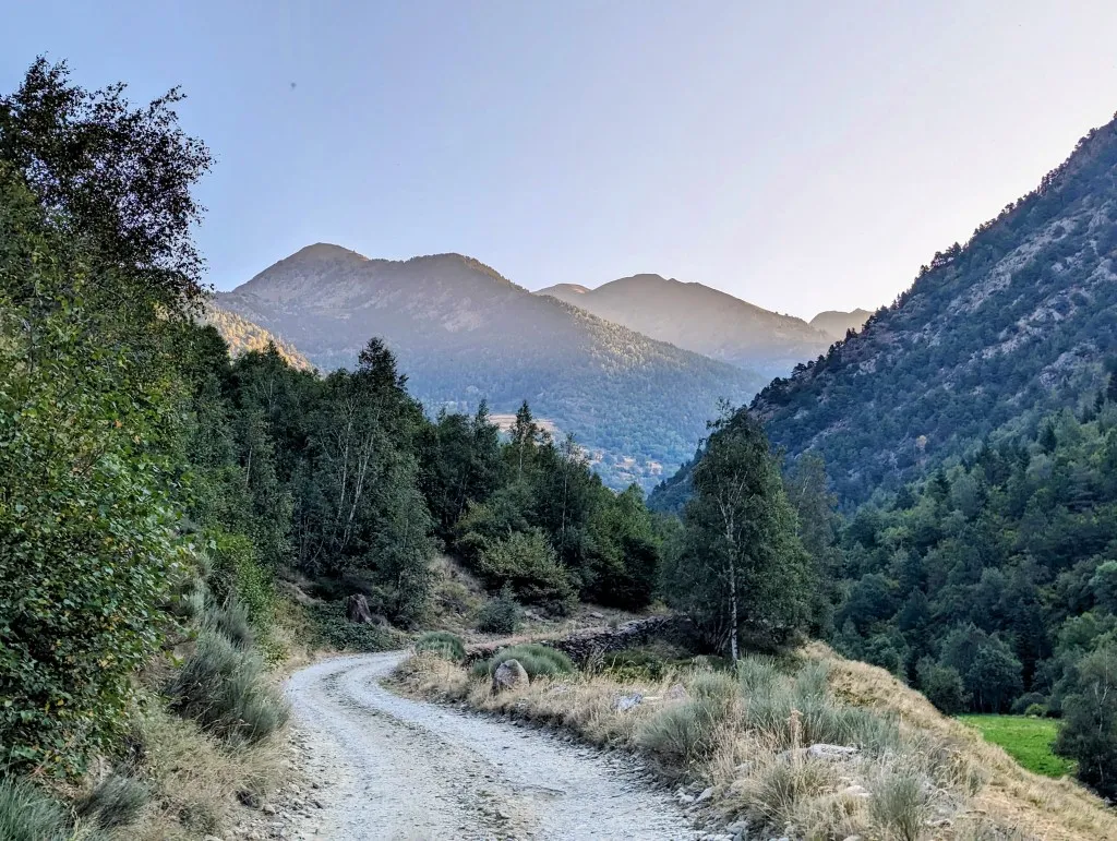
We split this stage into 2, 3, and even more. Left towards the city of Andorra, right towards Carcassonne or Perpignan. Eventually, after 10 mountain stages of less than 20 kilometers, we decided to turn this, the last stage for the foreseeable future, into a monster stage to Arinsal on the other side of the Andorran border. A hefty 27.5 kilometers with 3,600 altimeters of elevation gain, and we'll go higher than we did in the Alps last year. A challenging trek, especially now that this morning it turns out that Malou picked up something on the campsite or somewhere along the way, making her not quite fit. Was it the untreated water, the crowded campsite's facilities, or perhaps something she ate? We'll never know. The timing couldn't have been worse with the trek looming ahead. We discuss this morning what we'll do. Thunderstorms are forecast for later in the day, and the weather will really change from tomorrow; it's not advisable to head high into the mountains. We decide to push on and keep an eye on how things go, especially in the beginning. So, we pack our things and set off. Exiting the campsite and then turning right, through the valley, all the way to the end where at the col Portella de Baiau, at an elevation of 2,826 meters, Andorra begins. It's not yet half-past seven, and it's peaceful as we walk past La Forca d’Àreu, the last village in Spain. We're greeted by a puppy running out from a little lane, followed quickly by a few more.
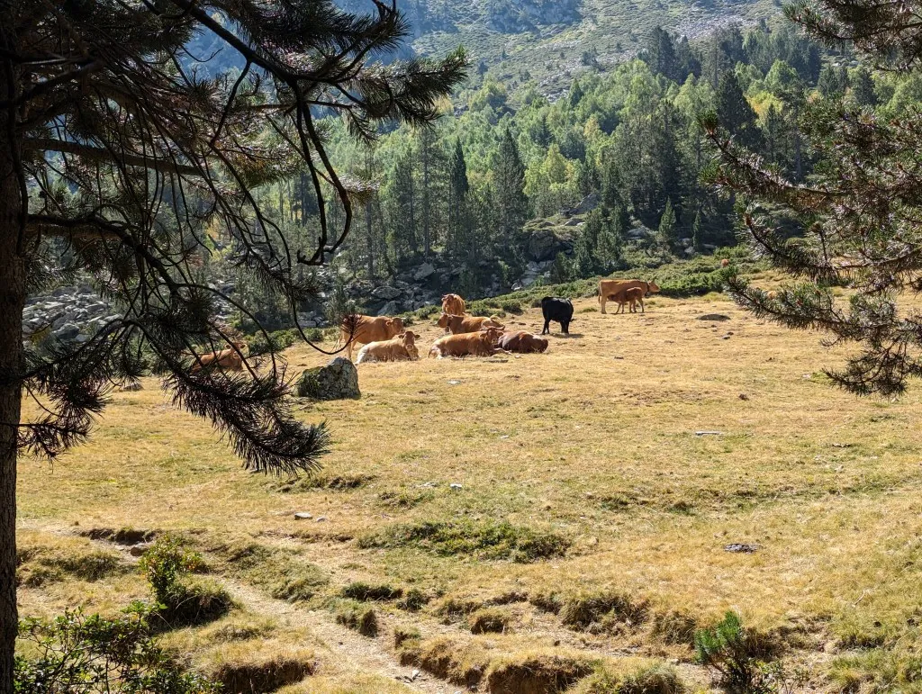
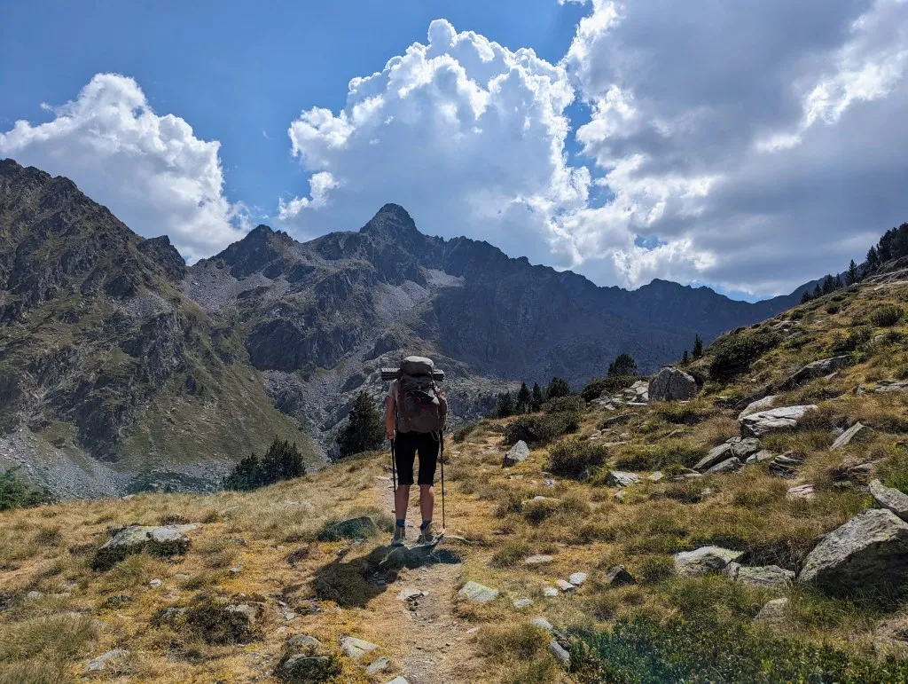
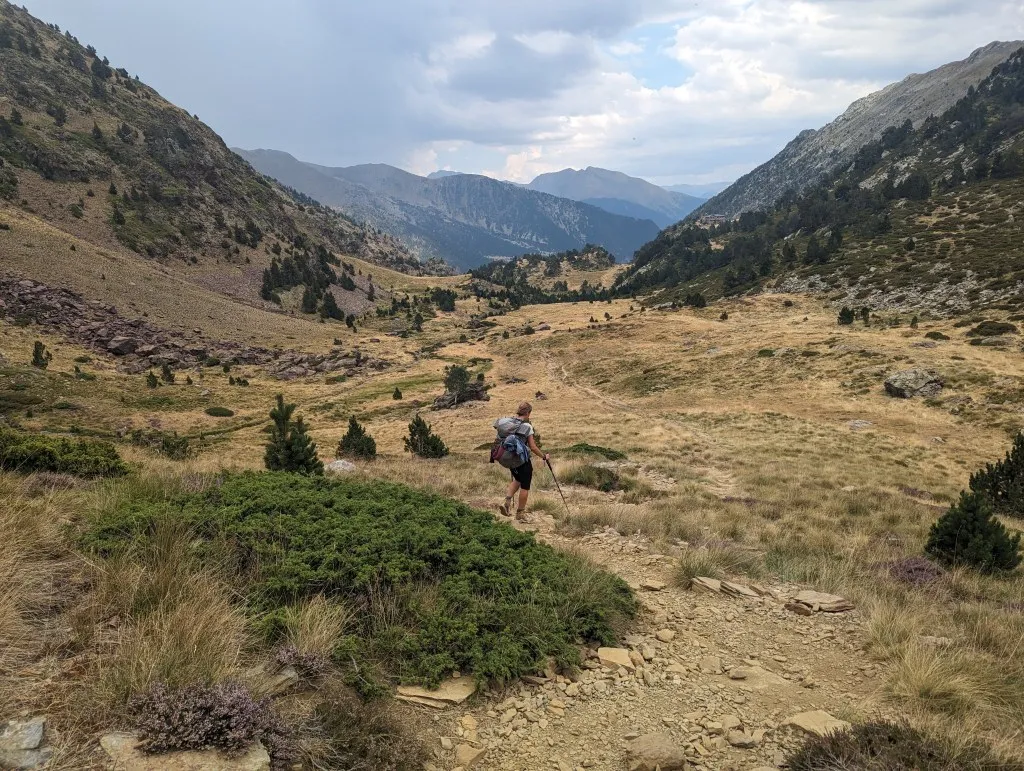
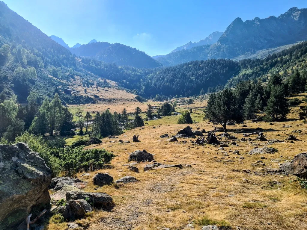
We pet them for a moment and continue along the small road between the fields. The road turns into an unpaved track and continues to follow the river. Here and there, old channels lie to water the fields. The road progresses smoothly, good for warming up the legs. After 3.5 kilometers, we turn right onto a smaller path that occasionally becomes a bit steeper but is never difficult to walk on. The fields give way to forests, and the landscape becomes increasingly mountainous again. Previous stages felt more like hilly terrain, but the bare rocks ahead indicate that we are truly gaining altitude again. We reach a wide path and arrive at the last parking lot in the valley, where several hikers' cars are already parked, as they come to hike in this beautiful part of the Pyrenees. We continue through the valley, which soon widens, passing a vast expanse of yellow grass with old pines. By now, we've walked about 7.5 kilometers, and it's still early, but especially for Malou, it's time for a break. She's managing the walk well, but it's still draining more energy than usual. Eating and drinking something, lying down for a bit, and then getting back on our feet with renewed energy. The landscape becomes increasingly stunning. Meadows and clusters of trees, dry rocky patches, and wet marshes alternate. We pass by cows and cross streams more frequently, sometimes using bridges, sometimes hopping from stone to stone. The terrain becomes rougher, and we get more and more views of the area we're heading towards. In the distance, we see high, barren peaks of over 3,000 meters, with the sky above becoming increasingly cloudy. Since thunderstorms are forecasted for later in the day, this is about the point where we need to decide whether to continue or turn back. We've managed to keep up a good pace, and things are going well, so we decide to press on.
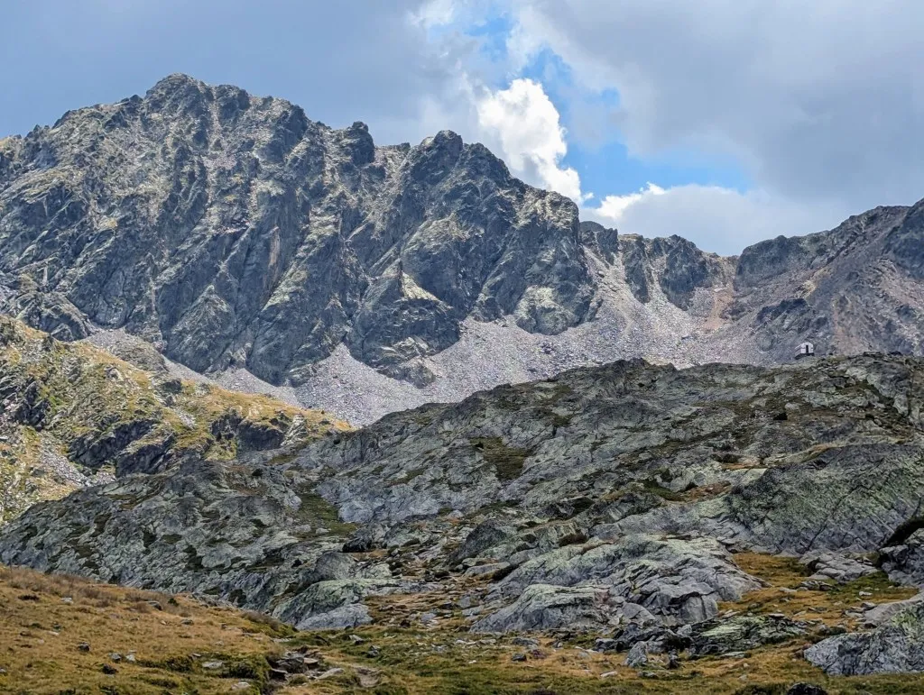
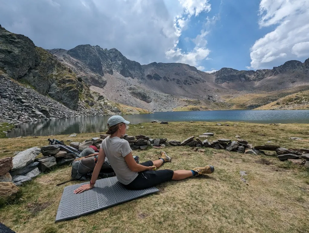
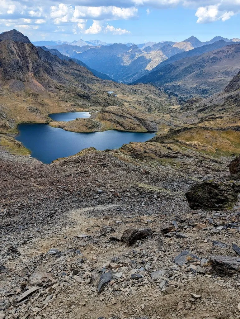
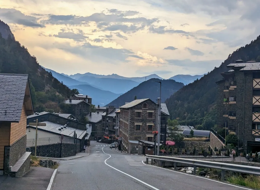
The paths become narrower and narrower, and the landscape becomes increasingly open. Along the way, we're treated to a handful of raspberries, welcome vitamins from nature. Towards the end of the valley, we pass by three lakes, beautifully surrounded by the barren mountains and a steel cabin that can be used as a refuge. There are quite a few people who are hesitant to cross the mountain due to the approaching thunderstorm. They probably haven't checked tomorrow's weather forecast, which is even worse, so the window of time to cross the mountain is shrinking. We would prefer to continue, but at the last lake at the bottom of the steepest section, we need to replenish our energy. A quick break is in order. It's still not entirely clear to us where we need to climb the slope; we don't see a path leading up the mountain.
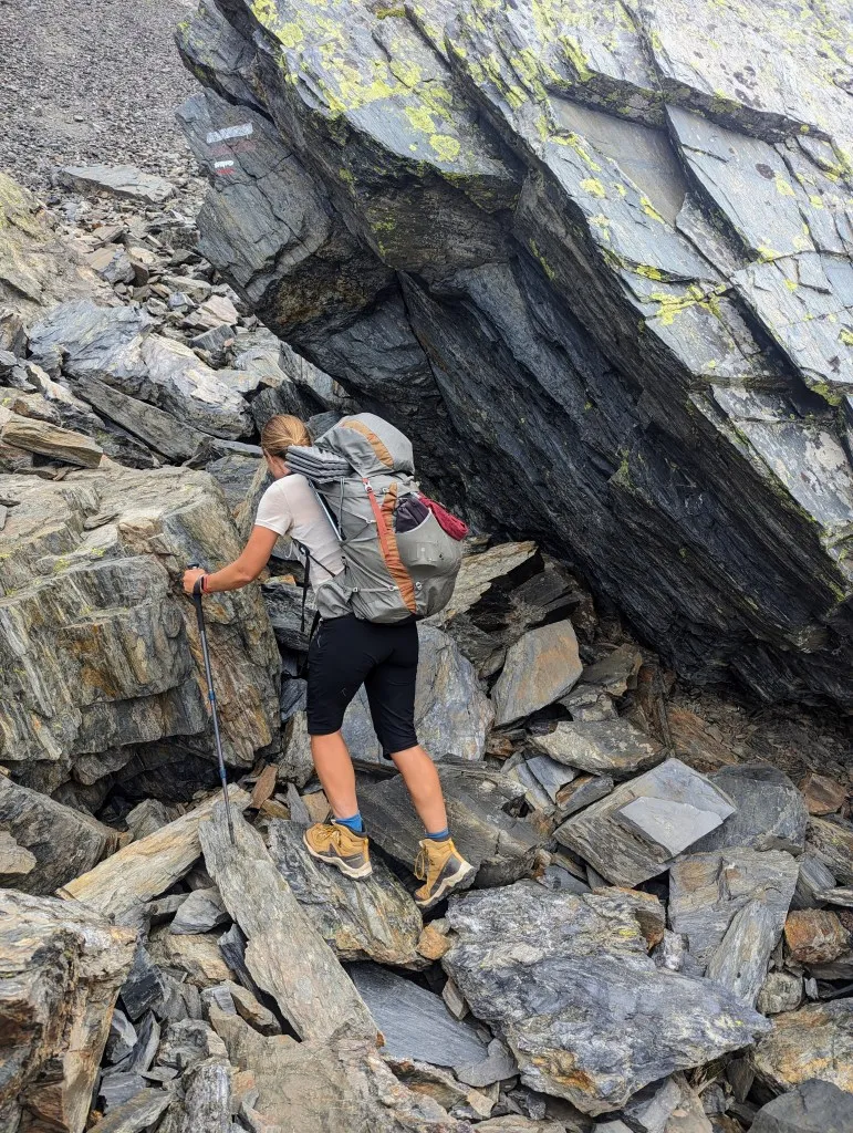
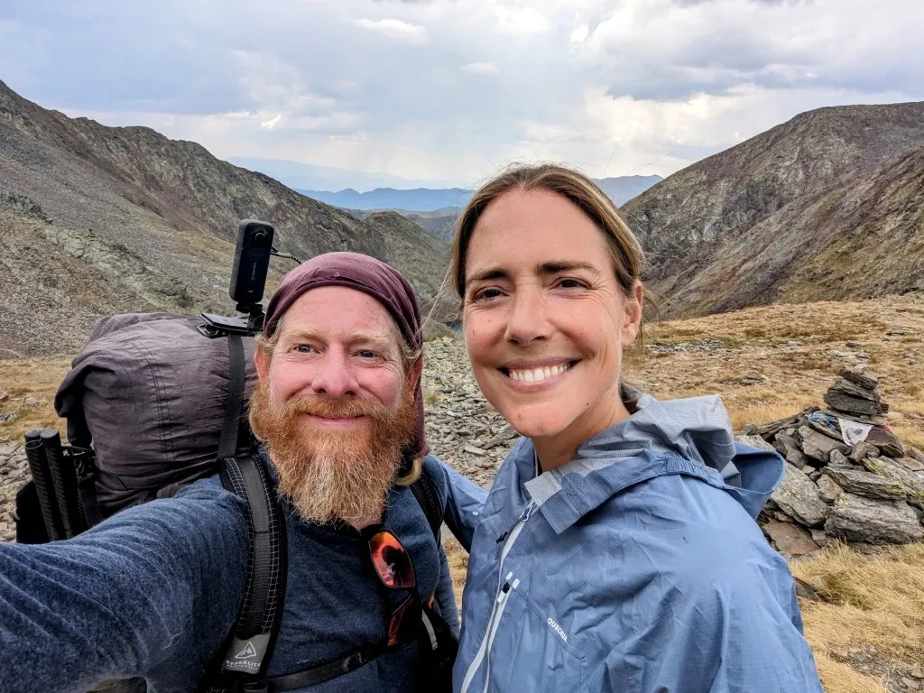
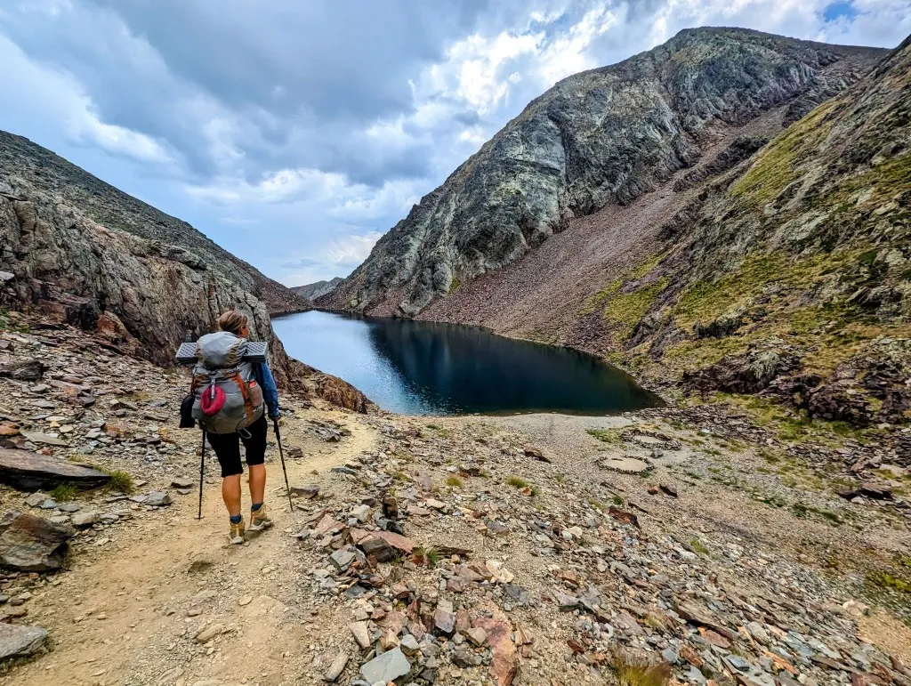
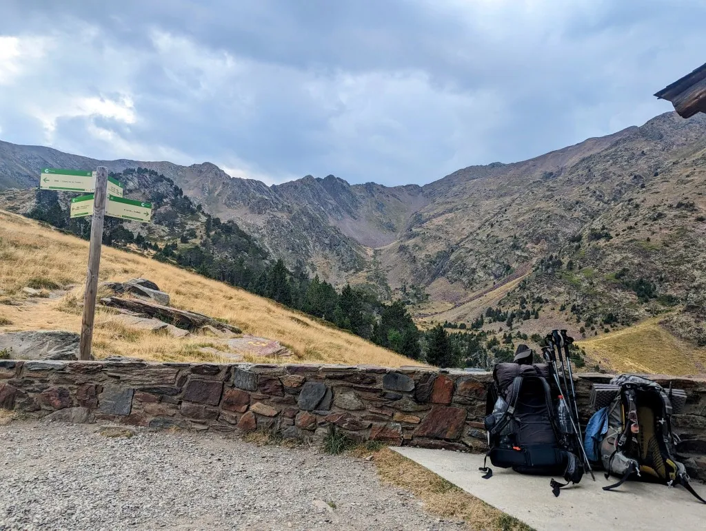
But it's the last bit of climbing for this journey, so we're excited. After the break, we follow the white/red markings of the GR11 out of Spain along the lake, across a large stone plain, and then up the mountain. Steep uphill. The reason we didn't see a path from below is that there isn't one. A steep slope of loose stones is the final stretch to Andorra. Steeper than the steepest slope we've encountered. We ascend 30 cm, and then slide down 20. It's only a few hundred meters, but we struggle our way up. We're passed by a Spaniard who says he's hungry and can already smell the pizza on the other side of the mountain. With a beard down to his navel and shoes without tread, he races up the mountain. So, it can be done, as long as you're hungry enough, haha. Eventually, we reach the col at 2,826 meters, the border of Spain with Andorra, and a view of the French border. The last meters in Spain, the country we entered from Portugal on February 20th, exactly six months ago. And what a six months it's been! We'll miss you Spain, hasta luego… on to country number 10 on our journey: Andorra! Here at the border, we catch our breath and enjoy the magnificent view. What a beautiful place; that climb was definitely worth it. The sky becomes cloudier and darker, but we're already off the ridge before the thunderstorm hits. We have one more steep descent to Arinsal, a ski resort village at the foot of the mountain. Descending 1,500 meters in 7 kilometers. Fortunately, we see a path leading downwards, rather than a stone slope. We gather ourselves and start walking again. The kilometers and altitude meters start to add up, especially for Malou, whose energy seems to deplete more quickly after a break. Fortunately, the descent is much easier, and we make good progress. The first steep section descends towards a lake, then it's a bit flatter over large rocks before becoming steep again towards the first valley. In the distance, at the end of this high valley, we see a refuge. Hopefully, we can take a longer break there; then we will have descended enough to safely reach the bottom if the weather turns. We descend from the rocks through grassland to the tree line and continue on to the refuge. What a stunning landscape! And even though it's tough, we fully enjoy these last kilometers of the high mountains. We take a turn towards the refuge, which thankfully turns out to be open, and we can buy a sandwich and something to drink. What a treat after such a stretch, delicious! We have a view of the mountains we've come from, and in the meantime, we see dark thunderclouds hanging there and hear rumbling. We've been lucky, or made the right assessment. After living in and with nature for a year and a half, we'll go with the latter. You learn to sense nature's whims quite well. In any case, we're in a good spot here; it seems to have passed us by. We enjoy the break a little longer and then set off for the last stretch. We continue to descend. The landscape becomes more forested again, and the high mountains seem to be getting further away. At the end, at the bottom of a ski slope, the paths have changed, causing us to get lost and have to walk an additional distance, but not much further, we enter the buildings of Arinsal. Just a bit to our hotel, passing ski shops, restaurants, and hotels: civilization. It's been a while! Despite feeling a bit exhausted, we reach the end of the journey. Along the endless ocean, the vast dry inland, the mighty mountains to Andorra. We made it! From 'dreaming to reality'. From 'the Algarve to Nice' has turned into 'the Algarve to Andorra', leaving plenty for the next journey: 'From Andorra to Nice', from the Pyrenees to the Alps!