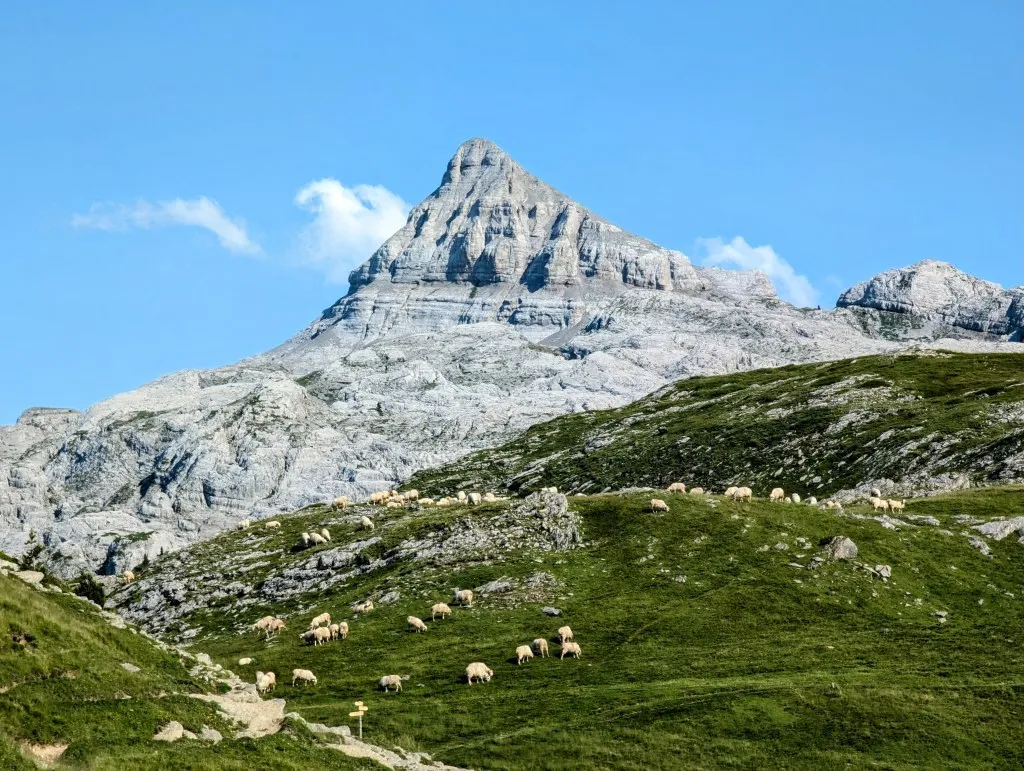
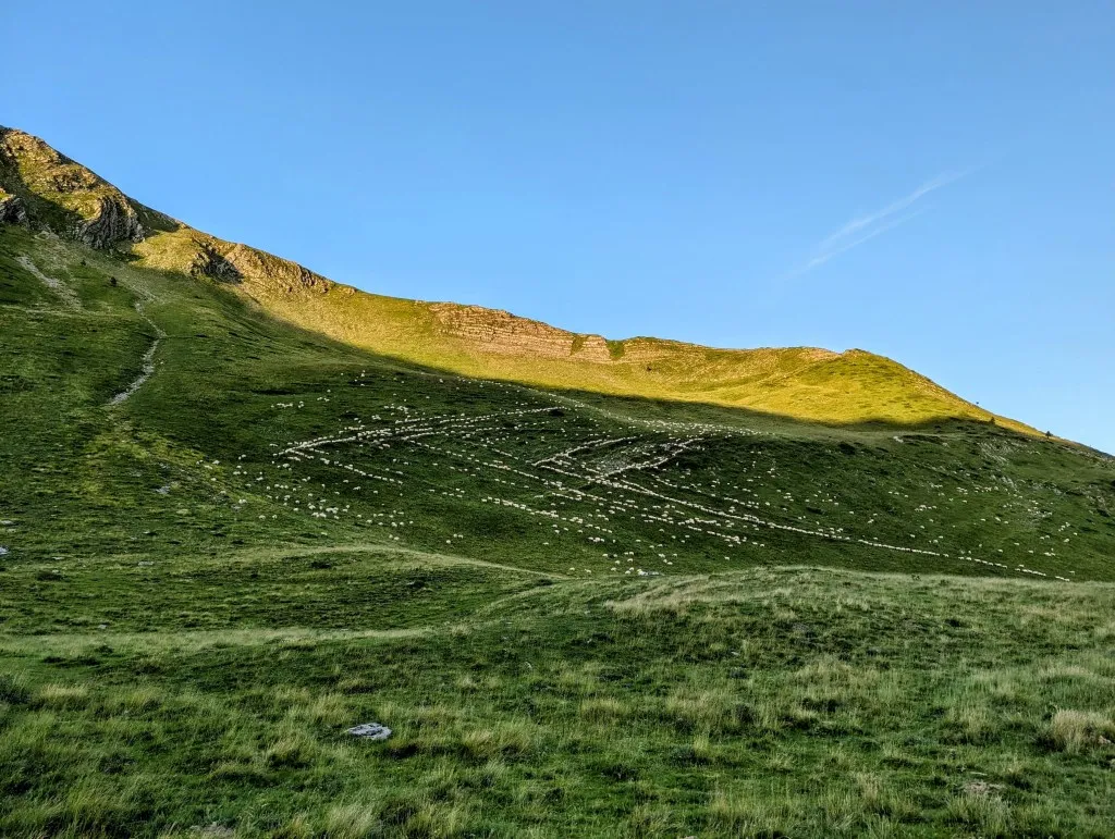
When we unzip the tent this morning, we find ourselves right back in the mountains. The rocks and peaks in front of us are stunning, and on a small hill next to us lie the cows that also trekked up the mountain last night to stay overnight. Despite some rain and considerable wind last night, this morning is crystal clear. Towards France, there are some clouds in the valley, but the peaks beyond are clearly visible. A flock of sheep descends from a hill further down towards our valley, and as we enjoy our breakfast, a few hundred meters away the flock passes by with a shepherd and a sheepdog, moving further up the slope. A unique spectacle in the early morning. Despite the rain, our tent is bone dry, so we quickly pack up our stuff and resume our hike around eight. We climb a bit more to reach the original route on the pass above us. Except for a few scattered pine trees, it’s grassland that we walk through. Low grasses, herbs, and flowers cover the higher parts of the mountains. Once over the pass, we re-enter Spain and descend slightly into a valley with horses. The Camargue is known for its wild horses, but here in the mountains, whole herds can also roam freely over hills and valleys, though they often wear a bell around their necks.
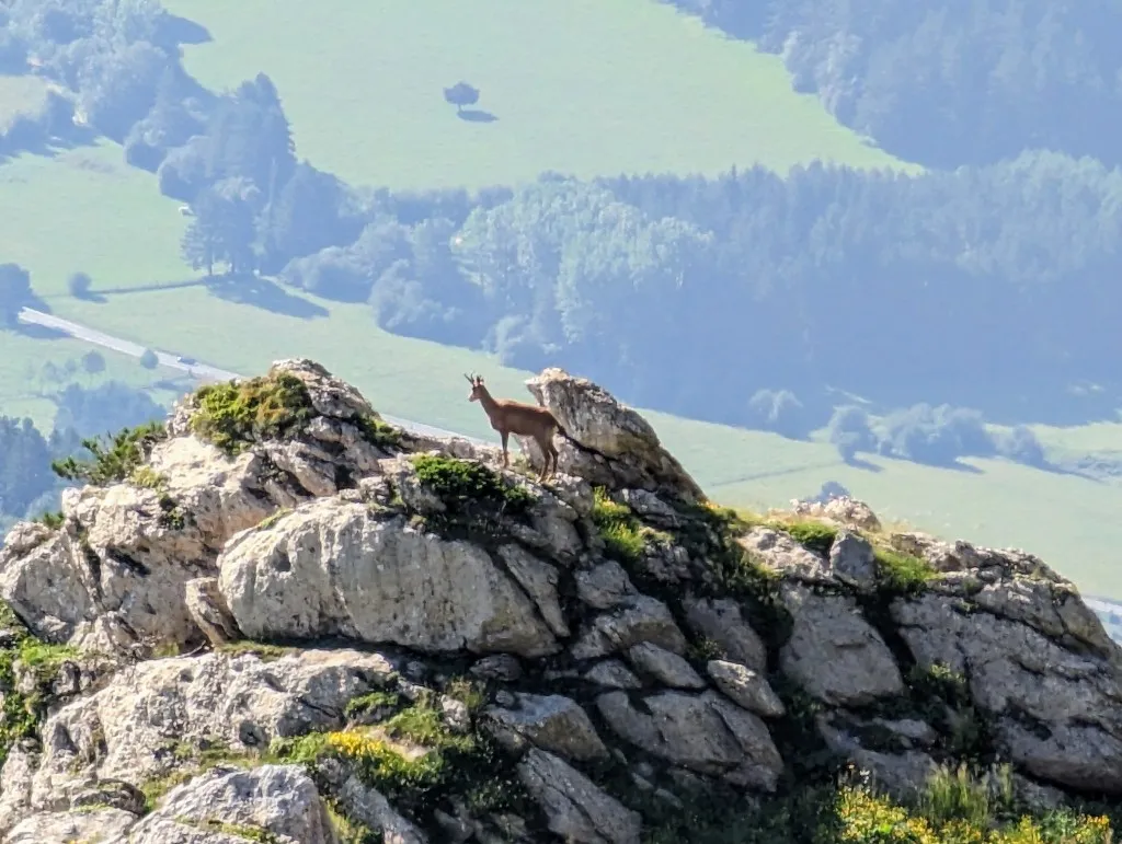
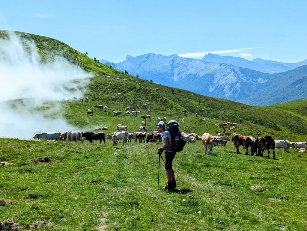
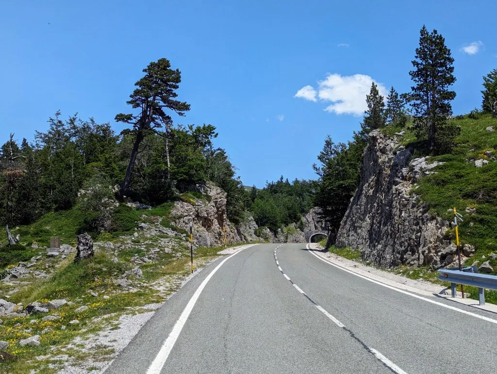
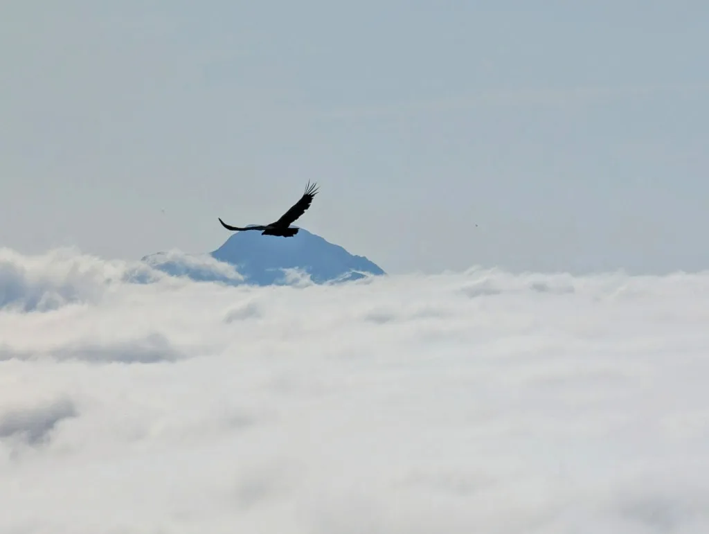
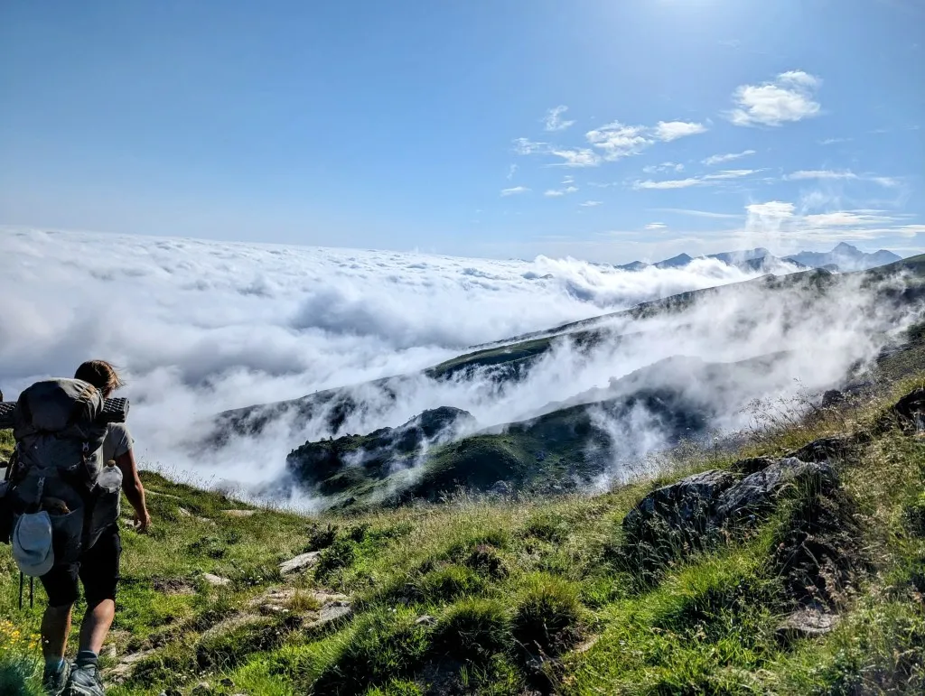
Down in the valley, there are dozens of horses, many with foals. They remain calm as we pass by. A bit further, we lose the trail again and have to scramble a bit to find the correct route higher up, heading towards the pass on the other side of the valley. The cloud cover below us has become quite a carpet. France is under a thick blanket of clouds, while Spain is basked in radiant sunshine, and we are walking right along the dividing line. The path occasionally rises steeply against rocks, but most sections are easily navigable. We climb to about 1.800 meters and then descend to 1.400 meters over 2 kilometers, a 20% grade. Steep, but oh, how rewarding this landscape is. The descent leads us to Port d’Ourdayté, a busy pass. It's visited not only by hikers and the occasional cyclist but mainly by many cows and horses that seem to enjoy all the passing people. At least, they are not bothered by it. We walk right through the herd, past the lying bull and large horses, and they don't move at all. Clouds try to push from France into Spain by climbing the hill over the pass, but as soon as they rise above the land, the strong southern wind from Spain blows the cloud back in a swirl. Magnificent! From here, the route continues on the Spanish side of the ridge and gently slopes uphill. There are many springs, streams, and small waterfalls. We cross a road and arrive at Refuge Belagua. It features a terrace with stunning views and delicious sandwiches with coffee, as it turns out ;-). A break is by now much welcome, and since we have taken the bare minimum of food into the mountains, this feels like a real treat. We take our time, as this will be the only luxury we encounter until tomorrow evening. To the east of us lies the large Larra-Belagua massif (Spanish) or La Pierre Saint-Martin massif (French) with its highest point, the prominent Pic d'Anie at 2.504 meters. This karst mountain range is made of sandstone that is highly susceptible to erosion. The area is quite inhospitable and difficult to traverse on foot. To the south of the highest point are routes, but those are dozens of kilometers extra. We choose a route to the north of Anie, but then we must walk a considerable distance along a two-lane road to enter the chain from that side. We find a path through the meadows that leads to Col d'Eraize, leaving us about 4.5 kilometers to cover on the road. But the road is beautifully situated between the mountains, though we see little of it at first. The pass is covered in thick fog and is home to countless horses. Every couple of steps we walk further, we see more of them, in the meadows and on the road. We walk on and the sky clears. Gray rocks with pine trees adorn the hills. Due to the white/gray stones, it almost looks like a winter wonderland. This landscape is home to the Pyrenean chamois, brown bear, vulture, and capercaillie. We've seen the chamois and vulture earlier in this stage; we hope to spot the capercaillie, as it's a very beautiful bird. And the bear, well… it would be nice to spot it from a large distance.
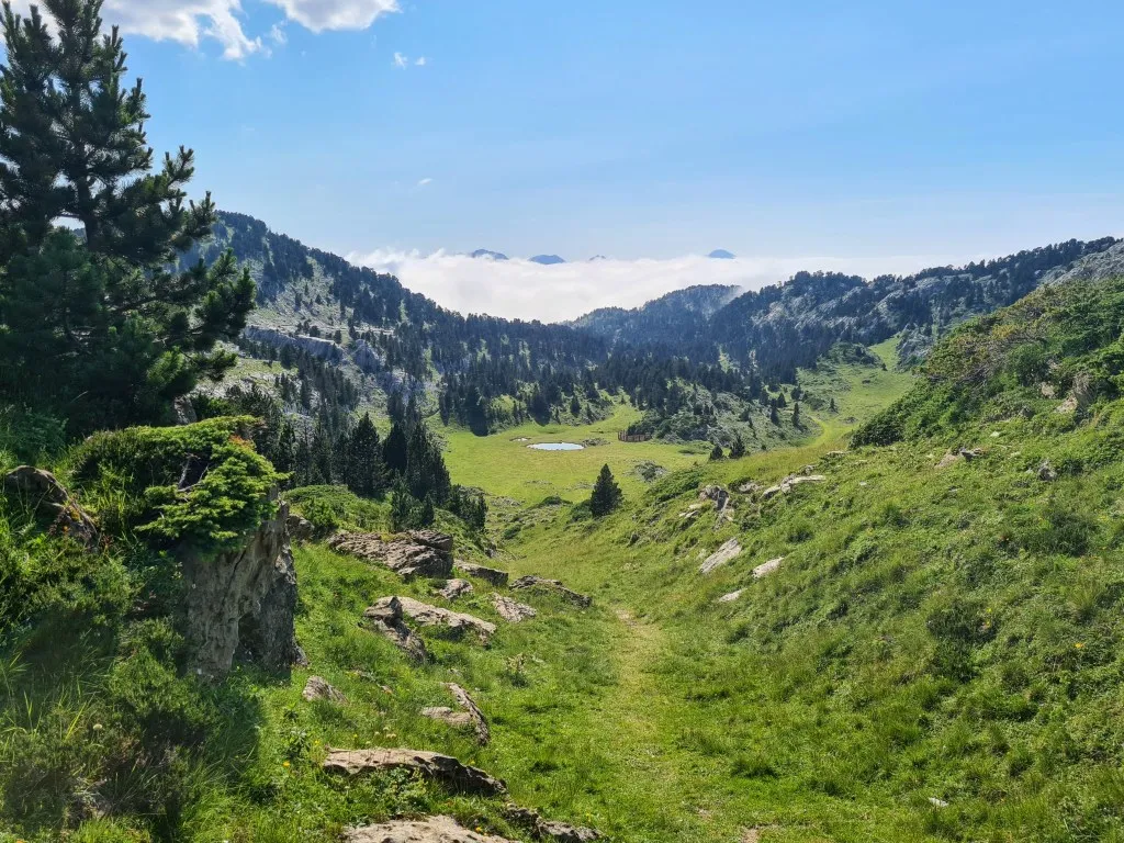
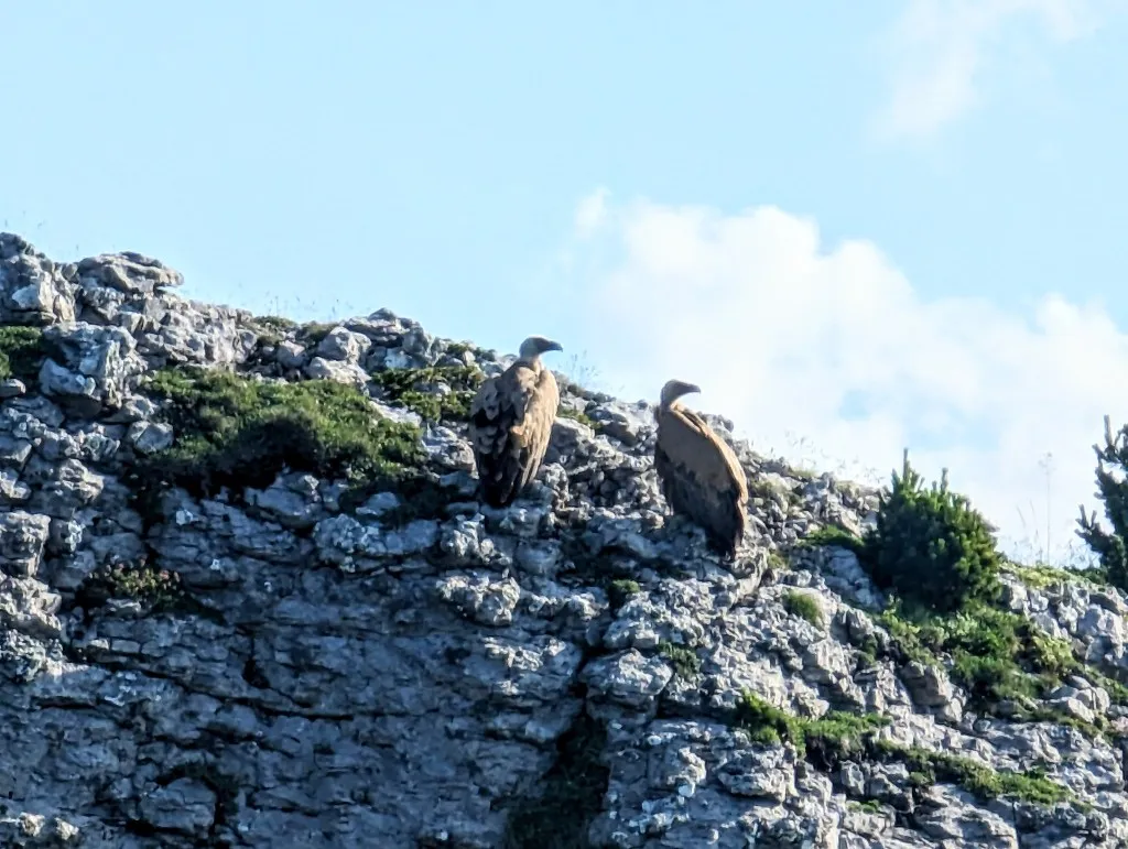
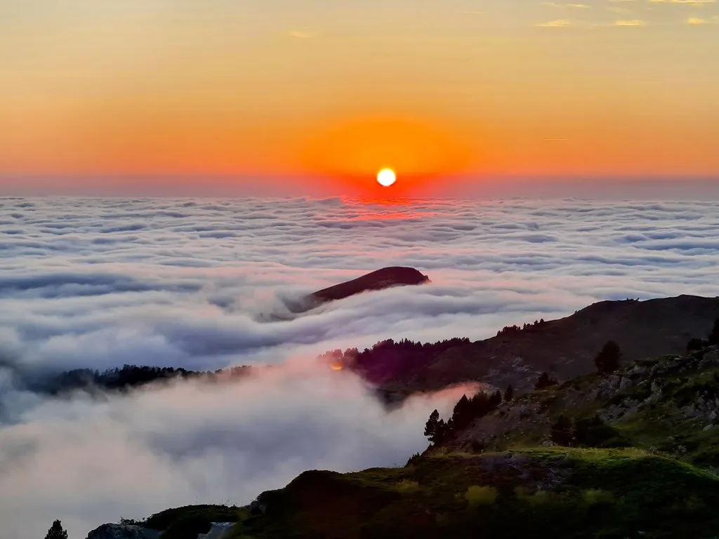
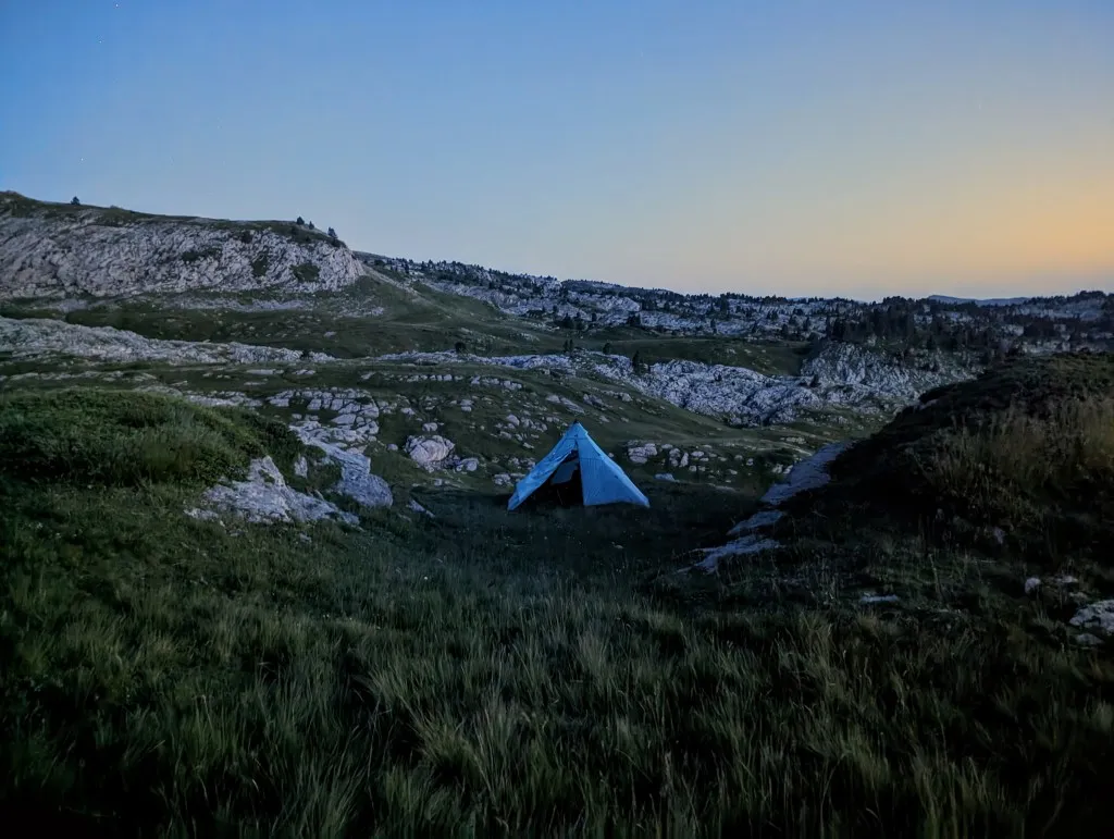
Once off the road, we first traverse a rocky grass path among the pines used for cross-country skiing in winter. At the end, it transitions into mountain meadows with occasional deep holes. The soft rock erodes faster in some places than others, creating holes and caves. The path climbs steeply, and with every meter we ascend, our energy depletes, but before we can look for a spot to camp for the night, we must first find water. The map shows two springs and at the second one, we are lucky. Clear water flows from a hose out of the mountain. There are many sheep and cows, so we filter it and add chlorine tablets just to be sure. And we'll also boil most of the water for coffee, tea, and our food. Not double Dutch, but even triple Dutch ;-) so it should be fine! The last stretch to a place where the contour lines are further apart, giving us more chance of finding a flat spot for the tent, stretches long, but in the last meters, we are unexpectedly treated to two griffon vultures sitting on a rock no more than a hundred meters away. The valley below us is enveloped in clouds, with some mountain peaks sticking out. We walk in the sunshine past the two large vultures, who quietly glide away as we approach, looking for a spot for the night. It feels almost surreal to be here, just the two of us alone on the mountain, alone in the world. WOW! The spot we find is perfectly sheltered between two low hills with a view of Pic d'Anie, nearly at its base. From one of the hills, we watch the sun set in a sea of clouds. The red glow over the clouds below us is unparalleled. What a view! The tent is securely pitched in case the wind picks up again. Oddly enough, even though we are nearly at 2.000 meters altitude, it's still warm as we enjoy our pasta and as a dessert, freeze-dried raspberry cream after sunset. The day could only get better with a good night's sleep. Hoping the bears stay away!