This stage follows the Via Alpina from Fontan to Sospel. In doing so, the Via Alpina follows mostly the GR52A. The route soon passes through picturesque Saorge. Through small alleys and past beautiful old buildings, the route hikes out of the village towards slopes with olive trees and oaks. The paths wind along the slope of the river Roya and are more often very steep. Once at Breil-sur-Roya, the trail leaves the valley and climbs to today's highest point: Baisse de Levens at 1093 meters. Then the route descends through forests to beautiful Sospel.
At the crack of dawn we are back at the little station of Fontan with dry clothes. From here to Sospel we will walk the Via Alpina. This is a hiking trail of no less than 5000 kilometers through the 8 countries of the Alps, stretching from Slovenia to Monaco. Today we walk a good 26 kilometers of this route, leaving the rest for another time...
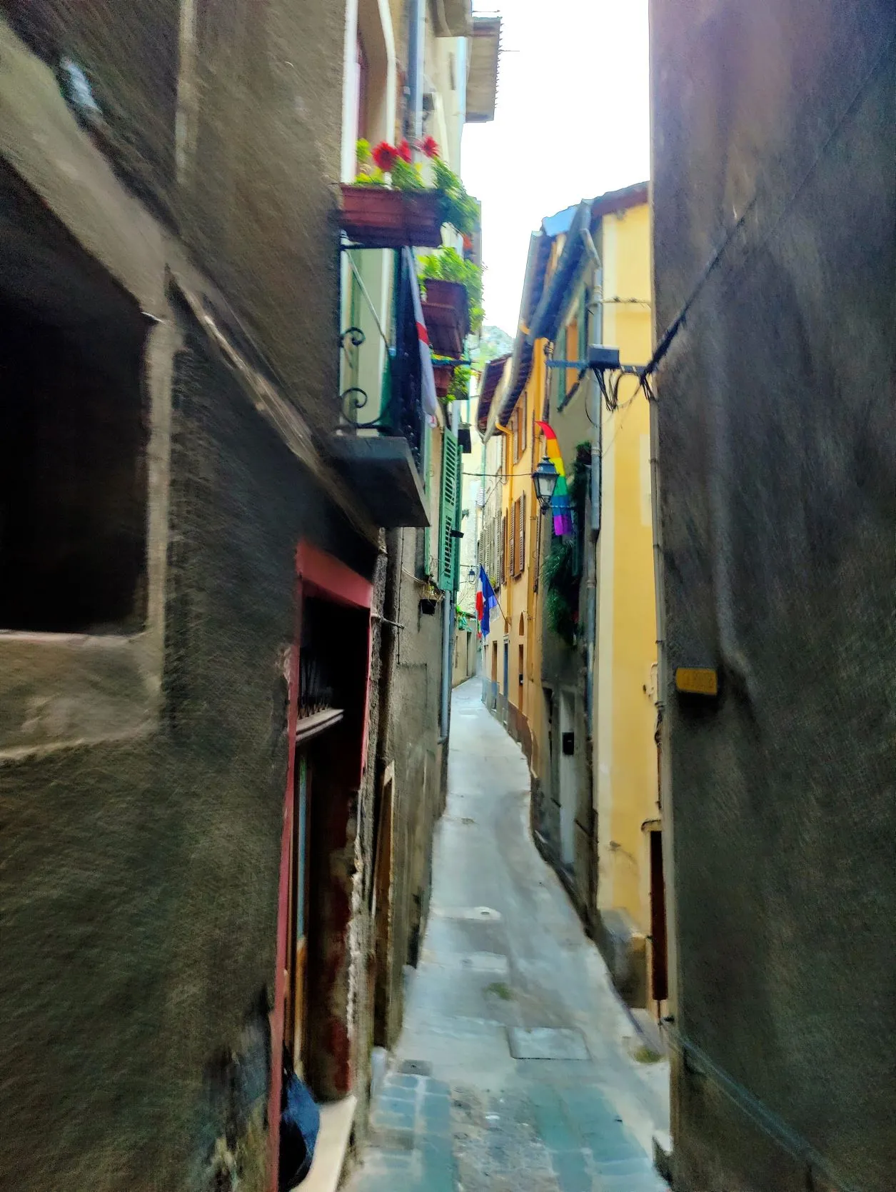
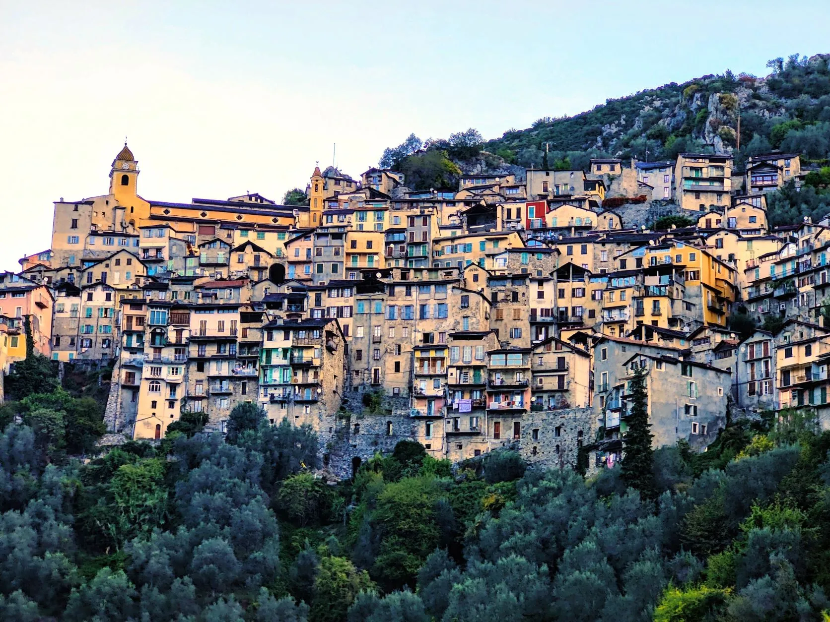
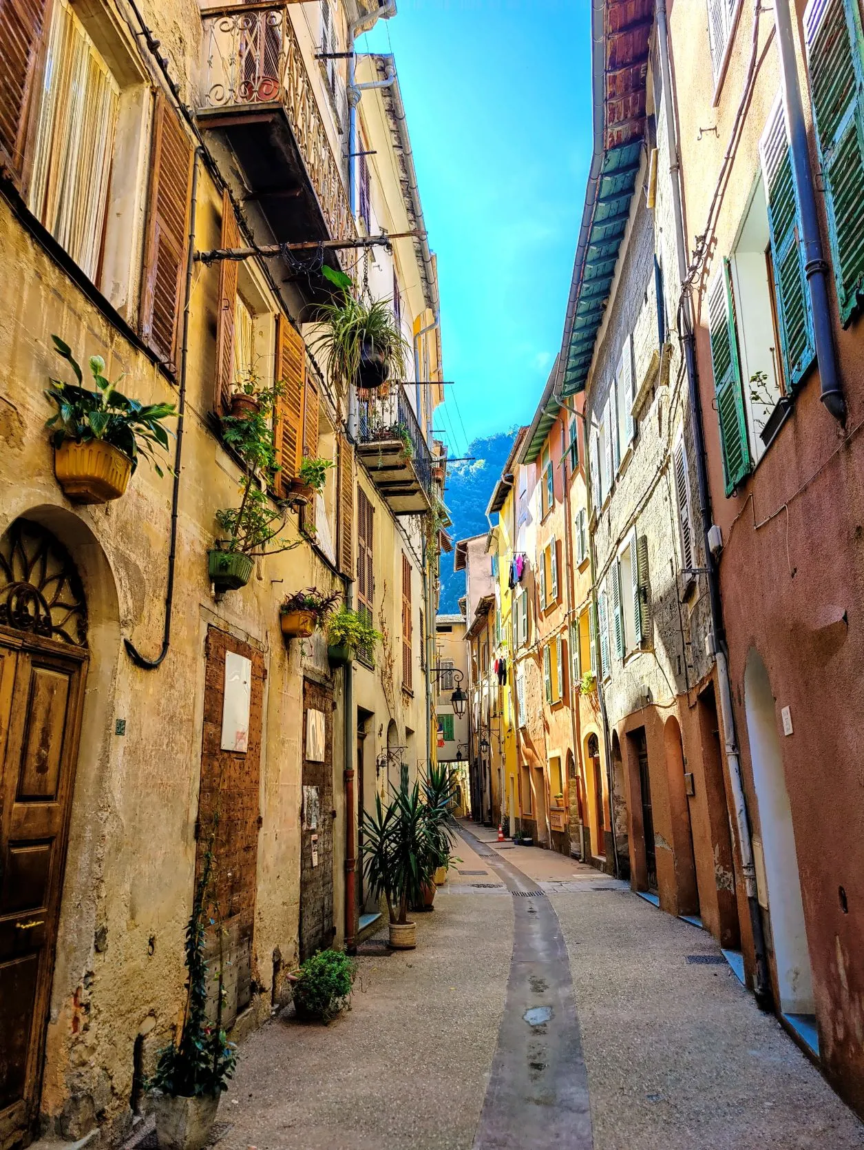
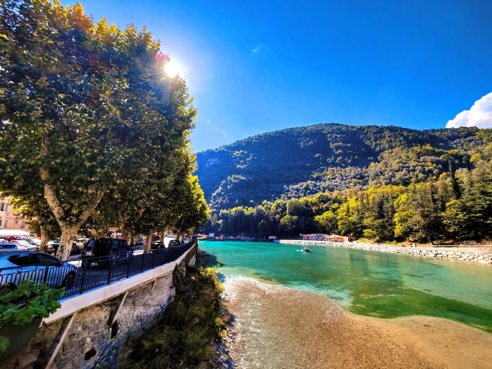
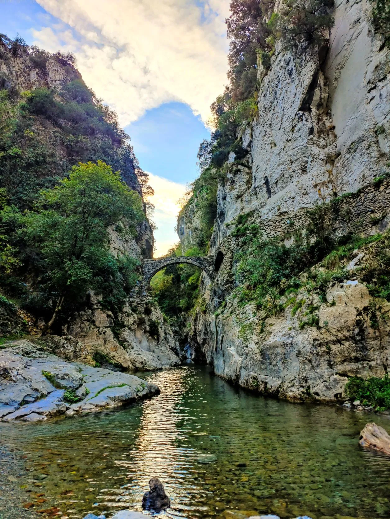
From the train station, the trail leads quickly to the town of Saorge. A small, picturesque mountain village with less than 500 inhabitants. It has small narrow maze alleys and tall houses of up to 4 to 5 stories, its special medieval architecture beautifully preserved. We find our way through the alleys to the edge of the village and descend down an old cobblestone road past terraces of olive trees and small oak trees. At the bottom we come to the Roya River, where the tributary Vallon de la Bendola flows into the Roya through a deep gorge. The old bridge that lies here is a remnant of the salt route. This is an ancient trade route that ran from the rich coastal area to the poorer mountain areas. This route was already there across the river 2000 BC, long before any road was built.
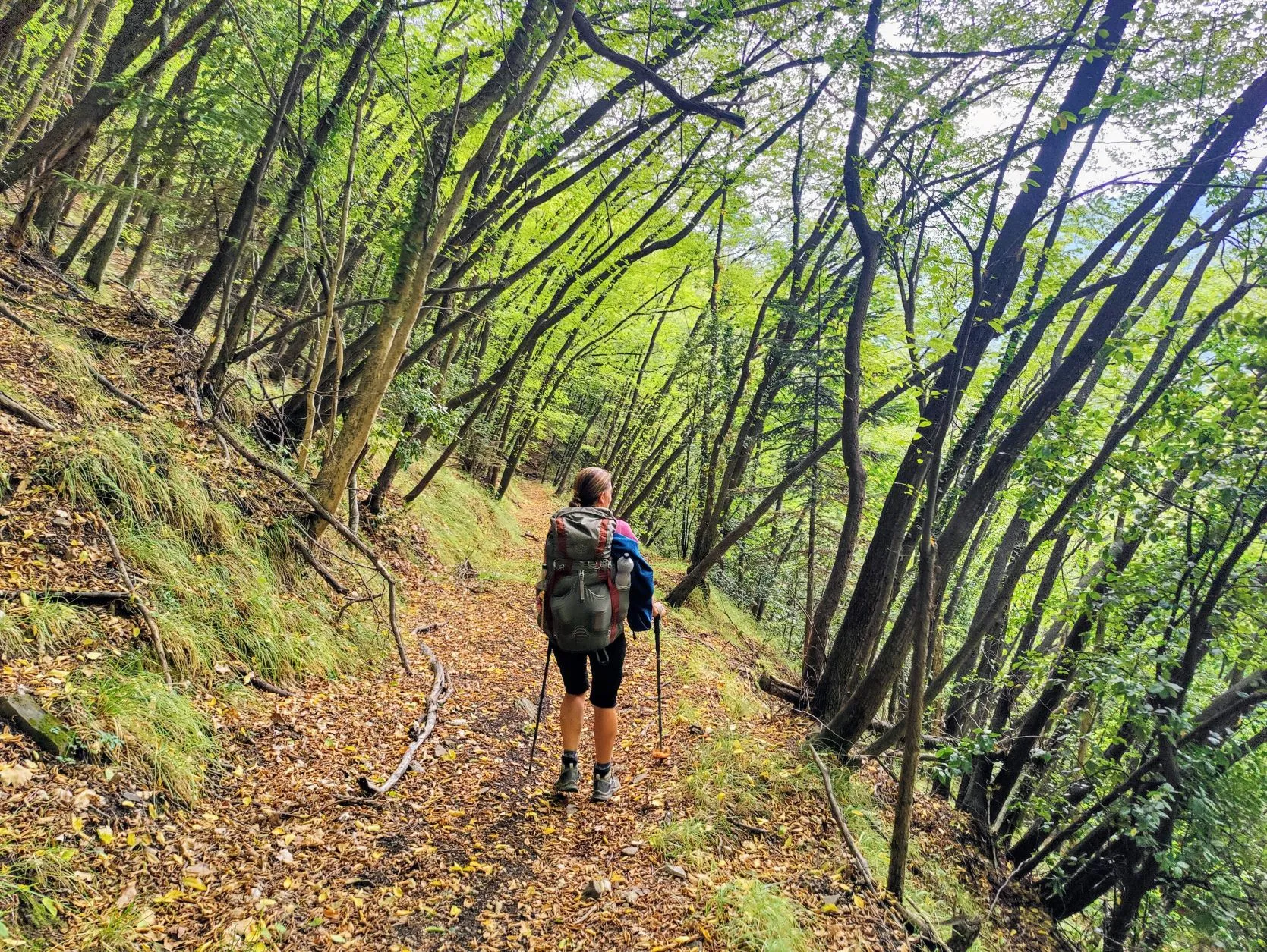
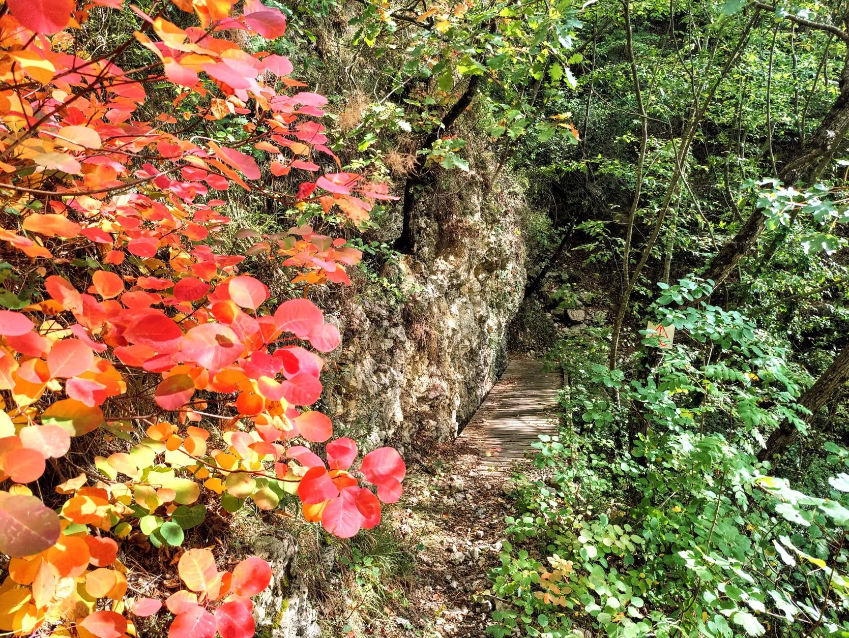
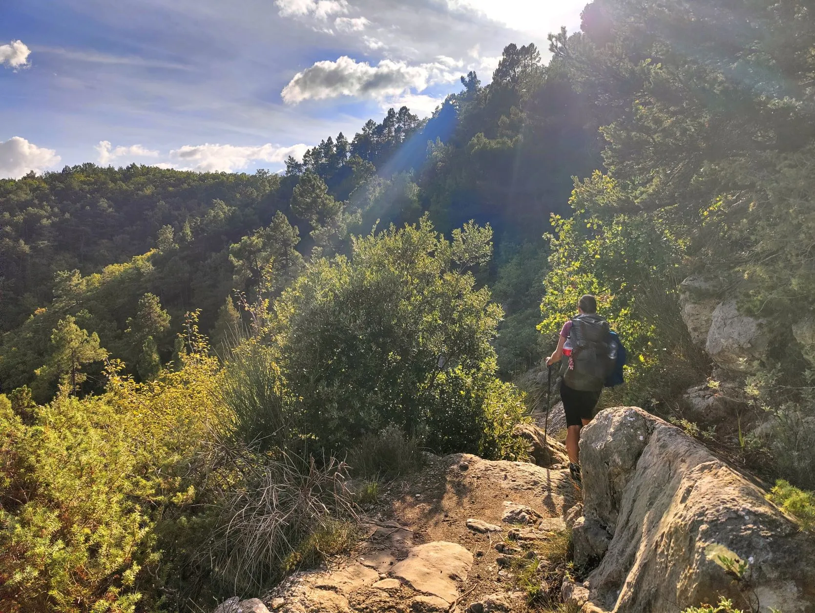
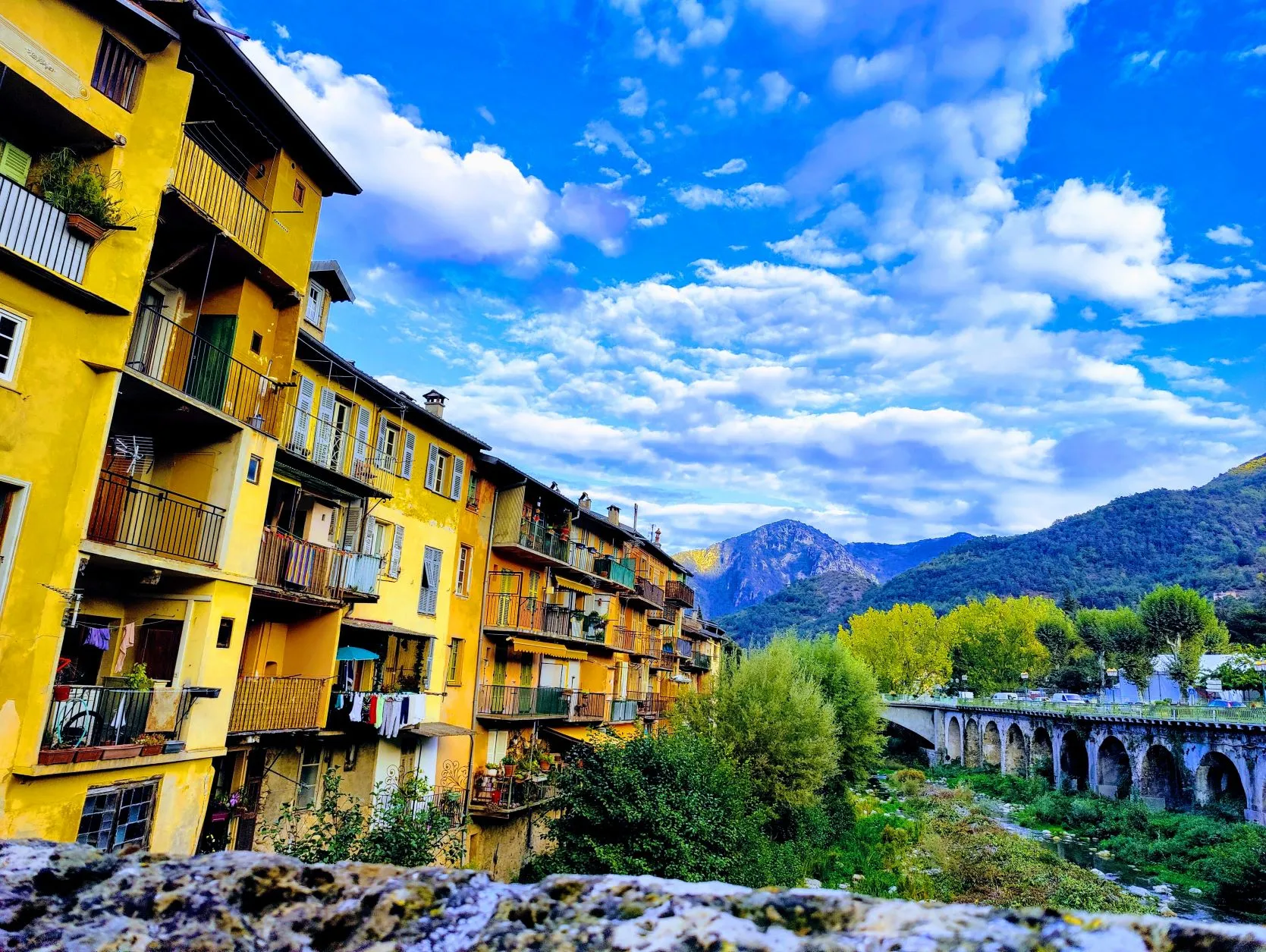
The road that runs alongside the river goes into a tunnel from here pretty quickly. The trail goes over the mountain, a short but steep climb and descent brings us back to the river on the other side. It is immediately clear that the landscape is a lot drier and Mediterranean than we are used to from the mountains. We are between 300 and 500 meters here, which is quite a bit lower than we have been for the past few weeks. From here we were supposed to follow the river for a bit, but the signage goes the other way again. A section of trail was closed due to the flood of 2020 and goes steeply up the mountain again from here. We walk past bushes and over fields of stones and later up steep carved steps of stone along iron ropes. A little further on we walk into the woods and will actually continue to follow it along the east flank of the Roya until we reach the town of Breil-sur-Roya, whose old part again consists of nice narrow alleys with tall houses. It canbe seen that these areas so close to the Mediterranean have a rich history. We briefly look for a supermarket on the outskirts of the village for some goodies for lunch. And at a picnic bench in the sun we make a cup of coffee and take a break.
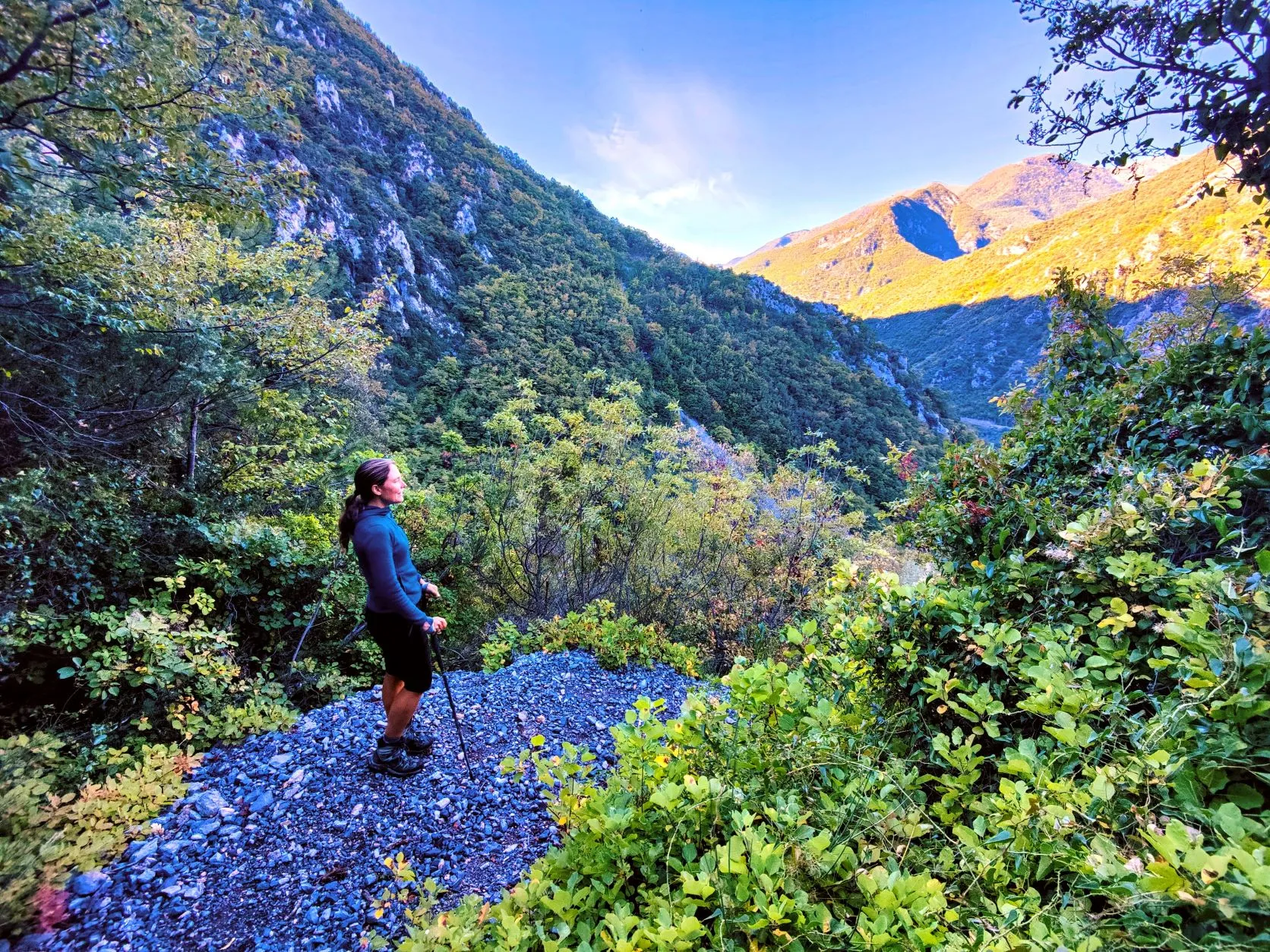
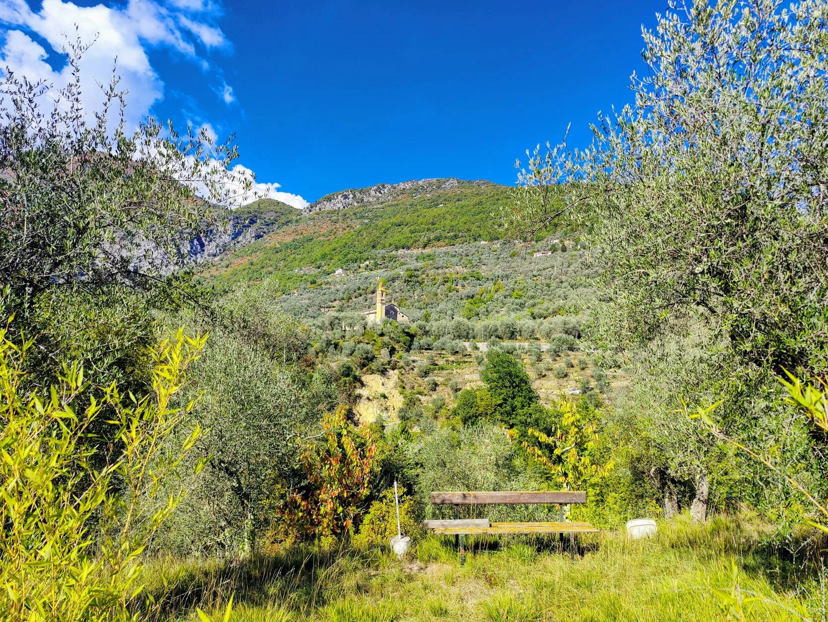
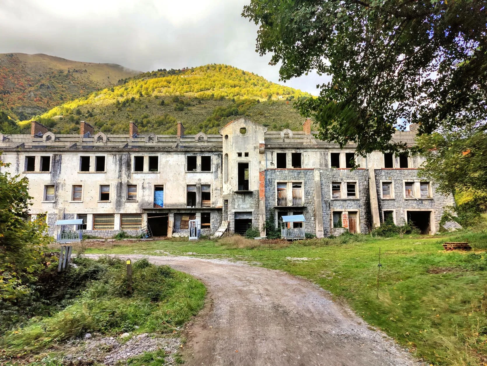
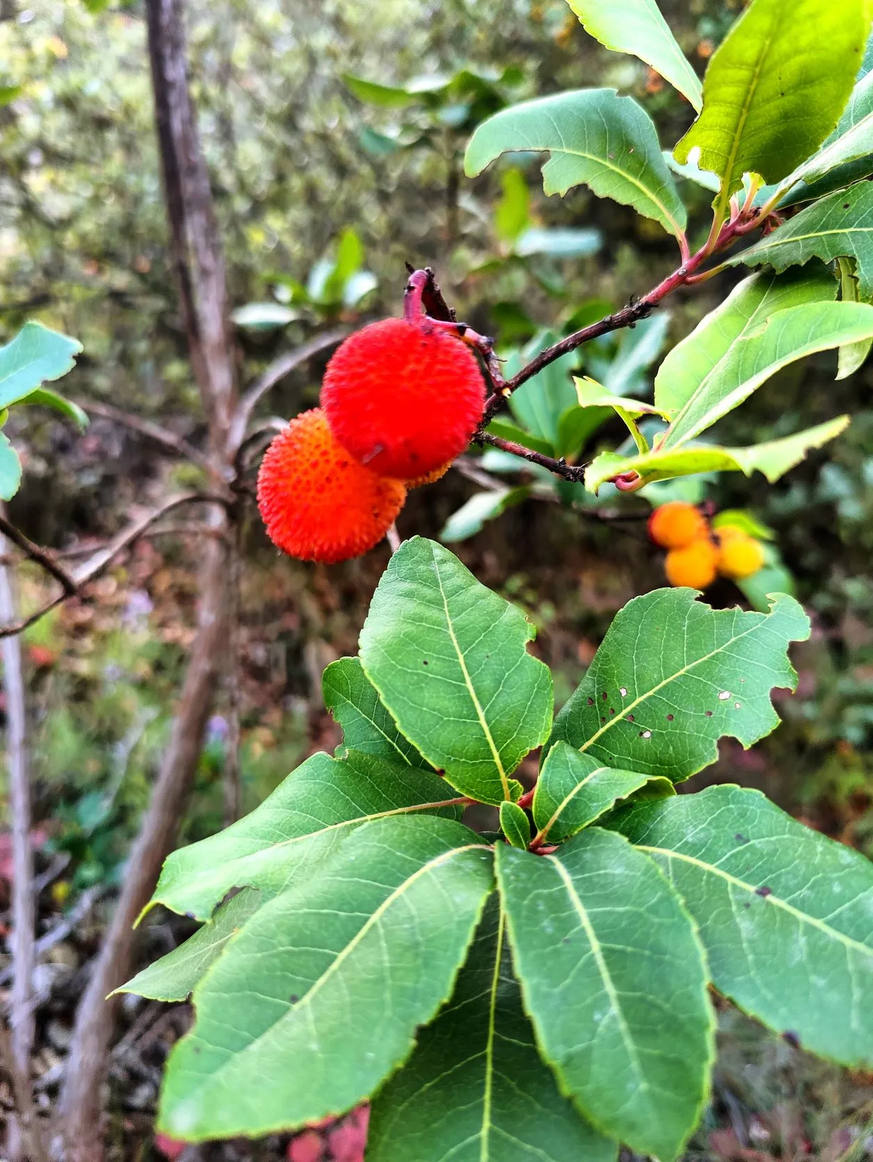
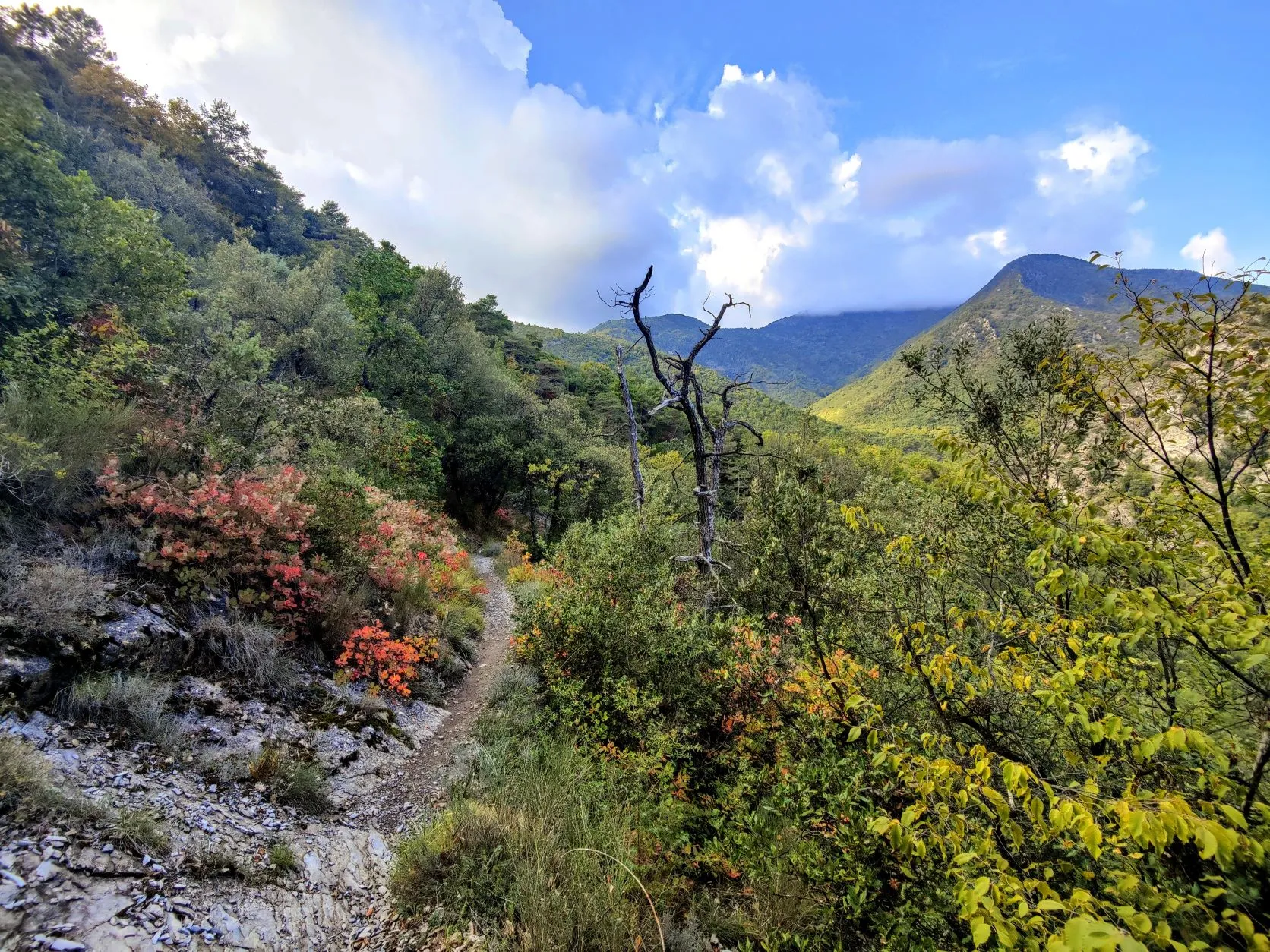
We cross the river and will leave the valley of the Roya here. We will now follow the valley of Vallon de la Lavina. A climb of 800 meters will bring us to today's highest point. At first we walk along a small asphalt road past the small houses in the slopes with olive trees, grape vines and even an occasional persimmon tree. We pass a huge, old barracks that has now been renamed a cowshed. The final stretch to Col de Levens at 1106 meters altitude is mostly through forests. From here it is about 7.5 kilometers downhill to Sospel. We walk on small forest paths gradually downhill. About halfway down, we see little trees along the path with yellow and red fruits as big as cherries. We look for them and they turn out to be strawberry trees and the red fruits are edible. We have to taste those... The orange flesh is a little tasteless at first, but a little later a nice sweet taste is released. Somewhere in the distance, it is easy to understand why it got the name strawberry tree. Nice, at the last minute we have discovered a new fruit!
We continue our route to the village, and it is not long before we are walking along the back of the houses in the slope above Sospel. The narrow paths lead us into the town and bring us to the bridge where the markings of the GR52 can be seen again. Here ends today's stage and we will return in a few days, for the very last stage to the Mediterranean: Sospel - Menton....