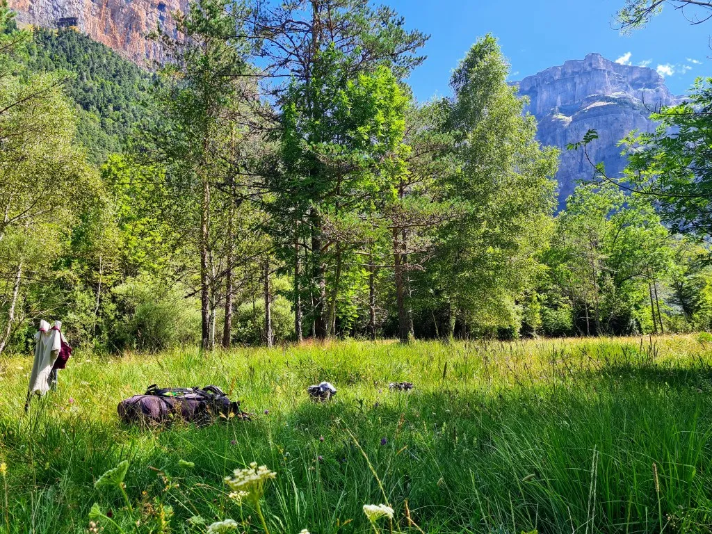
Bujaruelo is too beautiful to give our legs too much rest. The mountains and the gorges beckon, and even shopping in the nearest village of Torla is a mountain hike of over 20 kilometers with nearly 1,500 meters of elevation gain. It’s been wonderful to spend a few days here. But this morning, it’s time to depart from this magnificent place. Onward to Ordesa, the nearby nature reserve. This 11-kilometer-long valley, carved out long ago by glaciers, is unique in the Pyrenees. Almost all valleys run from north to south or vice versa, but this one runs from east to west. Ordesa has been a national park since 1918, it’s the second oldest in Spain, and a UNESCO World Heritage Site, allowing nature to thrive undisturbed for a long time. It’s a long, sprawling valley, bordered by high cliffs. Today’s journey will take us to the Góriz refuge at the other end of the valley. There are 80 sleeping places in the building and space for 90 campers. Online, it says they’re fully booked, and that’s also the case for at least the next two weeks. For us, that’s a problem since camping isn’t allowed in the national park, and it’s too far to walk through the entire park in one go. But after a phone call, we were fortunately allowed to come, and they said they’d arrange a spot for us at arrival. So, with everything packed again, which always takes a bit longer after a few days, we hit the trail once more.
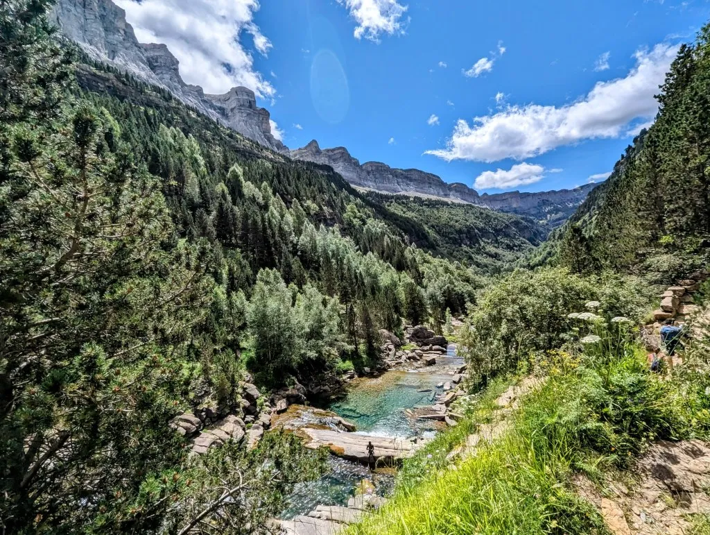
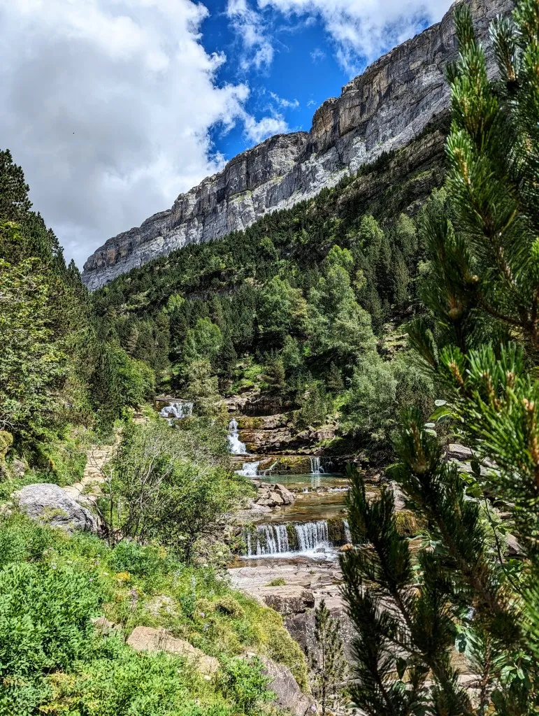
From the campsite, we follow the valley of the Ara River downstream towards the rio Arazas, which flows out of Ordesa. The GR11 trail runs on the left side of the river, while a (mostly) unpaved road runs in the same direction on the right. It offers the same beautiful view of the valley and the stunning rocks but is much easier to walk. We walked the GR route a few days earlier on the way back from Torla, and the route is quite challenging. So to keep up the pace in the morning and spend more time in Ordesa, we opt for the road. Plus when we follow this route, we pass by a small campsite shop where we can make some last-minute purchases, which is welcome with a few days of wild camping ahead. It’s a beautiful but steep road, with often a deep abyss on the river side, with the raging river below, and on the other side, high cliffs with occasional waterfalls. When cars come around the winding sections, it’s important to be careful. They need quite some speed to climb the mountain, and it’s pretty busy. Before it used to be visited mainly by tent campers, and it was already a challenge to get there with a folding trailer. But nowadays the largest campers, caravans, and vans drive up, with all the problems that come with it when there’s oncoming traffic. As often, we’ve avoided one challenge, the GR route, only to encounter others. But after 6.5 kilometers, we reach the beautiful old bridge Puente de los Navarros, where we can follow a smaller path. Not much further, we leave the Ara River behind, and from here, we follow the rio Arazas towards the Ordesa National Park. At the confluence of the two rivers, the clear deep blue water of the Arazas flows through a narrow gorge, swirling between the grey stones. It looks like one giant round stone, shaped by the water. We cross the river via a small bridge, and the ascent begins. Zigzag paths wind up through the woods. Along the path, there are occasional beech trees, but mainly boxwood bushes as tall as trees.
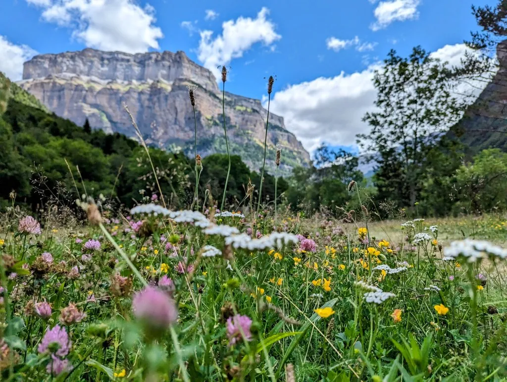
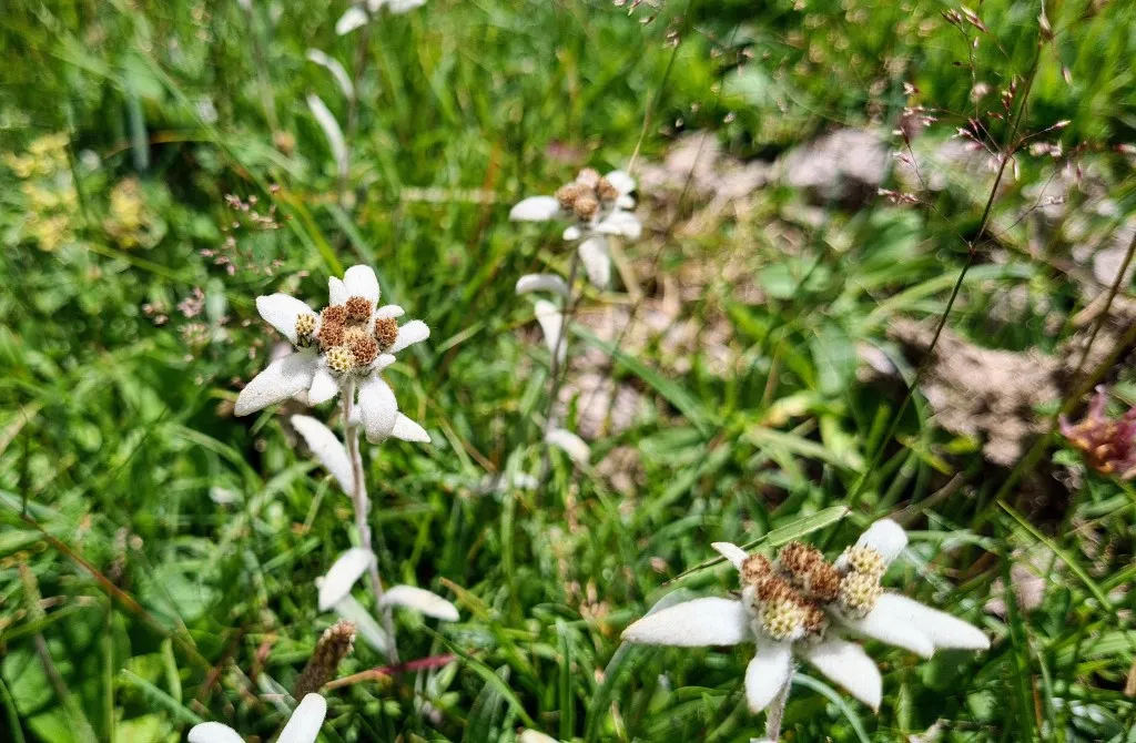
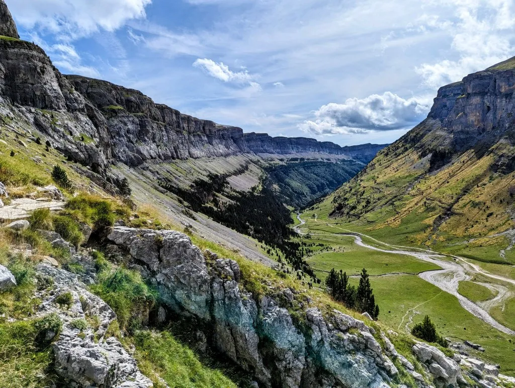
Often we only see the path through the trees, but occasionally we walk along deep ravines with views of waterfalls, and the cliffs above the wooded slopes on the other side of the river become more imposing with each step. We’ve ascended quite a bit when we reach a more open and flatter section, with grasslands dotted with clusters of trees, bushes, and thousands of flowers. It’s only a short distance to the visitor center and the entrance to the park. It’s still relatively quiet here; experience teaches us that it can get very crowded from the beginning of the park. The walking is delightful, but we’ve already covered almost 12 kilometers, so we seize this beautiful spot to take a break. We walk a bit into the grassland and set up our chairs. What a view!
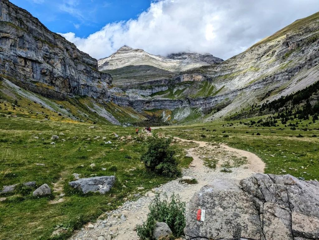
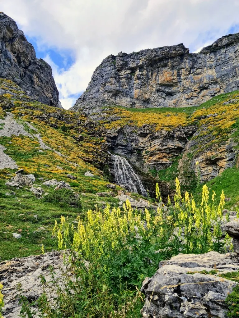
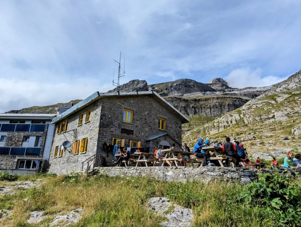
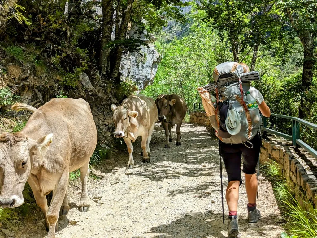
We still have a bit to go to reach the refuge, and the most special part is yet to come, so we keep the break short and walk to the cottages at the beginning of the park. We can get drinking water here for the rest of the day, and we get distracted by the ice cream menu at the little shop. Okay, we’re not in that much of a hurry, and it’s already quite warm, so we’re easily persuaded to extend our break a bit longer. When we finally get going again, we’re immediately in Ordesa. The path is flat, wide, and easy to walk at the beginning. The river flows calmly over a bed of gray stones, the green meadows and boxwood bushes give it a bit of a city park feel but looking up at the gigantic cliffs on either side of this valley, it looks more like a backdrop pulled down on a string in a photo studio. What a place... We’re certainly not alone, but surprisingly, it’s pretty quiet here at the beginning. We walk for a while and then the path starts to climb again. The river must also overcome the altitude differences and cascades down from great heights. We zigzag up that stretch of the slope. We walk through a forest of thick old beech trees. At the top, the path is carved out of the cliff with a view of the river far below us. It’s much busier with people now, and suddenly, there are cows too. A large herd of cows is being led down the path from the higher mountain pastures. It’s a fairly narrow path, so we stop for a moment to let the animals pass. Fortunately the beautiful animals are quite calm, because we can’t go anywhere here. Beyond the herd, we reach a narrow valley, where at the end the river flows from dozens of small waterfalls from an even higher large valley. This is where the cows have been. The valley is much wider, a large bowl-shaped valley. There are still some pine trees, but the valley is green with countless flowers; the slopes become increasingly barren and rocky. At the end of the valley, after one last wide waterfall, the valley ends. There is no higher valley, only a steep cliff with a zigzag path to the highest parts of the mountain. We have to climb up here to reach the refuge. The crowds stay below; for most people, this waterfall is the furthest point, but we keep going. It’s the steepest part of the stage, and after 23 kilometers, we still have to push hard. In 3.5 kilometers, we climb 450 meters over a narrow path made only of loose stones. It’s a tough climb with legs that wouldn’t have minded finishing the stage in the last valley and setting up the tent. But eventually, we see the roof of the refuge appear, and not much later, we arrive at the beautiful building. The terrace is quite full; people are sitting with their backpacks on flat spots, waiting until seven o’clock to be able to set up their tents. It’s a constant flow of people at the laundry room and the adjacent bar and reception. We put our backpacks down, and Malou goes to ask where we can set up our tent. She stays away for a long time, and she comes back looking disappointed. It’s completely full, and they don’t care about what another colleague promised on the phone earlier. But higher up on a col, half an hour further, camping is allowed. And of course, we can have dinner here and come back ‘just’ for breakfast tomorrow. Good luck and bye! Well, they don’t rely on service here… Fortunately, we can fill our water bottles.
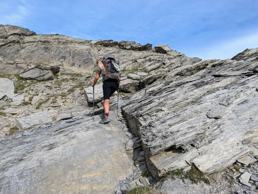
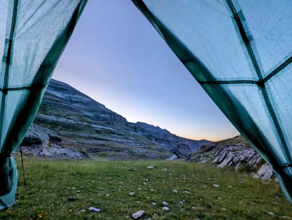
It’s already 6:00 PM, but we pick up our even heavier backpacks and walk on, looking for the col and a spot for the night. By now, the route on Wikiloc had already stopped and saved, so we start stage number 97B for the last stretch. Another 160 meters ascent, a granola bar for some energy, and we’re at the col. What a beautiful view, another mountain ridge further, but the col is just a plain of stones. It’s nice that you can set up your tent here, but you won’t get a peg in the ground. At cols of this altitude, it can be very windy, so we can’t set up the tent here, and we descend a bit further on the other side. After some tricky sections over slate plateaus, the surroundings become greener again. Now we just need to find a flat piece. We pass by a few more people with tents that are probably also sent away from the refuge. A bit further, out of sight from the path and the other tents, we find a small dell where it’s flat, and we can set up our tent properly. We look around just to be sure, but this is it. A fantastic view and quiet, much quieter than at the refuge. We’re certainly glad we can take off our shoes and rest; our legs and feet have had a good workout today. But it was an exceptionally beautiful stage, and we end up in a fantastic spot after unexpectedly covering many kilometers. At least we don’t have to walk those tomorrow. Right now, it’s time for some rest.