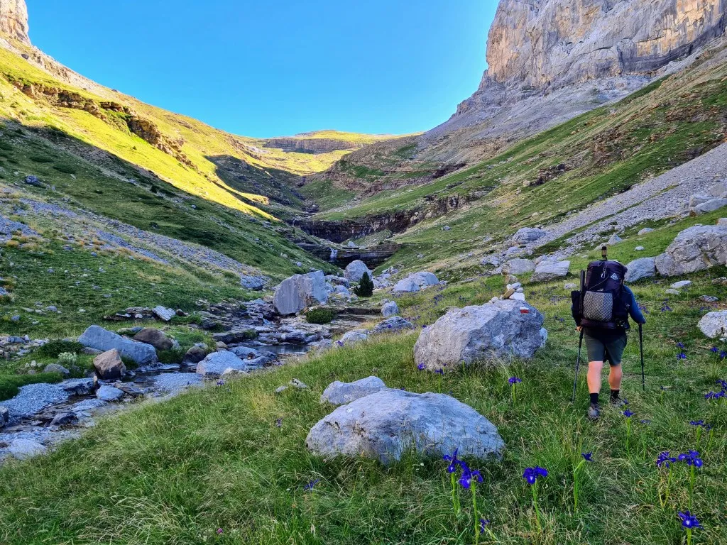
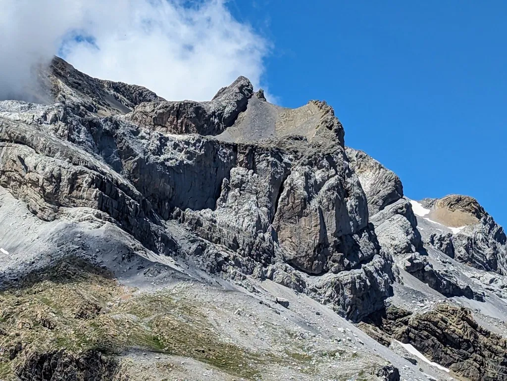
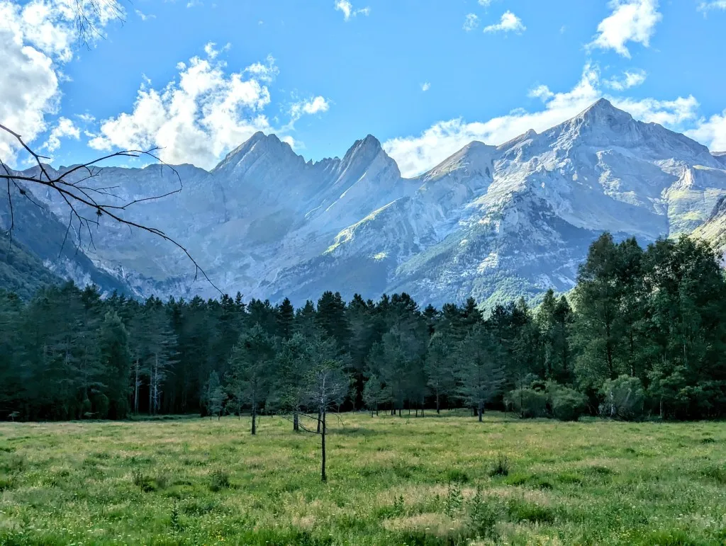
We wake up at an altitude of 2,200 meters. It was a wonderfully peaceful night at the foot of Monte Perdido, whose peak is still 1,155 meters higher, making it the highest peak of ‘As Tres Serols’ or ‘the Three Sisters’, three peaks that form the highest limestone massif in Europe at 3,355 meters high. But it was also a cold night. When the sun sets at this altitude, the temperature drops quickly. When we emerge from our tent around 6 o’clock, the sun is still below the horizon, and it’s still quite chilly. It’s also quite windy, so for once, we leave the tent up a bit longer to have breakfast somewhat warmer and out of the wind. A few early hikers pass by, but they don’t pay us any attention, so it’s a good spot. We take our time packing up, delaying changing into our shorter hiking clothes until the sun is up a bit higher on the mountain. But after a while, we give up, pack everything up, and start a new stage, still wearing our vests. As we descend through the valley over the grassland, we quickly enter the sun, and we take off our vests. What a difference between shade and sun. From 5 to 25 degrees within a few minutes, or at least that’s how it feels because it immediately feels really warm.
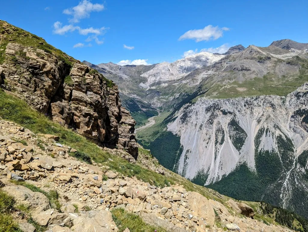
Where we start, the valley is still very wide. On the north side is a high mountain with bare rocky peaks. To the south, it’s more gentle, with green round hills from which you can see far into the Pyrenees; the mountains become lower in that direction. We descend and the valley quickly narrows, the grassy plain flattens, and then it ends. We walk towards the edge, at the top of a deep abyss where the valley plunges into a narrow gorge.
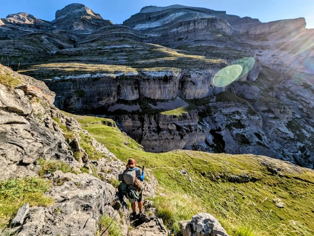
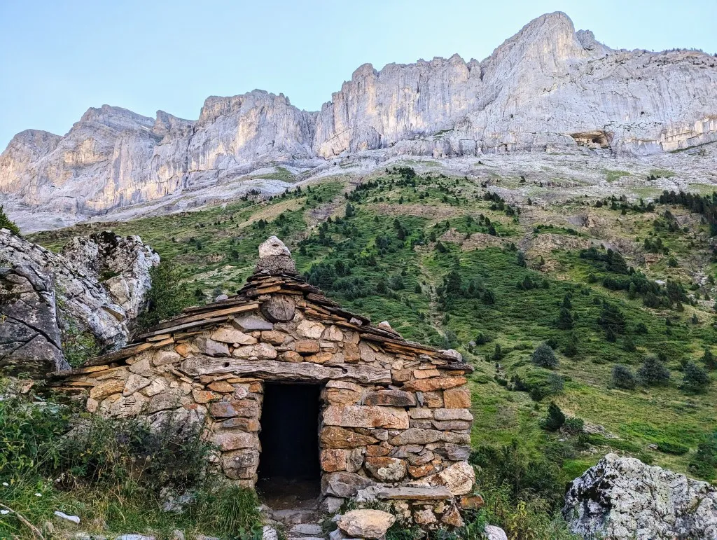
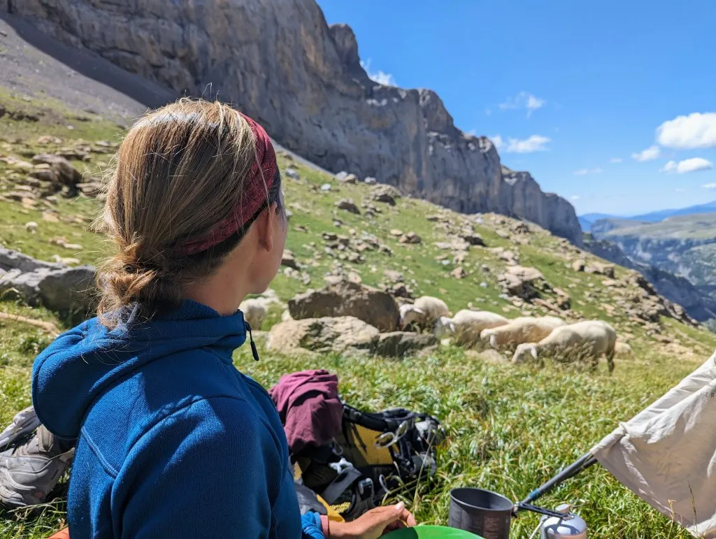
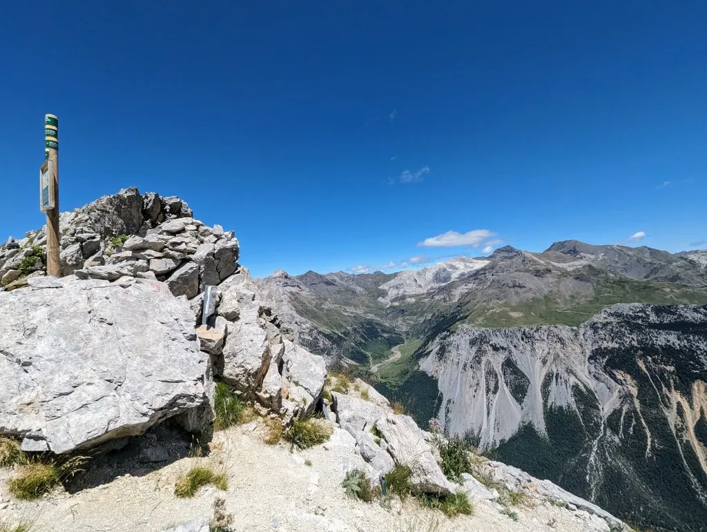
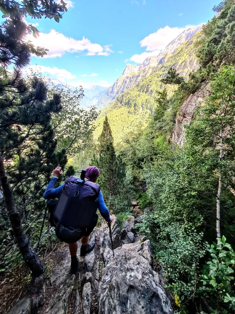
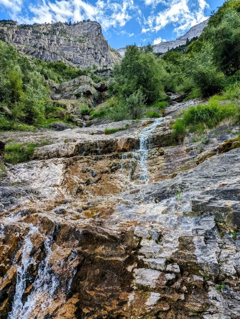
Hmm, there we have to descend, into a slate abyss, almost straight down. Fortunately, ropes have been fixed in the rocks on the steepest sections, making it manageable, but it requires careful attention. Now that’s what I call a warm-up, descending with a heavy backpack using ropes on a slope of loose slate stones… At the bottom, we find ourselves on an almost flat stretch again. It’s an intermediate plateau before we continue descending. It’s really a magnificent place, this narrow gorge. The charm of the grass with the flowers and the overwhelming mountains, what a contrast. A bit further on, we descend again using ropes, cross the river, and continue descending along narrow paths along steep slopes. The landscape becomes more forested, an open forest of pine trees that have managed to anchor themselves between loose stones, sometimes even on top of stones. Hikers pass us on their way up; the panting and fatigue of the ascending hikers suggest that we still have a long way to go to reach the valley. And that turns out to be correct. In terms of kilometers, it’s not so bad, but the terrain and the often large steps make it take a long time to reach the lowest point at around 1,680 meters. We’ve only walked 2.5 kilometers, but we’ve already descended 600 meters. It took us almost 2 hours… In the valley, we come across a small house, a shepherd’s hut, and if the shepherd isn’t there, you could bivouac there. You’d have to crawl in, but there’s a small fireplace, and it’s quite clean. It’s beautifully built with stacked stones and has a nice slate roof. It’s surrounded by greenery, but we’re surrounded by the high barren mountains where waterfalls cascade down, and there’s a solitary sheep left behind for company. An idyllic spot, but we decide to keep walking. The ascent begins. The paths are much easier to walk on than the descent, but this slope is also steep. The valley is wider here and also beautifully green. The paths clearly show that there are sheep higher up. Fortunately, we’re mostly climbing in the shade of the mountain; it’s already pretty warm in the sun. We’re heading towards Collado Añisclo at over 2,460 meters altitude, which is another 770 meters higher than the house in the valley. Halfway up the slope, we encounter the sheep. It’s a large herd of hundreds of sheep spread across the entire width of the valley, and they’re also heading towards the col. There’s no way around them in this landscape, so we calmly walk through the herd. For some reason, there are always guard dogs with sheep in France. But in Spain we’ve seen many dogs at houses and yards, but none with herds of animals. This is a Spanish valley and we don’t see any dogs with the sheep. We walk slightly faster than the herd, so we walk with them for a while and then surpass them. We’ve been on the road for 3.5 hours already, and we’ve regained the meters we descended. We feel it in our legs, so it’s time for a break. We walk up a few plateaus with waterfalls, above the animals, and it’s not difficult to find a nice spot in the grass. During the break, the sheep slowly approach, passing us from above and below. It’s nice to be able to calmly observe the dynamics of such a herd. They’re usually so busy with the grass and each other that they only notice us at the last moment. Some of them get a bit startled and quickly walk past us, while others stand still and stare at us until one of them moves and the rest follow. Usually, they just go about their business. After this spectacle, our legs are rested, and we continue the ascent. Another 250 meters to go, and we’ll be at the top of the pass next to Monte Perdido. Wow, what a magnificent view! A deep valley with a dizzying descent lies before us. Whereas the valleys behind us are high with small rivers, small patches of trees, and a few hiking trails, the valley in front of us is deep, with a road running through it, with buildings, forests, and a wide river. Due to the depth, it seems quite narrow, but according to the map, it’s about 3 to 4 kilometers as the crow flies to the pass on the other side where we need to go. If there were a bridge, it would be a three-quarter-hour walk; via the trail, it’s 11 kilometers with a 1,250-meter ascent and 950-meter descent. And especially the latter will take us a lot of time. We walk faster uphill than the signs along the route indicate, but downhill, we have to make an effort to keep up with that time. Especially at the beginning of the descent, it’s over loose rocks and zigzag paths with gravel and loose stones. With each step, you slide a bit further down, so you have to carefully control that sliding. It takes a lot of muscle power. In a reaction you become somewhat too cautious due to the sliding, which requires even more energy, and it slows you down even more. We have to encourage ourselves and each other repeatedly to descend a bit more smoothly to keep up the pace. After 2.5 hours, we’ve completed 1/3 of the elevation gain, but from here on, we’re entering greener terrain, and the trees provide a more solid path.
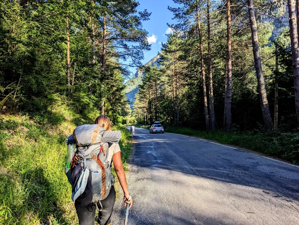
We take another break to recover, and indeed, after the break, the path becomes more walkable. Walking becomes smoother, and we make faster progress in terms of elevation gain, although we encounter sections where the path sometimes goes straight down 2 to 3 meters, and we have to climb down, sometimes with ropes. With legs that feel like spaghetti, we finally arrive at the bottom of the valley after 6:00 PM. We had planned to climb a bit further up the slope on the other side and bivouac somewhere there, but we won’t make it today. We check if we can set up our tent somewhere here, but we still need water, and wild camping in this busy valley doesn’t feel right. There are still some options: not far ahead is a refuge, but we don’t feel like lying in a bunk bed in a dormitory after such a grueling stage. 3 kilometers further along the route is a hotel where you can stay in a hostel-like room for almost 200 euros, and 3.5 kilometers along the flat road, although perpendicular to the route, is a campsite. We look at each other, and the decision is quickly made. Let’s walk another 3.5 kilometers to the campsite, where we can shower properly and sleep in our own tent. That way, we’ll rest best. Eventually, it’s almost 8:00 PM when we arrive and can set up our tent. But upon arrival, we see a sign for pizza, so we don’t have to cook ourselves. A treat after such a magnificent, but quite strenuous stage. The last kilometers were flat; before that, we ascended 2,650 meters in 10.5 kilometers. An average gradient of over 25%! From the pass, we already had a sneak peek of where we’ll be walking tomorrow, and it looked stunning from above! Hopefully, our legs will have recovered a bit by then…