This stage is again part of the GR52. This magnificent hike goes up some particularly steep slopes over loose stones and high rocks. The route begins calmly through a beautiful valley and along Lac Niré. At the end of this valley follows the steep climb to Baisse du Basto at 2693 meters. This is followed by a descent towards Lac de Basto and a climb to Baisse de Valmasque at 2549 meters. This is the boundary of Vallée des Merveilles: a unique piece of Mercantour with stunning nature. Through this valley the route hikes about 7km and leaves it via Pas du Diable at 2430 meters. From here, the route descends mainly over grassy slopes to Baisse de Saint-Véran. A little further on, this stage ends.
What a magnificent place to wake up. Our tent on a patch of grass among the rocks and mountains in this magnificent valley. How lucky we are to be here and to be able to bivouac here, in the middle of endless nature.
Since we have a long stage on the program today (of the kilometers that were left yesterday, several more are coming today) we get up early again and it is still dark when we get out of our tent. The frozen grass crunches under our feet; it was good cold again last night. During our breakfast we see it slowly becoming light and around 8 o'clock we are already on the road again.
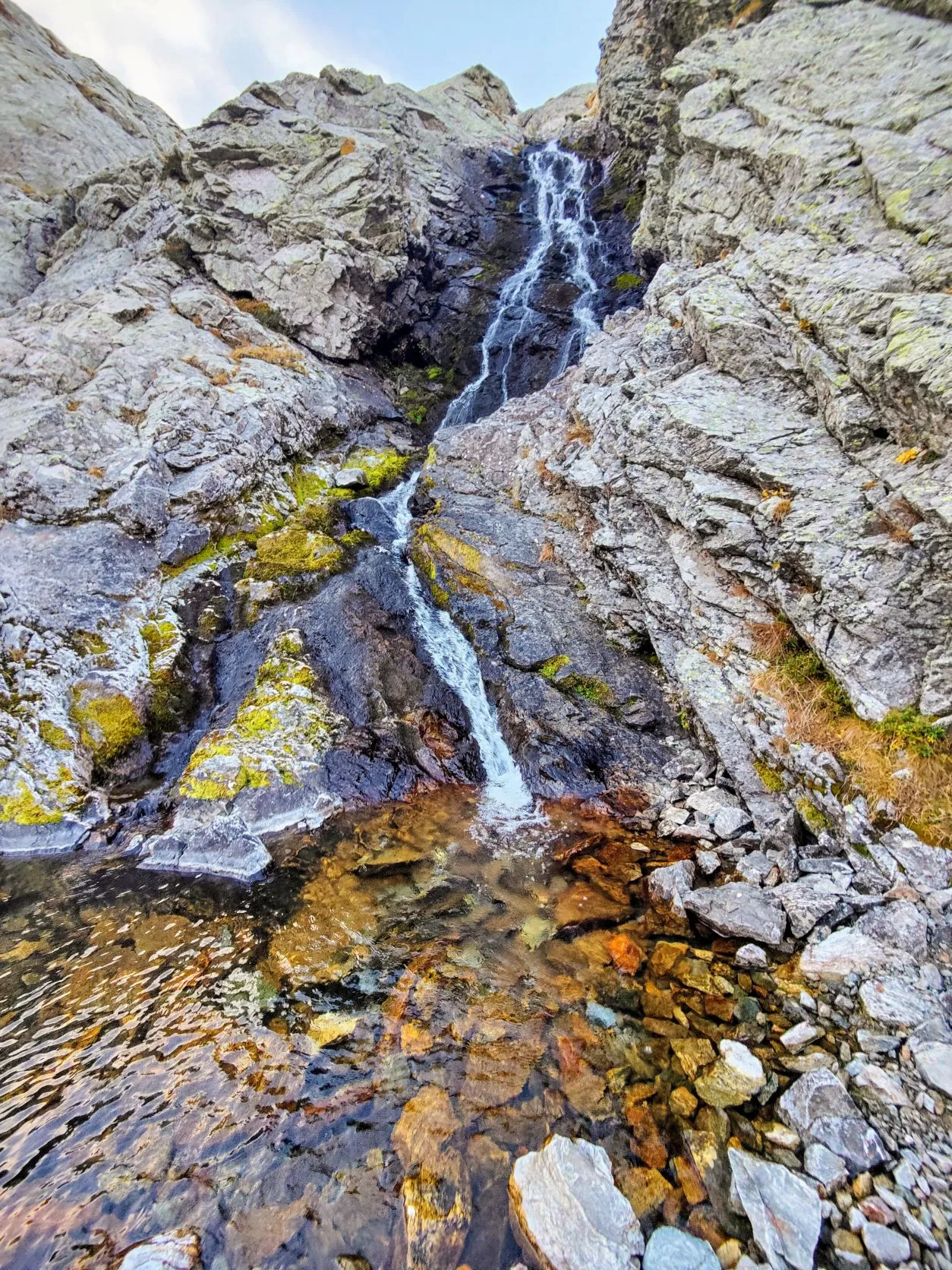
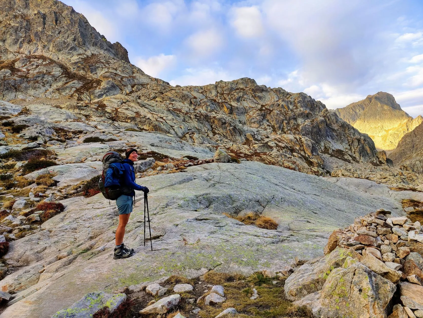
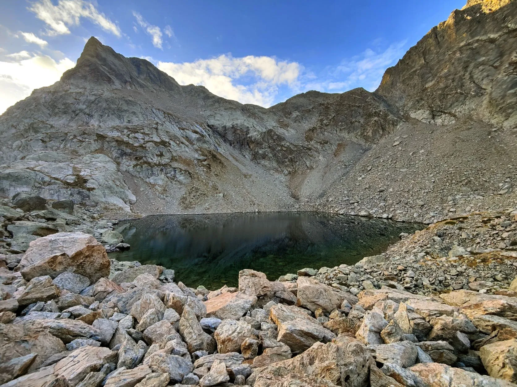
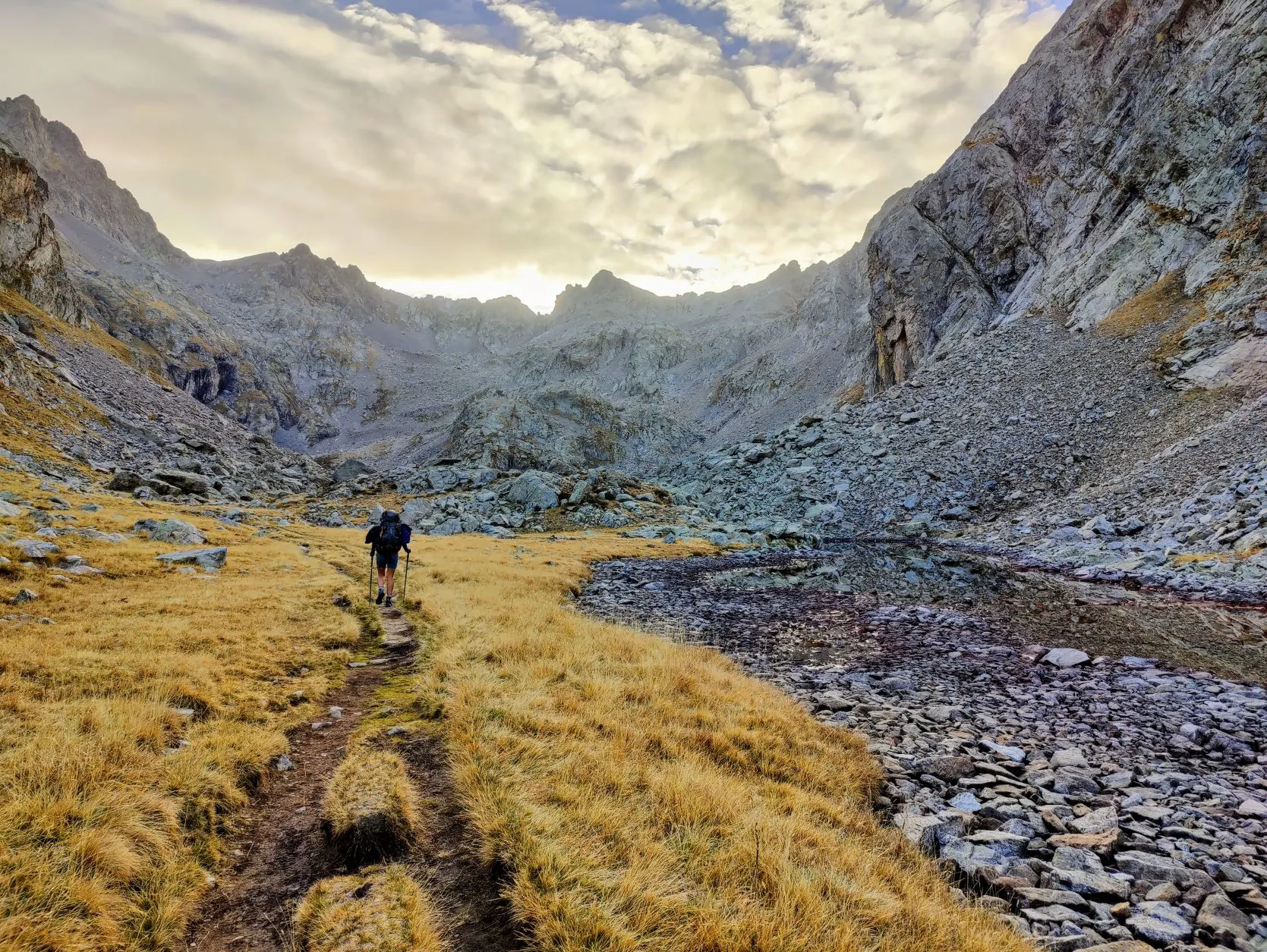
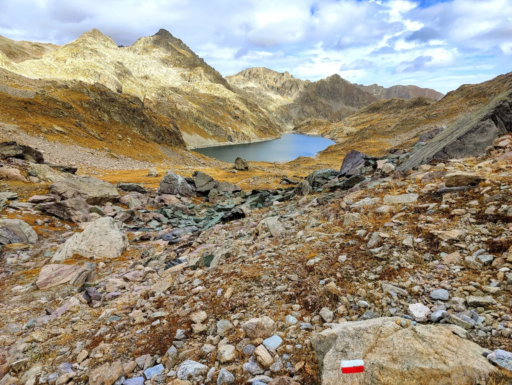
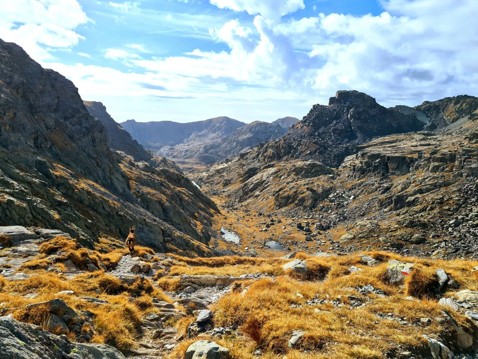
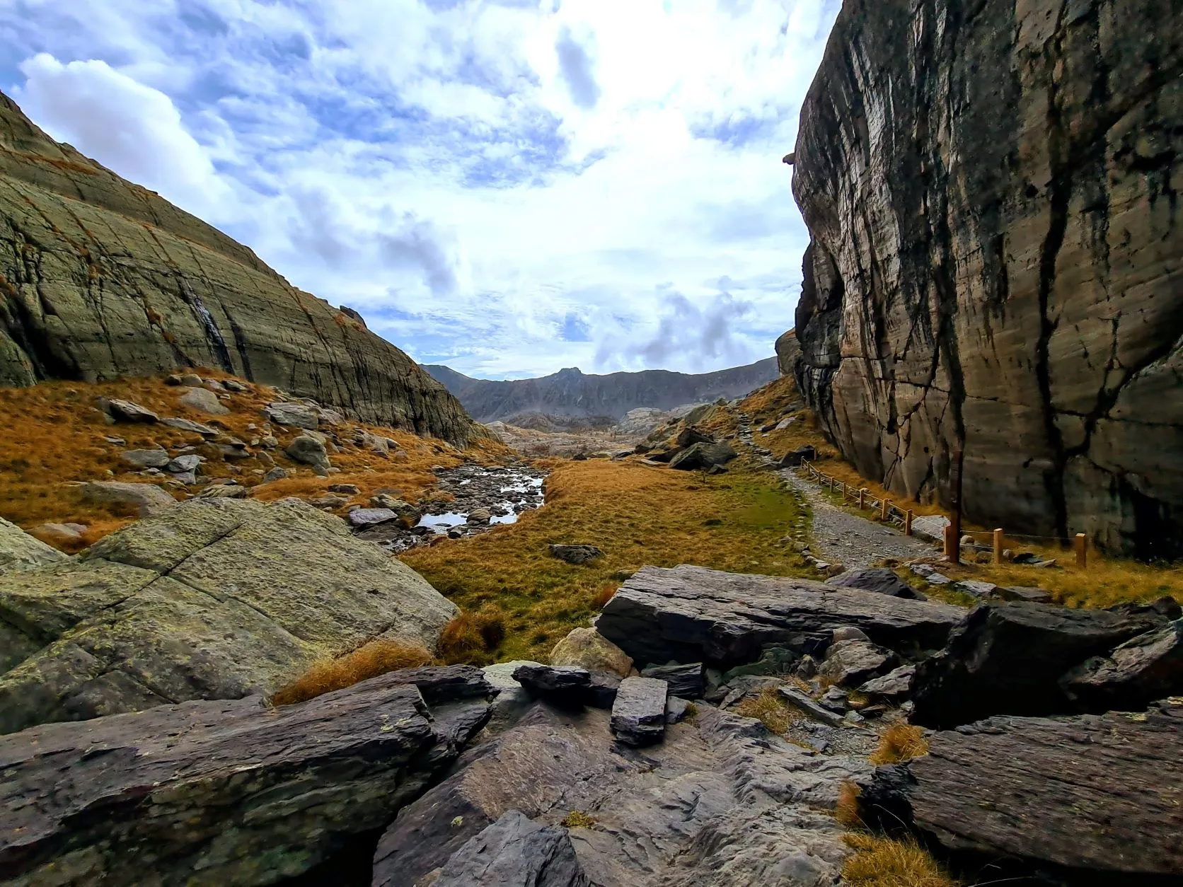
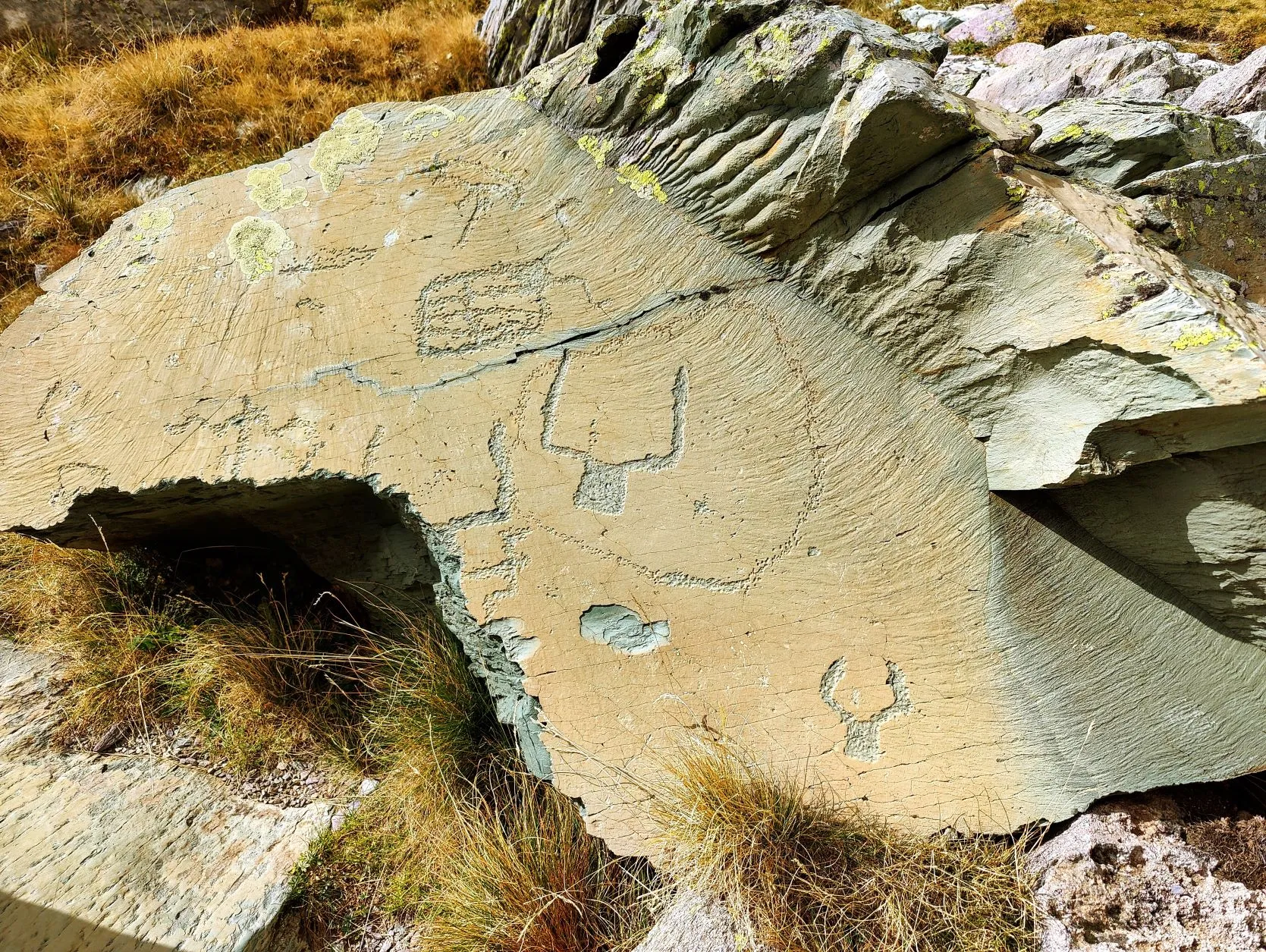
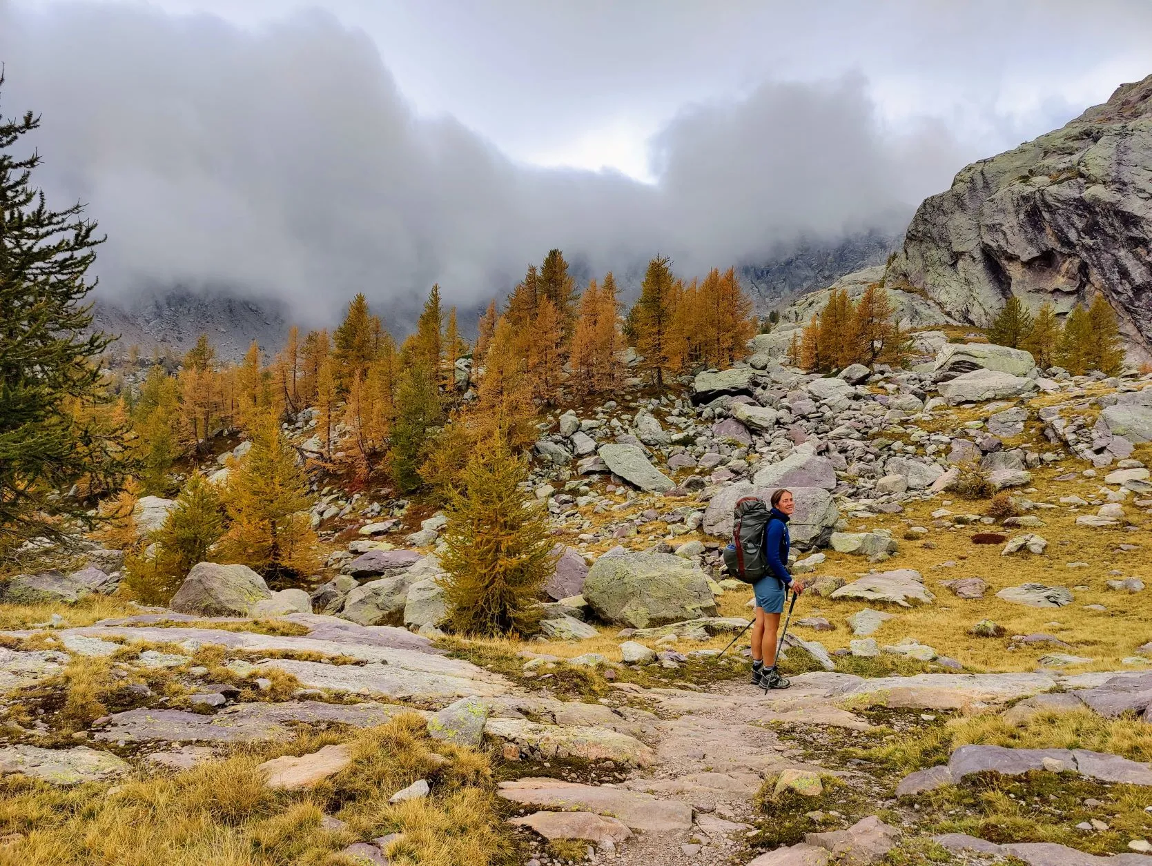
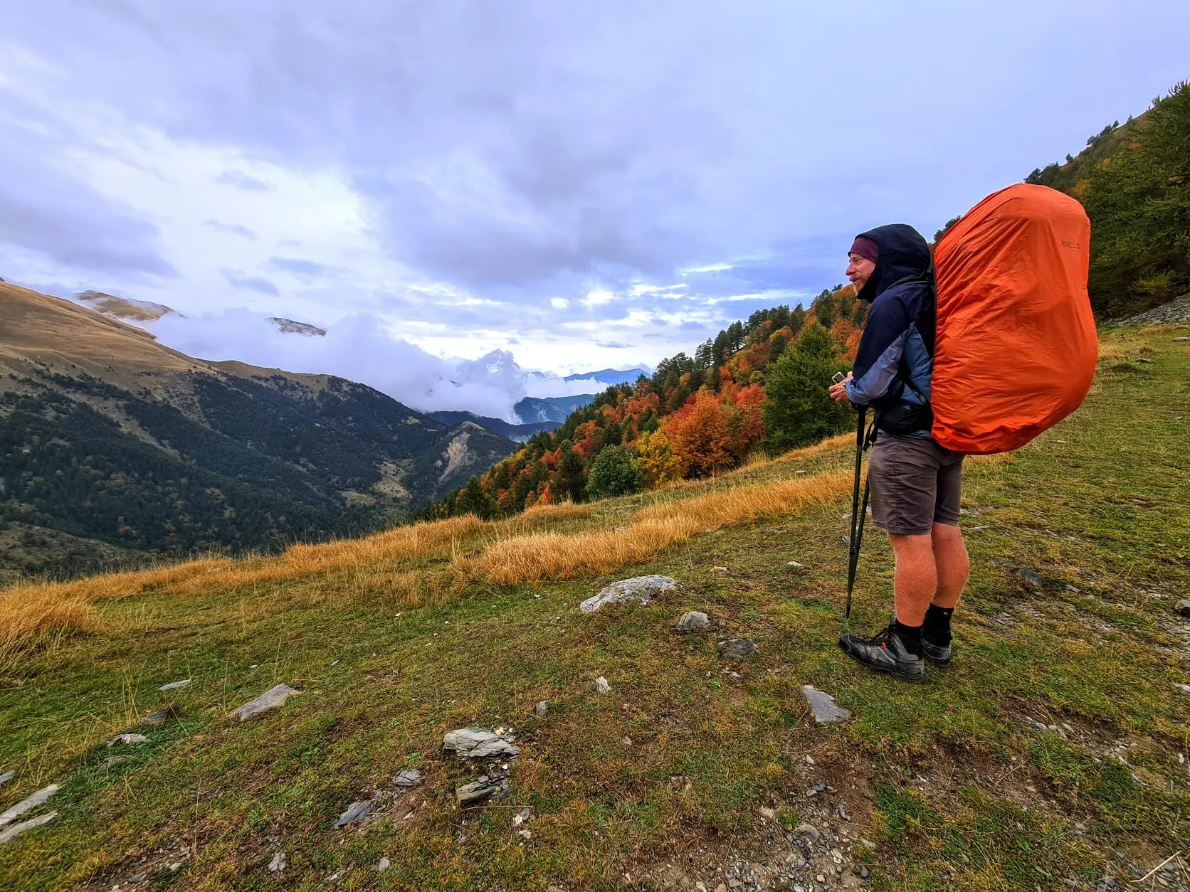
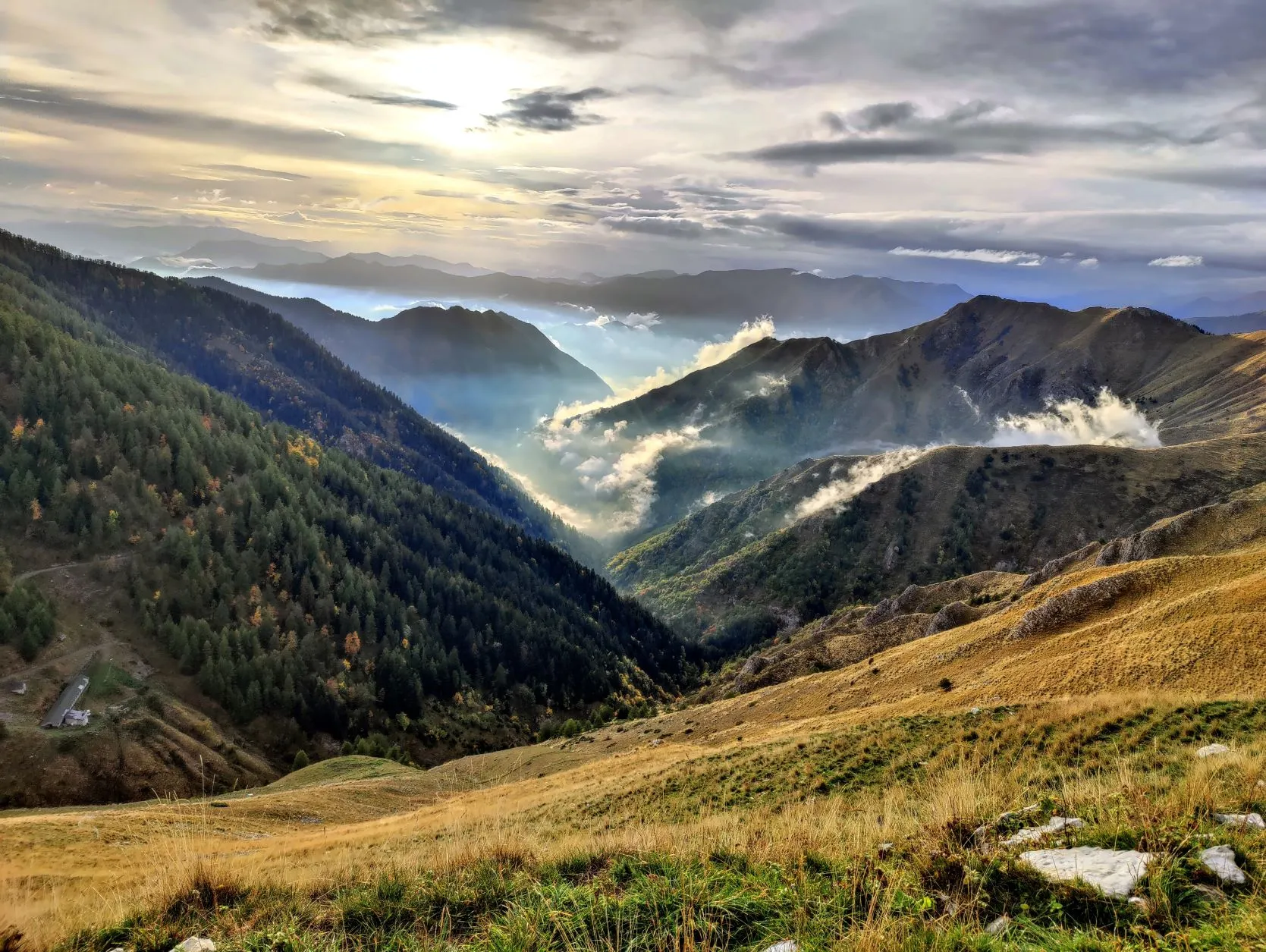
We walk through the valley past waterfalls and a river towards some beautiful lakes. Since we slept around 2,300 meters altitude, we are already quite a bit above the tree line. The higher we get, the rockier and barer the landscape becomes. It's a good thing we didn't keep walking yesterday, because it is so rocky here that we wouldn't have been able to pitch our tent anywhere. This part of the valley is enclosed by a high, gray ridge and at the end we will cross it. It promises to be quite a climb, climbing 300 meters in 1 kilometer (a gradient of 33% on average) This is the steepest kilometer since we left the Netherlands. The trail, or rather the lack of it, runs along one big rocky slope and can only be seen because, fortunately, they have been fairly generous in putting white/red markings here. Using hands and feet, we sometimes climb almost vertically from rock to rock and rock to rock. It feels like a victory when, 1.5 hours after departure, we arrive at the top of Baisse de Basto. At 2,693 meters, it is only slightly lower than Col d'Iseran which was the highest point of the GR5 at 2,770 meters. We enjoy the view for a while but 'what goes up must come down': we quickly start the descent again towards Lac du Basto. Fortunately, the descent is a little less steep than the ascent, although we still have to watch out for loose stones and large boulders. When we arrive at Lac du Basto, it starts to get a little busier. We are clearly approaching the jewel of the Mercantour: Vallée des Merveilles. To get there, we are left with a small climb to Baisse de Valmasque. Here the stones begin to get more colorful, the gray changingto purple and green, and we feast our eyes during the climb. From the top we have a view of Vallée des Merveilles, or Valley of Wonders. It is immediately clear where the name comes from, because what an amazingly beautiful valley this is! Because of the strict rules that apply here, nature is even better preserved than in the rest of the Mercantour. But that's not the only thing that makes the valley so special. Thousands of prehistoric rock engravings have been found here, many of which date back to the Early Bronze Age, making them nearly 5,000 years old. Some of the engravings are also located along the path through the valley and we come across several of them. This is truly another unique piece on our way to the Mediterranean.
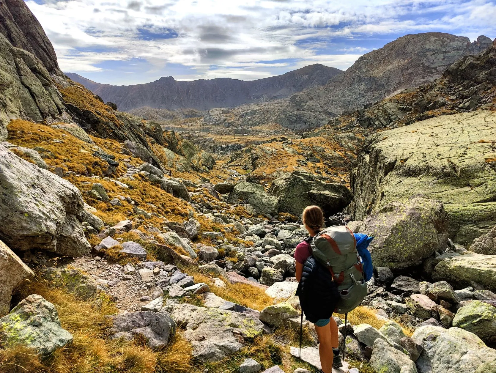
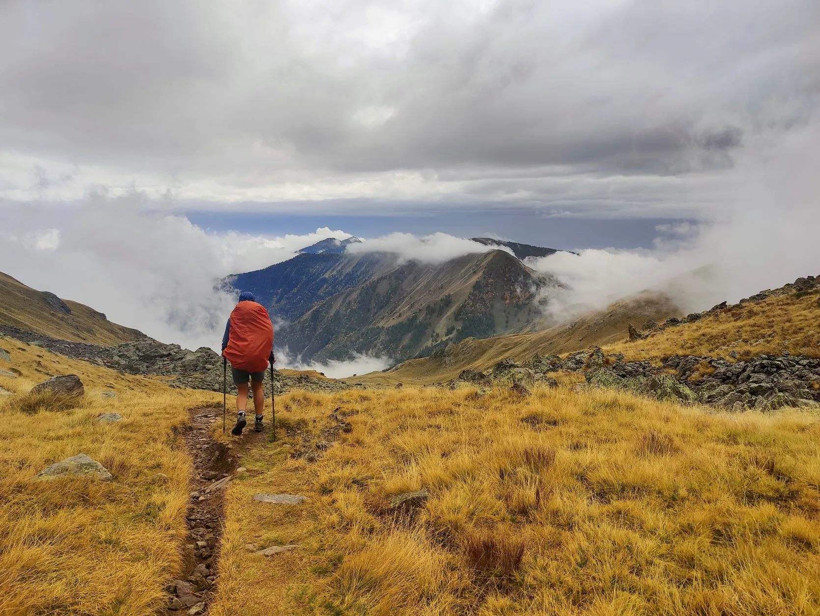
At the end of the valley we make a break, on a flat piece of grassland just off the trail. Good thing we didn't walk too far off the trail, because soon a park ranger comes by and informs us about the rules in this nature reserve. It's a friendly man who gives us a lot of information, including that you must stay strictly on the trails here and that it is not allowed to use hiking poles without the protective rubbers over the iron pins. Of course, to save weight, we don't have those with us, so unfortunately we have to go through the rest of the valley without the use of the poles. He asks where we are going and then tips us to take plenty of water at the refuge a little further down the valley, since there would be no water to be found in the rest of the stretch. So after the break we walk a little detour to Refuge des Merveilles to fill some bottles with water. Not too many because we still have quite a bit to walk and we will soon start a steep climb to Pas du Diable over which we walk out of the valley. It has become quite cloudy by now and it doesn't take long before we enter the fog. We walk up without poles through the southern part of this beautiful valley and pass several reservoirs. A little further on we meet a group of hikers with a guide who tell us that we won't be walking in the fog for long, on the other side of the pass the weather is supposed to be better. We hope so, because by now it is starting to get pretty chilly. From the pass we unfortunately don't really have a view. When we have descended a little bit, the weather does change. But unfortunately it does not get any better; it starts to rain. This was not predicted when we left Saint-Dalmas 2 days ago... We have not been able to check the weather forecasts since then. Anyway because we have very bad coverage here in the mountains, but also because our phones are on airplane mode and battery saving mode, since we have to do 4 days with the battery of our phones and the power bank. But in the mountains a shower can pass by, so we are not so worried. As soon as we reach a more open area, we'll see if we have any cell coverage. First we put on our rain jackets and put the rain covers over our backpacks. The wet stones on the path are becoming quite slippery and we descend at a snail's pace. Yet all the caution does not prevent Malou from falling down
several times. After the descent, the weather and the path get a little better at first, but after a while the weather turns and it gets even more inclement. We walk through the fog with cutting wind and rain, mile after mile through the mountains. We soon learn that some rocks have a lot more grip in rainy weather than others: after a passage with slippery stones that gives Malou a big blue rump, the fun is over. It slowly starts to get really dangerous. We still need our legs too much to sprain or break anything on these paths, and since we keep going pretty fast but don't seem to make any progress with the kilometers, we realize that we won't reach our goal for today before dark. Around 6 p.m. we emerge onto an open mountainside. The weather is now a little friendlier so we stop to see if we have coverage. Yes, we have a few bars of reception. Checking the weather app, we see that 22mm of rain is predicted here for tomorrow and a few millimeters for tonight as well. From here to Sospel is still nearly 29 kilometers, most of it downhill, probably on similar trails we walked today. We doubt if that can be done at all in one day, let alone with this much rain, so we have to improvise. If the rain predicted for tonight falls as snow at this altitude, we do have a problem. We don't have the equipment for that. About 500 meters back we spotted a good bivouac spot on a section of trail and we decide to walk back there. To pitch our tent as quickly as possible and get dry and warm again. Luckily we followed the park ranger's advice, because except for the rain, we didn't encounter any more water.
Once we sit in the tent and weigh our options for the next few days, fortunately it clears up a bit. This immediately produces beautiful views of the mountains with the clouds and patches of fog. About 100 meters from our tent, a giant wild boar runs down the mountain. Hey, we haven't seen those in this trip yet! And the red deer keep roaring away, we hear the heavy cries coming from all sides. It feels so magical, to enjoy the wonders of nature in the wild.
What a day with many faces. But for tomorrow we have to think of something else, because if we have learned anything, it's that the GR52 is not the same as the GR5. The slopes and trails are of a different caliber... But so magnificent.

2 reacties